the suite life of travel
a collection of worldwide adventures
Menu
Skip to content
  • #2801 (no title)
  • About Me
  • Blog Disclaimer
  • Blog Style 2
  • Contact
  • Photo Gallery

Tag Archives: interpretive trail

Hiking the Blackhand Gorge Trail

1 September 201916 October 2024

1 DSC_0223

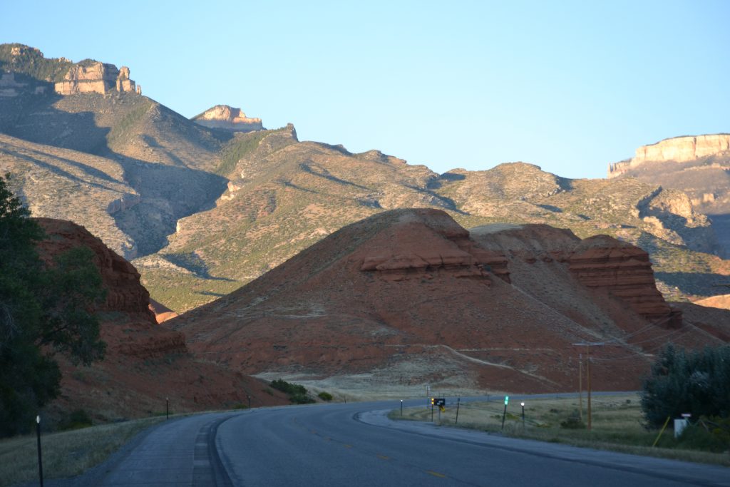
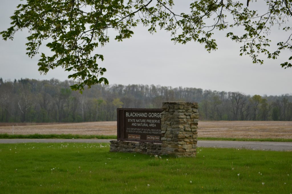
I absolutely love hiking Ohio and the Blackhand Gorge State Nature Preserve in Columbus is a perfect way to experience nature throughout the year.

2 DSC_0228

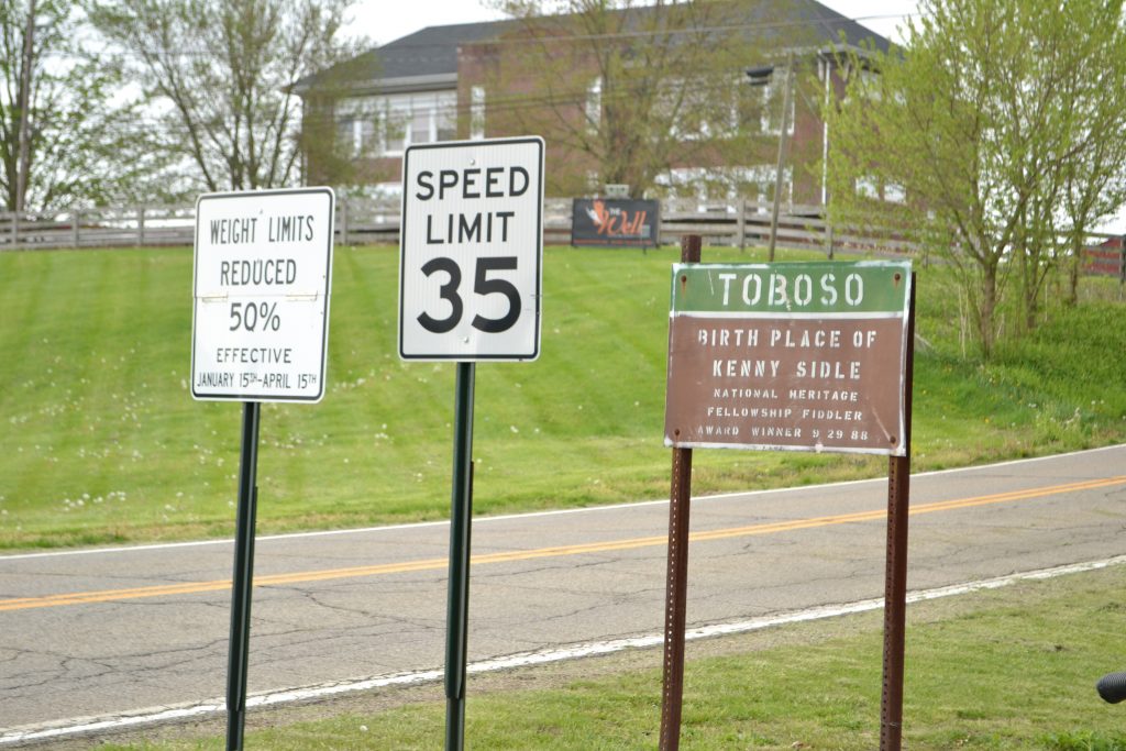
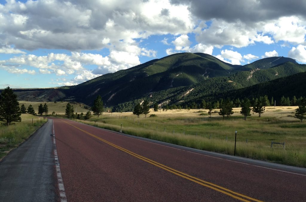
Located off of I-70, west of Columbus, take I-146 West, driving 17 miles until the exit for County Road 273. There will be a sign for Toboso and Blackhand Gorge State Nature Preserve.  I entered the town of Toboso which led me directly to the park.

3 DSC_0229

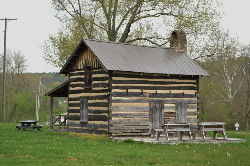
After parking my car, I headed towards the log cabin which was not far from the trailhead.

4 DSC_0233

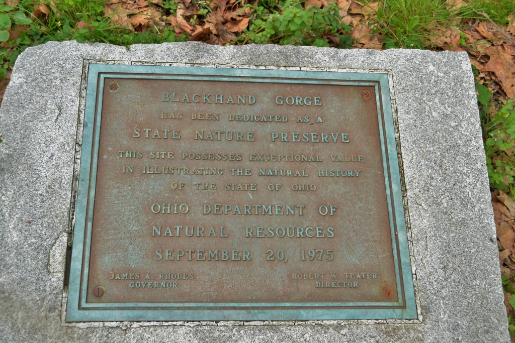
Blackhand Gorge was designated as a State Nature Preserve in 1975 by then Governor, James A Rhodes.

5 DSC_0236

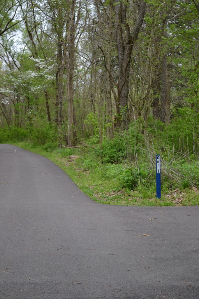
It is easy to find the trailhead with a marker starting at Mile 0.

6 DSC_0244

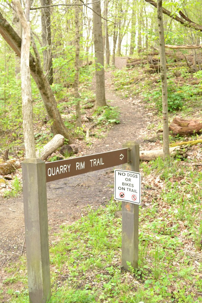
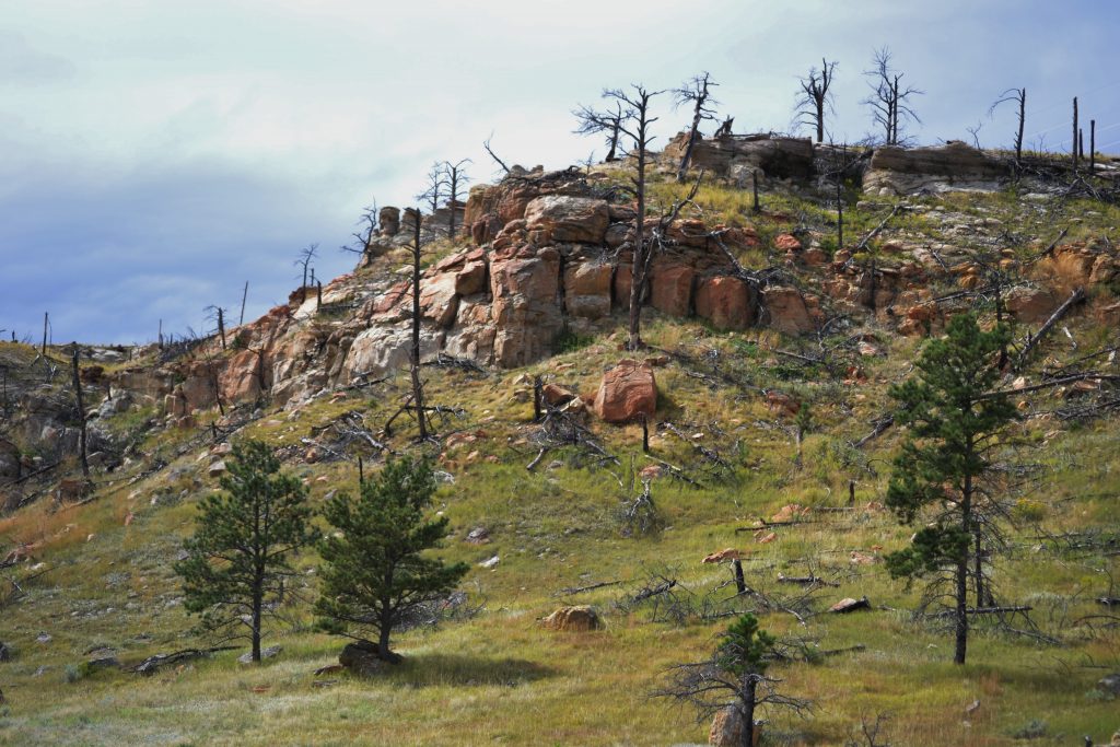
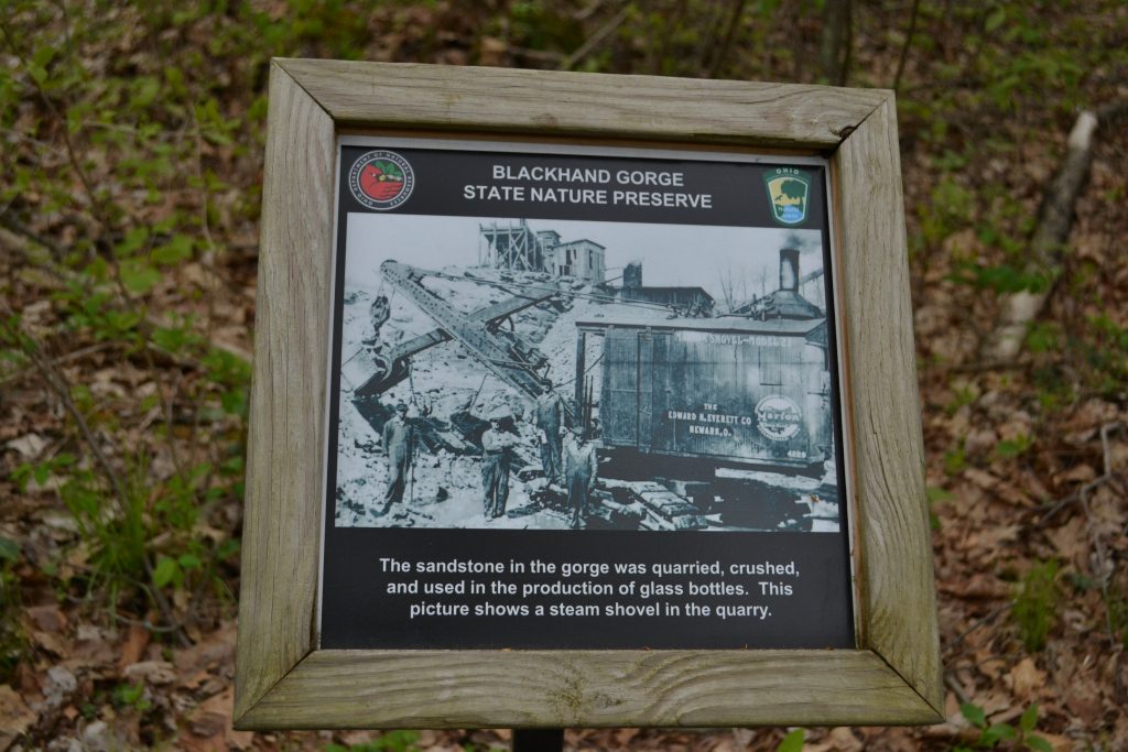
Located off of the main trail, there is a Quarry Rim Trail which provides a view of the quarry which was utilized in the 1800s.

I decided to forgo the Quarry Trail and take it on my way back as this trail is an in and out pathway.

8 DSC_0252

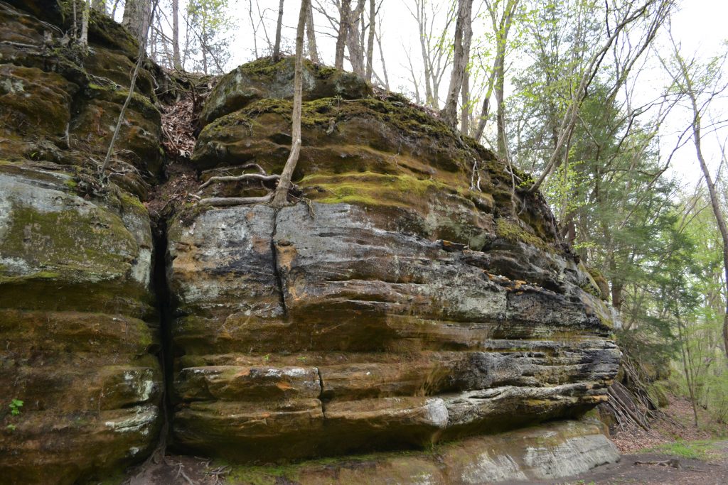
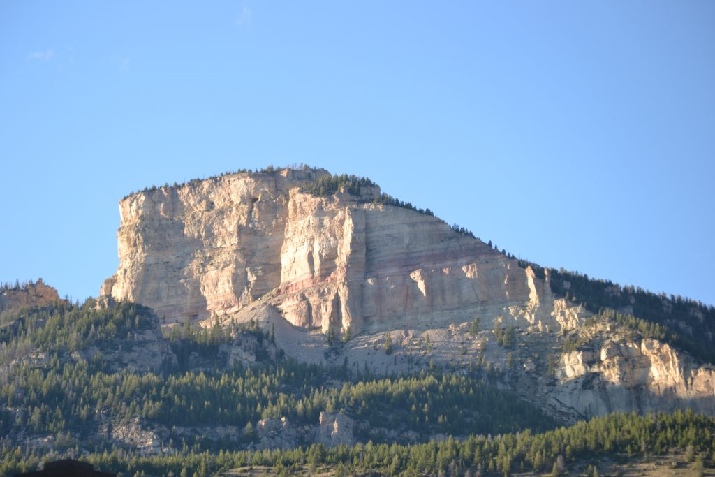
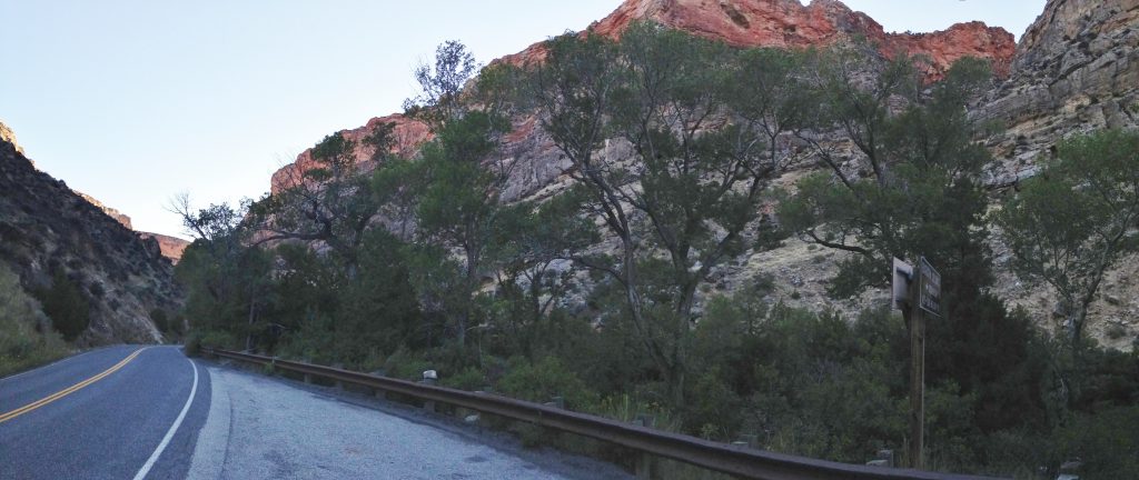
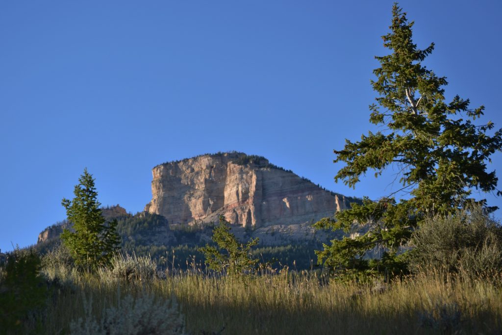
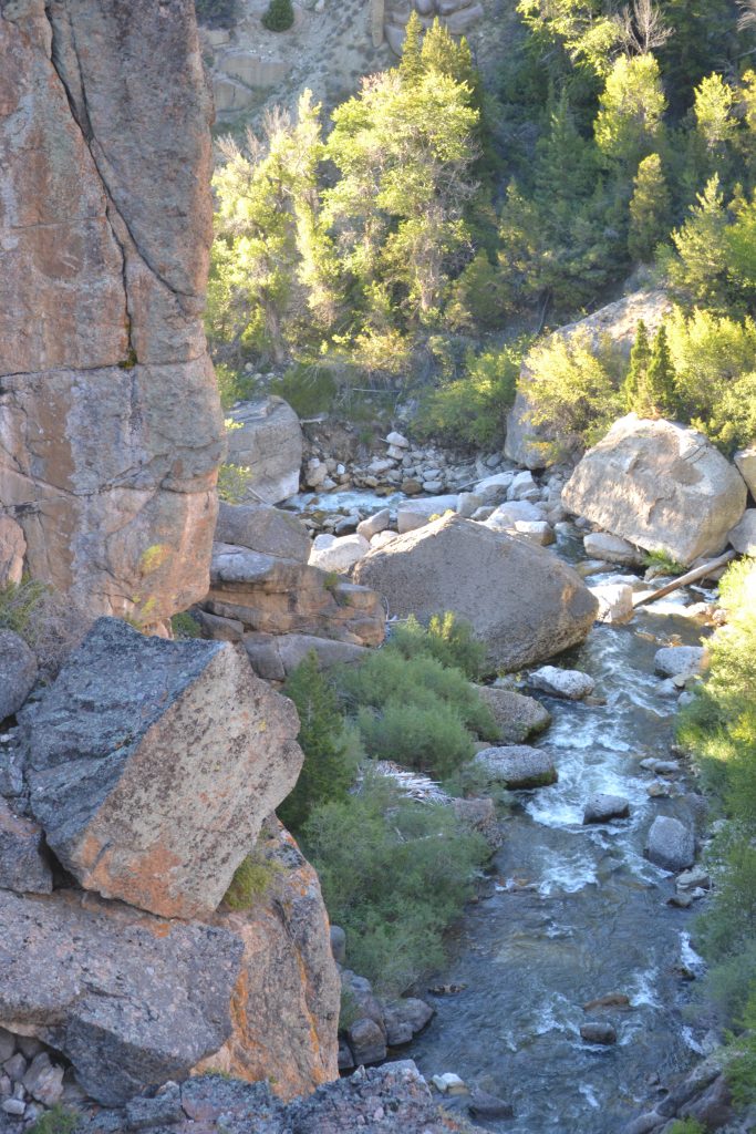
I enjoyed checking out the rocks up close along the gorge to see the protruding tree roots as well as the algae growing within the ridges.

9 DSC_0258

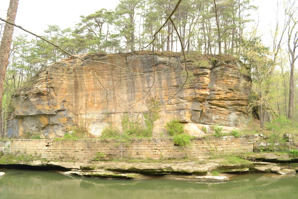
The name Blackhand comes from an ancient petroglyph, resembling a black hand that was discovered on the “Council Rock”.

10 DSC_0256

Unfortunately, it was destroyed when workers set the rock to dynamite to create the Ohio-Erie Canal towpath in 1825.

11 DSC_0261

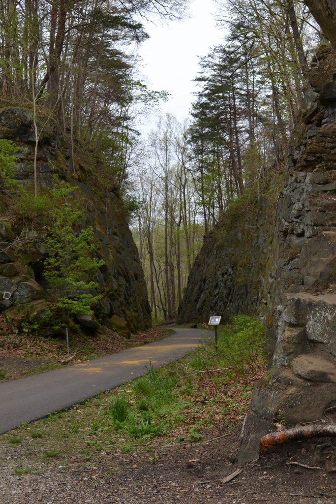
One of my favorite views includes the narrow passageway where trains would pass through the gorge.

12 DSC_0271

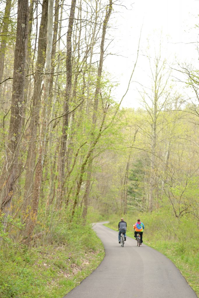
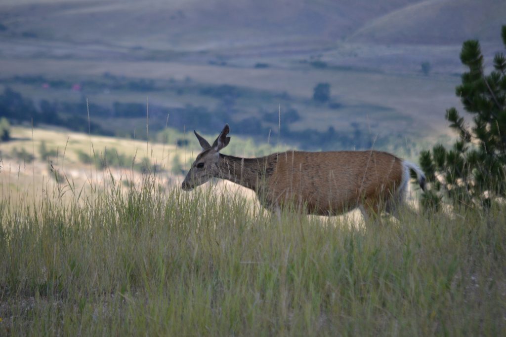
It is also exciting to see other nature lovers enjoying the path both by bike or on foot.

13 DSC_0273

Blackhand Gorge State Nature preserve is also considered an interpretive trail, providing an educational overview of the area and its importance to the Native Americans and explorers that once lived here.

14 DSC_0277

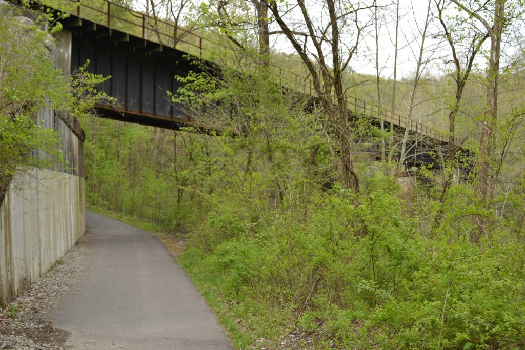
There is a rail system that runs above the gorge that once provided transportation to settlers and hauled rocks away from the gorge.

15 DSC_0279

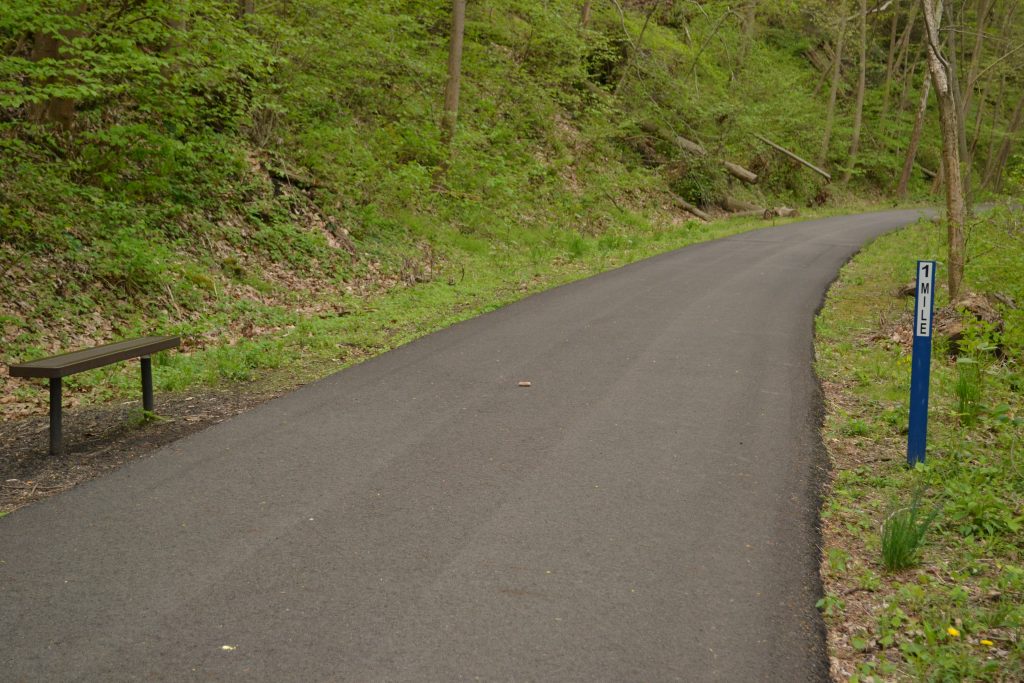
I learned from one of the local walkers that the benches are perfectly positioned at the mile markers and help to monitor the distance traveled.

16 DSC_0291

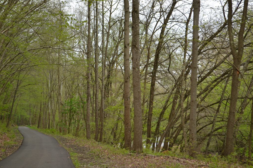
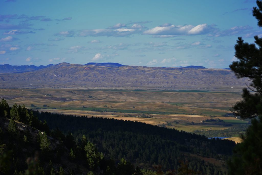
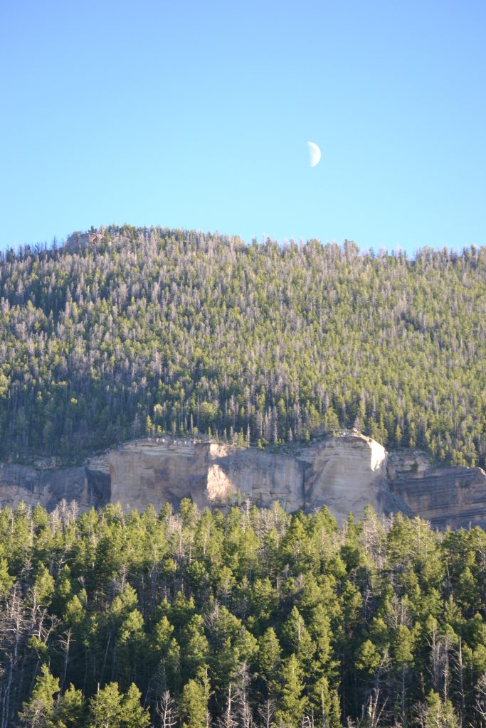
The pathway is a quiet escape from the fast-paced everyday life and eventually the summertime leaves will block the scenic view of the Licking River.

17 DSC_0293

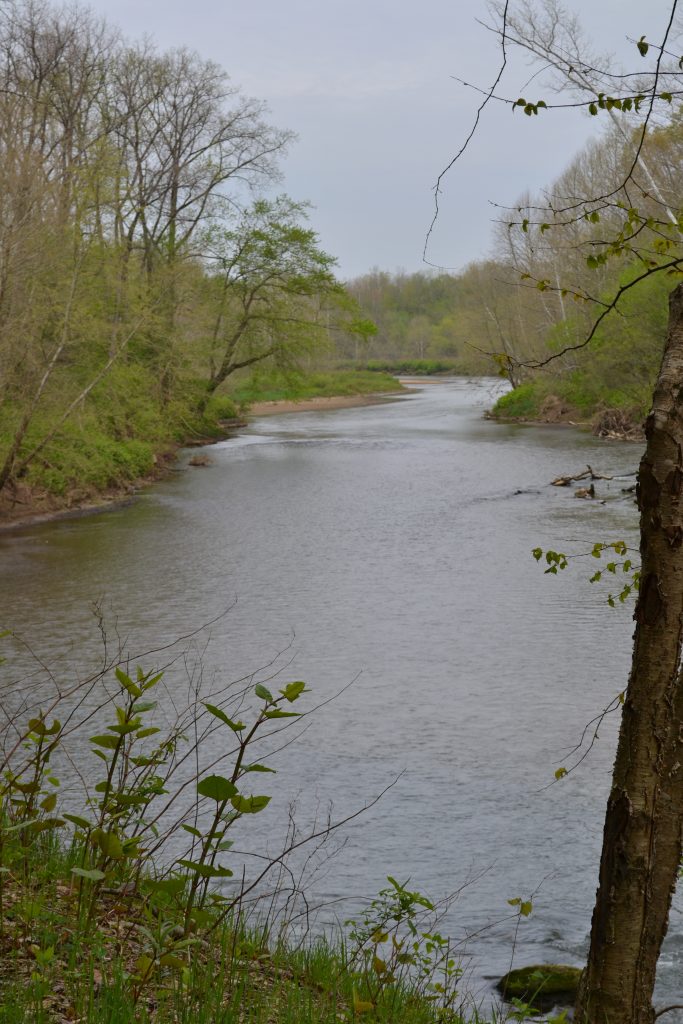
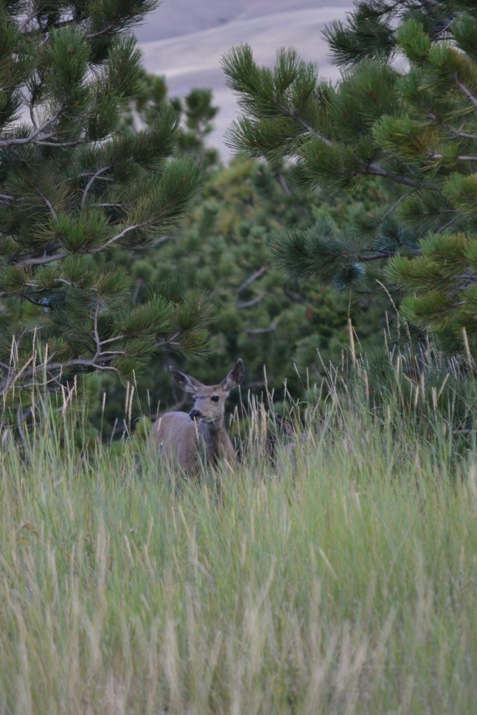
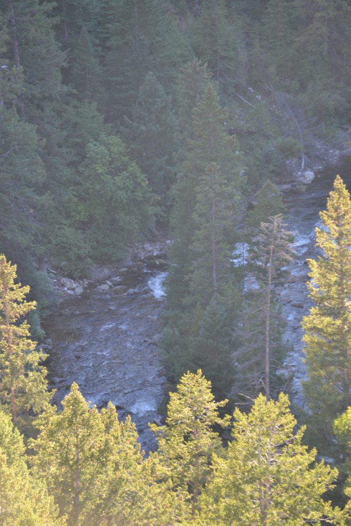
The Licking River came into full view.  I learned that there are several large birds that make this area their home, including the magnificent American Bald Eagle.

18 DSC_0306

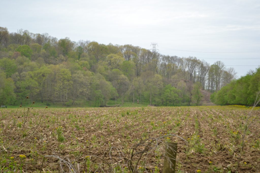
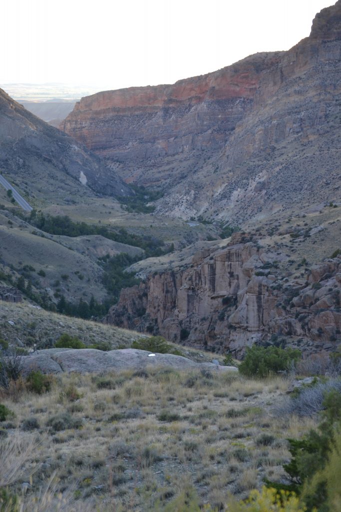
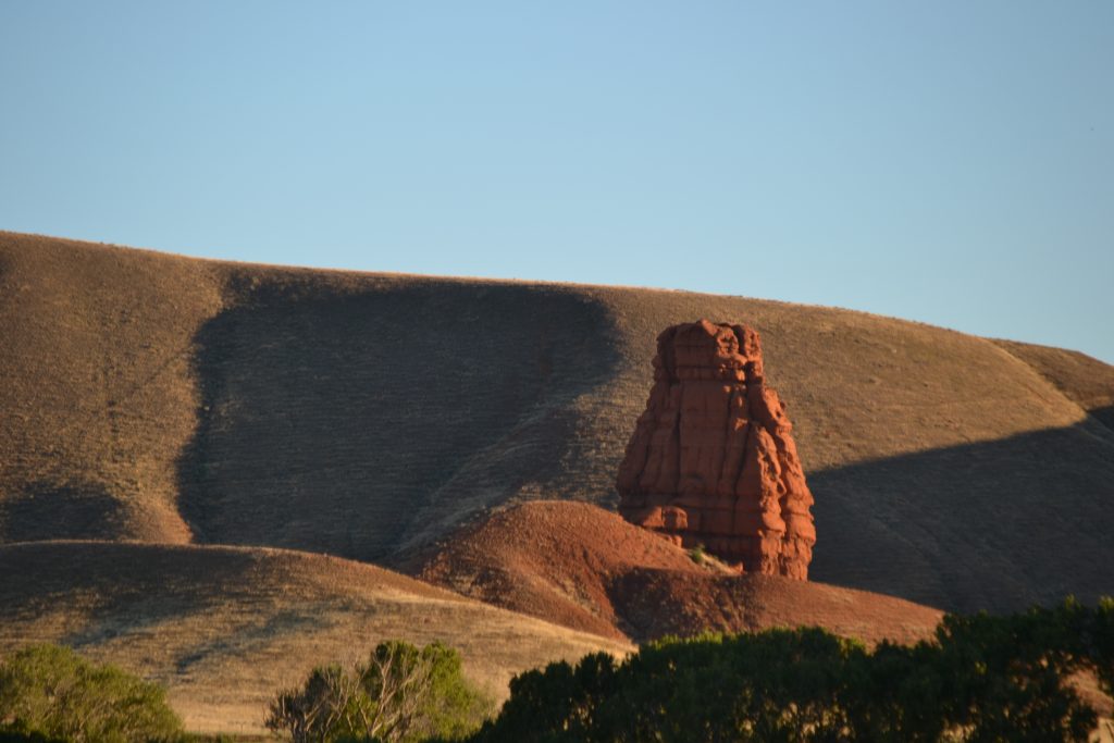
About halfway into the trail, I approached a beautiful field with trees overshadowing the backdrop.

19 DSC_0313

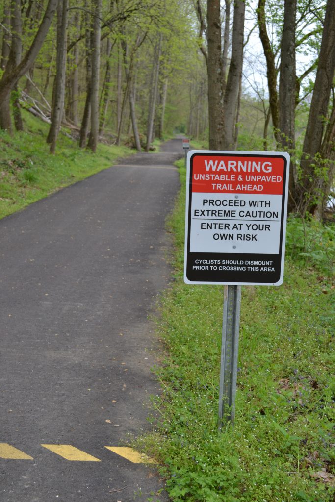
A sign was posted to warn hikers and bikers of a recent washout.  The unpaved trail is a bit rugged but not a challenge for my walk.

20 DSC_0319

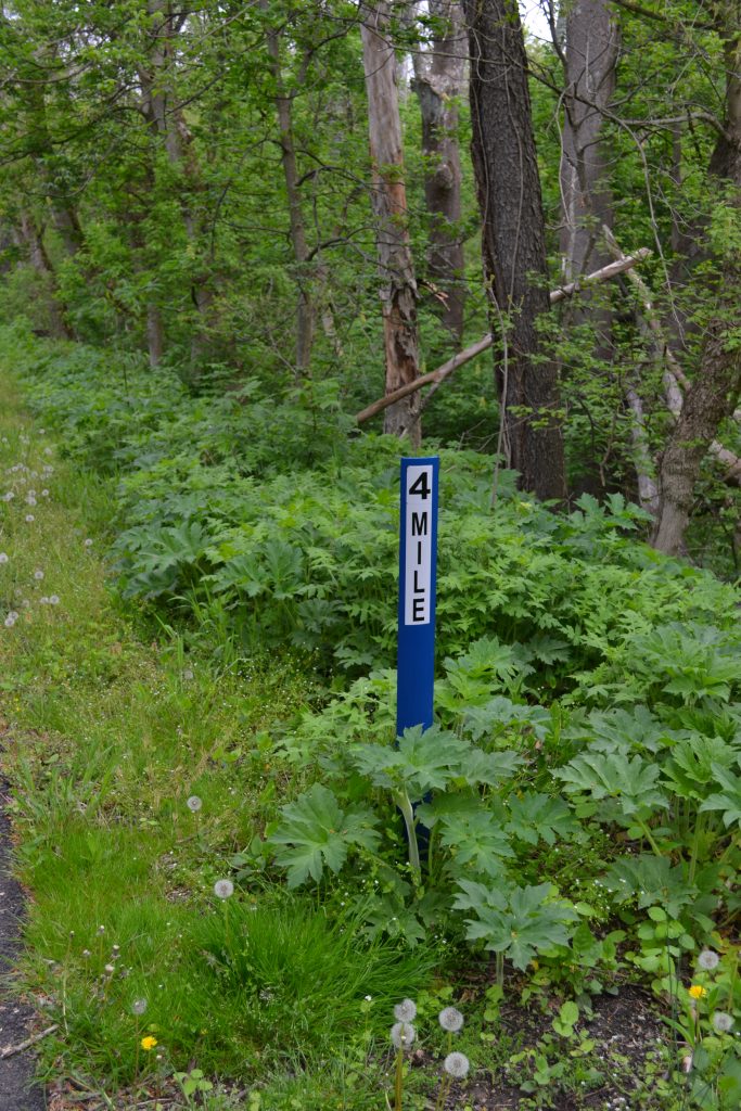
I finally reached mile marker 4 when it began to rain a little.  I was so close to the end of the trail that I was not giving up.  It will be interesting to see if the weather holds for my return trip.

21 DSC_0322

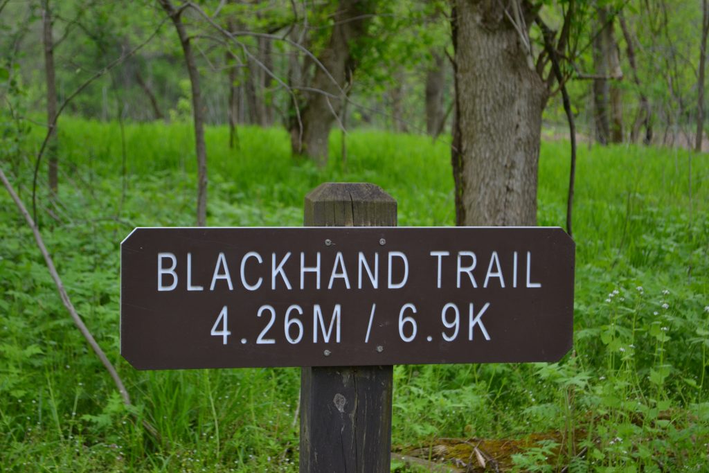
As I came to the end of the Blackhand Trail, I realized I had completed 4.26 miles.   I will have walked 8 and a half miles total this morning.

22 IMG_8704

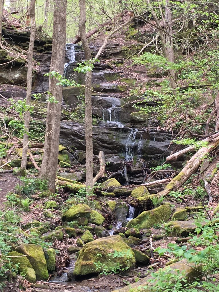
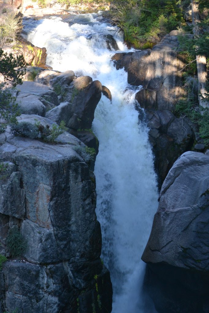
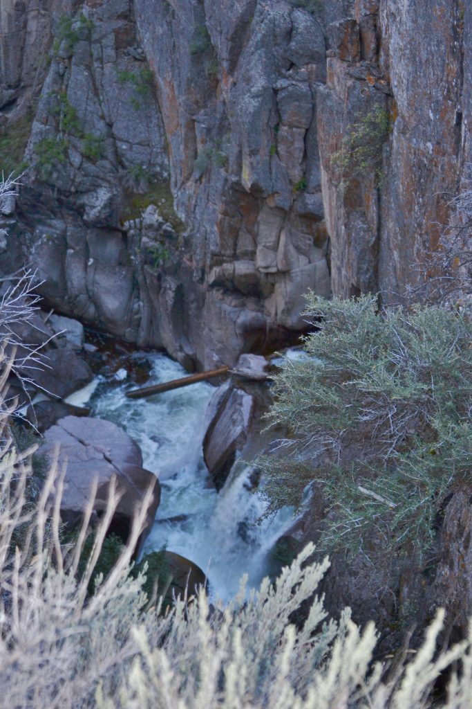
I was happy to capture this shot of this beautiful waterfall on my way back before heading over the Gorge Trail.

23 IMG_8705

Starting the quarry trail….

24 IMG_8708

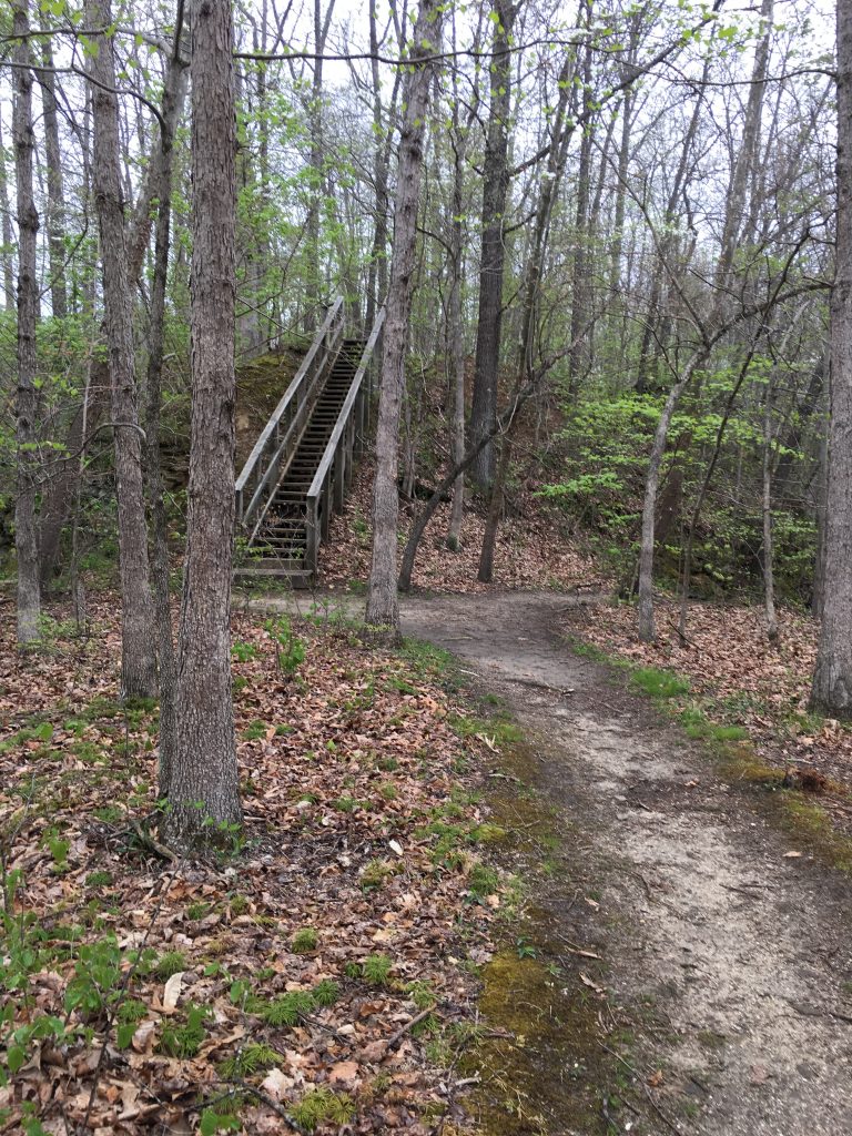
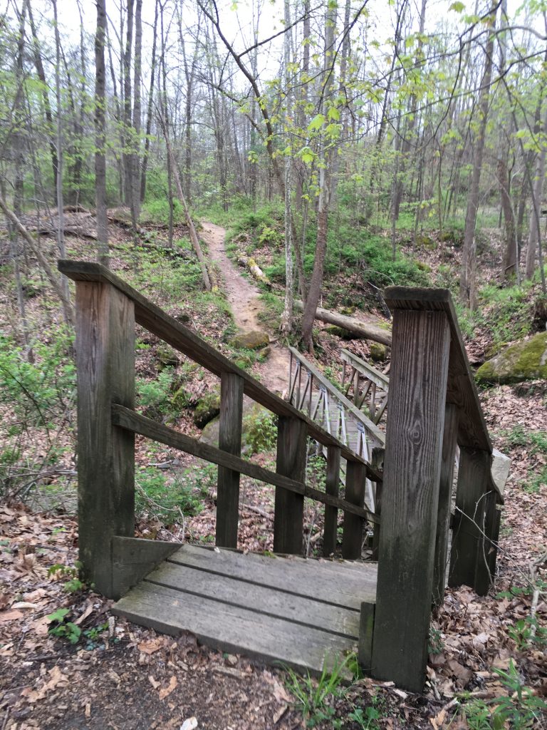
Another set of stairs that took me along the rim of the quarry.

25 IMG_8715

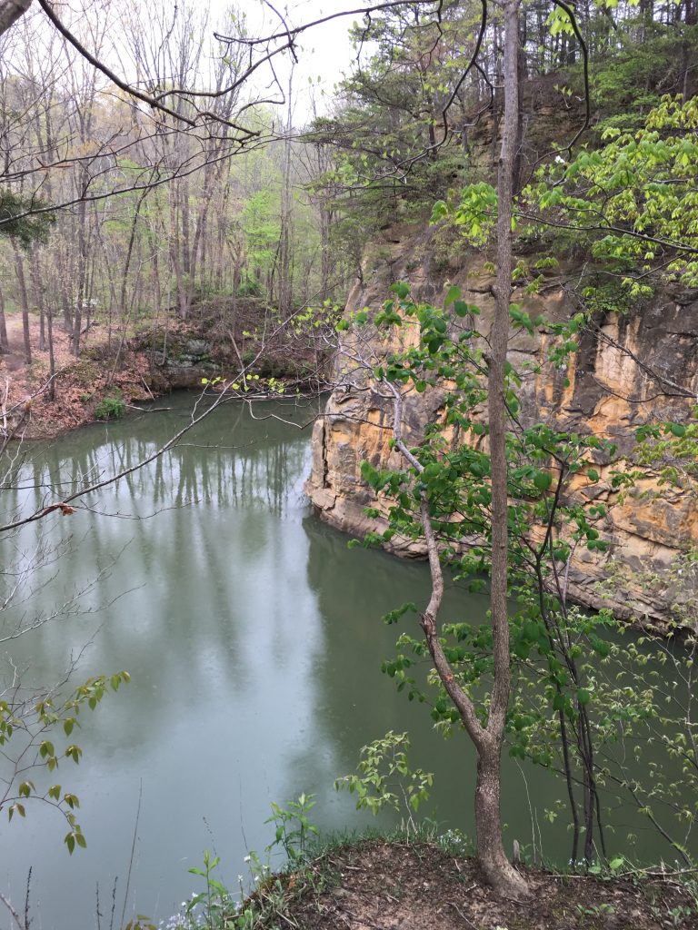
A beautiful view awaits at the top of the stairs.

26 IMG_8722

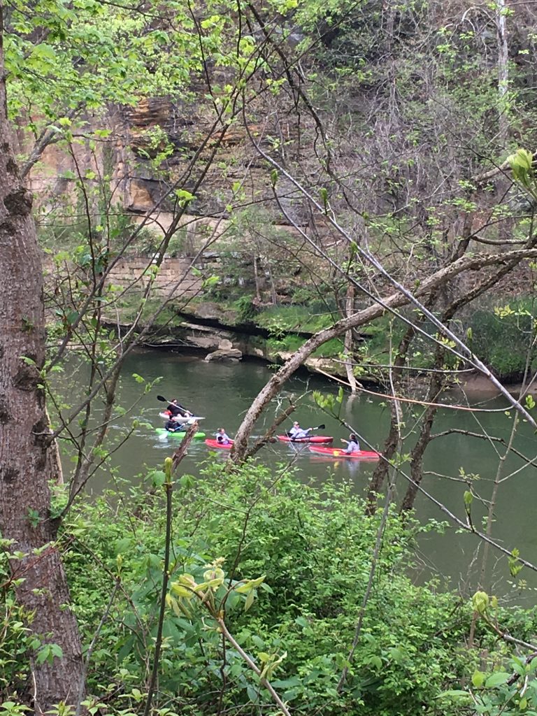
I have finished the both the Blackhand Trail and the Quarry Rim Trail while successfully managing to stay somewhat dry on my hike back.  I noticed some kayakers enjoying the Licking River to my left.  Once I approached the parking lot, I could see them loading their kayaks.

It was a beautiful day to enjoy Blackhand Gorge State Nature Preserve and I had barely made it to my car escaping the deluge of rain.  I was rewarded with scenic views of the quarry, sandstone outcroppings and even an eagle sighting.  What an amazing way to spend my morning.

Have you visited Blackhand Gorge State Nature Preserve?  I would love to hear about your hike, so please leave a message in the comments section below!  Many Thanks and Happy Travels!

What to See and What to Do: 

Blackhand Gorge State Nature Preserve
2200 Gratiot Road, SE
Newark, OH  43056
Telephone:  1 866 OHIOPARKS

Where to Stay:

Hampton Inn  Heath-Newark
1008 Hebron Road
Heath, OH  43056
Telephone:  740 788 8991

Where to Eat:

The Overlook Restaurant at the Virtues Golf Club
One Long Drive
Nashport, OH  43830
Telephone:  740 763 1100

I couldn’t resist ordering the Ginger Lime Grouper served with wild rice and the vegetable of the day (broccoli).  The ginger lime sauce was full of flavor and added to the tenderness of the salmon.

Leave a comment
Share
  • Pin it
  • Share
  • Tweet
  • Share
  • Email
  • Print

The Bighorn Byway Drive Towards Devil’s Tower

3 November 201817 September 2024

Traveling out west, I had finally reached Wyoming and decided to take the scenic route towards Devil’s Tower. My initial plan was to travel the Medicine Wheel Passage, but it had rained the night before and I was concerned that this would have an affect on the roads as US Highway 14A is not well paved.  Instead, I decided to continue towards Devil’s Tower by way of the Bighorn Scenic Byway.

DSC_0369

I refueled in Sheridan at the Holiday Stationstores for $25 and began my scenic drive through the Bighorn Mountains with a stop at Shell Canyon and Falls.

Climbing the mountain, I noticed a lookout and decided to pull over for a short break, taking in the scenic Blue Sky drive.  Stretching my legs and walking towards the edge of the parking lot to take in the view, I happened to notice a small deer out of the corner of my eye. She was making her way down the hill so I slowly crept towards her direction for a closer look when I realized there was a young buck further down the slope.  While keeping my distance, I stood still in the lot, taking in the beautiful moment before returning to my drive.

DSC_0381

I was nearing the end of the byway when I noticed signs for the Shell Falls Interpretive Site.  Thirty miles east of the town of Greybull, I was excited to make this stop to see the falls and explore the educational center.

DSC_0384

Opening the car door, I immediately noticed the sound of the waterfall,  Long before reaching the entrance, I was surprised to see a mist emanating from the cascade with a spray that was lightly covering my windshield.  A donation box marked the start of the trailhead and within minutes, I was standing on the platform facing the falls. It was then that I realized I was too close to capture the falls it in its entirety as I had not brought the correct lens.   I stood against the handrail with my eyes closed, feeling the spray on my face.DSC_0415

After a refreshing stop and a boost of energy, I continued along the interpretive trail.  Rounding the corner and towards my left, a pathway opened up to a canyon  Rock formations seemed to rise up from inside of the valley.

DSC_0382

In the distance stood a limestone and dolomite rock feature known as Copman’s Tomb, the precipice was so named in memory of local settler, Jack Copman whose dream was to launch a glider over the side of the cliff.  Unfortunately, he was unable to complete his dream, but locals have named this immense stone in Copman’s honor.

I had finally reached the end of the quarter a mile trail where I spent about twenty minutes.  Not only was the trail a perfect break during my long journey towards Devil’s Tower, the mist from the falls provided me with a much needed car wash.

Have you had the opportunity to drive the Bighorn Scenic Byway or stop by Shell Falls?  I would love to hear about your experience if you would kindly leave a message in the comments section below!  Many thanks for reading my post about the Bighorn Scenic Byway and Shell Falls!  Wishing you many Happy Travels!

For more information about the Bighorn Scenic Byway, visit the Bighorn National Forest website at http://www.travelwyoming.com/article/big-horn-scenic-byway.

Leave a comment
Share
  • Pin it
  • Share
  • Tweet
  • Share
  • Email
  • Print

Road Trip on the Bighorn Scenic Byway

1 September 201816 September 2024

1 2013 379

Are you a fan of road trips?  I absolutely love the energy that comes from driving the open road.  I’m also guilty of stopping by every Welcome Center for a few brochures and pulling over to check out the “Scenic View” for a few photos.

I was ready to tackle the 58 mile drive known as the Bighorn Scenic Byway.  Met with waterfalls, canyons, forests and open fields, my heart began to race as I traveled west into unexplored territory.   There is a freedom of taking to the highway and exploring the pure beauty of the Western United States.

The weather was perfect for taking the route along US 14, flanked by Powder River and Big Horn basins.  I was heading towards Greybull and had mapped out a few stops along the way checking out some recommended points of interest.     DSC_0415

Without any stops, my drive time would have taken about an hour, but the scenery was so spectacular, I couldn’t resist frequent stops to take photos.   While the detours added an hour to my trip, I was certain I would reach my hotel before nightfall. Shortly into my drive I approached the Bighorn Basin looking west where I could see the Yellowstone Plateau in the distance.  If I had more time, I would have loved to have spent more time to camp, fish or even pick up a hike or two.

2 DSC_0363
The highway passed a wide range of geological formations and landscapes.  As I drove through a small section of the scenic byway, I could see there had been a recent fire.  From mountain tops to meadows, there were craggy rock outcroppings that added to the fascinating roadside scenery.

4 2013 384

The red rocks seemed to increase the further I drove.   Roadside signs along the way documented the elevation as I began to reach the crest of the Bighorn Mountains.  Posted signs warned me of falling rocks and wildlife crossing the road.

5 DSC_0366

The mountains in the distance took on a shade of royal blue against the subtle earth tones of the rocks.  The drive brought me through a thick forest.  Random openings through the trees allowed me a short glimpse of the afternoon landscape. The branches and leaves were a great protection from the sun, casting shadows on the road ahead of me.

6 DSC_0376

The valleys began to open up ahead so I stopped at a scenic overpass to stretch out my legs.  As soon as I exited the car, I quickly noticed a doe in the tall grass.  She ignored me as she went about eating the grass at the edge of the roadway. Not at all aware that I was there, with her white tail flitting about to swat flies, she headed down the steep slope gently with each step.  I slowly followed her for a few feet and in the short distance from where she was standing, there was a buck and a smaller deer at his side.   I smiled to myself and was incredibly thankful for another unexpected surprise along my journey.

10 DSC_0394

The road continued to climb and in the distance was a large rock-like structure known as Copman’s Tomb. Copman was an explorer who loved spending time in Shell Canyon and had wished for his ashes to be scattered over the mountain when he died. Having reached an elevation of 8,875 feet, I finally approached Shell Canyon Falls.  Here I had planned to visit the interpretive trail and hike the falls.

12 DSC_0397

I parked the car and left a small donation at the trailhead.  It was a welcome sight to stretch my legs and enjoy a quiet hike.  Shell Falls was a short walk from the parking lot and I could hear the sound of the water crashing against the rocks long before reaching  the viewing platform.   As I approached the 120-foot plunge, the mist refreshed my skin from the heat of the sun.

Although the Bighorn Scenic Byway had come to an end, there was an endless number of spectacular sights from this point until I reached my final destination.   So as the day drew to a close, the sun’s reflection made the reds a bit redder and the oranges a radiant glow.  It was a wonderful end to a perfect day of travel and I would be ready to start tomorrow morning, once again hitting the open road.

Were you ever surprised by nature while traveling a scenic drive?  I would love to hear about your experience!  Kindly provide a summary in the comments below so that I can hear about your adventure!  Many thanks for reading about my adventurous drive out West!  Wishing you many Happy Travels!

Shell Falls and Canyon is open from 8 a.m. to 5:30 p.m. daily, mid-May through mid-September. For more information, visit the website at https://www.wyomingtourism.org/travel-resources/detail/Shell-Falls-Wayside-Bighorn-National-Forest/7957.

Disclosure:   Please refer to our blog disclaimer tab for more information.

13 DSC_0402

Shells Canyon

14DSC_0403

The Moon Appearing over Bighorn Canyon Scenic Byway

15 DSC_0404

More of Shell’s Canyon

22 DSC_0419

Beautiful geological features at dusk

23 DSC_0422

Exiting the Bighorn Canyon Scenic Byway

24 DSC_0423

Rock formation from the sideview mirror

Leave a comment
Share
  • Pin it
  • Share
  • Tweet
  • Share
  • Email
  • Print

About Me!

I have had a passion to travel for as long as I can remember and landed my dream job at the age of 19 on a cruise ship. The Suite Life of Travel is about those experiences as well as my future endeavor to explore this amazing world!

Categories

  • 2016 Trip Out West (26)
  • Africa (3)
  • Arizona (10)
  • Asia (23)
  • Bali (13)
  • Belize (2)
  • California (24)
  • Caribbean (34)
  • Central America (18)
  • China (1)
  • Costa Rica (1)
  • Egypt (1)
  • Europe (29)
  • Florida (17)
  • France (1)
  • France (3)
  • Greece (11)
  • Israel (3)
  • Italy (7)
  • Jordan (3)
  • Las Vegas (18)
  • Louisiana (4)
  • Maine (4)
  • Massachusetts (2)
  • Mexico (6)
  • Michigan (21)
  • Middle East (3)
  • New York (1)
  • North Carolina (12)
  • Ohio (200)
  • Pennsylvania (9)
  • Philippines (6)
  • South Africa (3)
  • Tennessee (24)
  • Texas (2)
  • Travel Tips (14)
  • Turkey (6)
  • Turkey (6)
  • Uncategorized (5)
  • United Kingdom (7)
  • US travel (399)
  • Wineries (53)
  • World travel (105)

Recent Posts

  • South Beach, Brunch and Island Gardens
  • Featured Ohio Winery: Markko Vineyard
  • Things to Do in Ohio in the Month of May

Instagram

Pins

  • Document Travel-Ways to Remember the Adventure - The Boho Traveller
Follow Me on Pinterest
Site made with ♥ by Angie Makes
Angie Makes Feminine WordPress Themes