the suite life of travel
a collection of worldwide adventures
Menu
Skip to content
  • #2801 (no title)
  • About Me
  • Blog Disclaimer
  • Blog Style 2
  • Contact
  • Photo Gallery

Tag Archives: rock formations

Torrey Pines Natural Reserve, California

8 April 20253 May 2025

1 IMG_0654

Having lived on the coast of California, I was determined to watch the sunset each night in San Clemente.  I would walk down  to the pier, take a stroll along the beach until the last flicker of light disappeared into the horizon.  I vowed never to take the experience for granted and wanted to continue my tradition on a recent visit to San Diego.  I was so excited to meet my friend Kristi with whom I had hiked so many times.  I thought about all of the SoCal hikes we had done as I drove  into Torrey Pines Natural Reserve.  This is absolutely one of the most beautiful coastlines in the world and I couldn’t wait to take in another Pacific Coast sunset.

2 ZView of PCH from TPSP

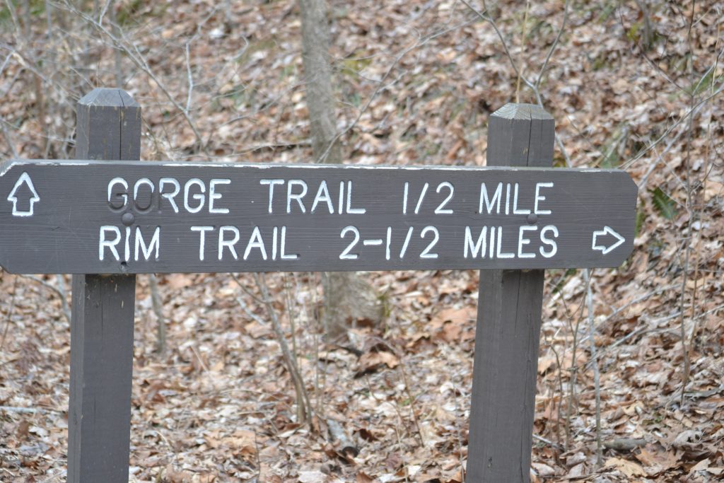
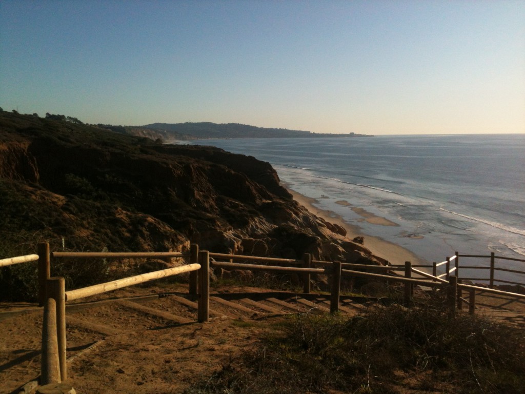
We decided we would hike the Guy Fleming Trail because it has the most scenic overlooks.  Measuring a short two-thirds of a mile loop, this hike is also known for its wildlife and wildflowers. There are several trails within the reserve including a beach trail.  This one is most popular with the locals during the evening hours because it is easy and in good condition as well as provides the most beautiful views of the sunset from here.

3 ZState Park, San Diego

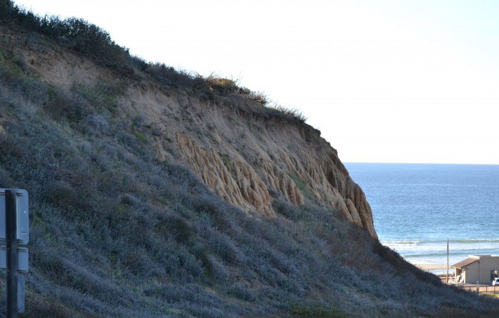
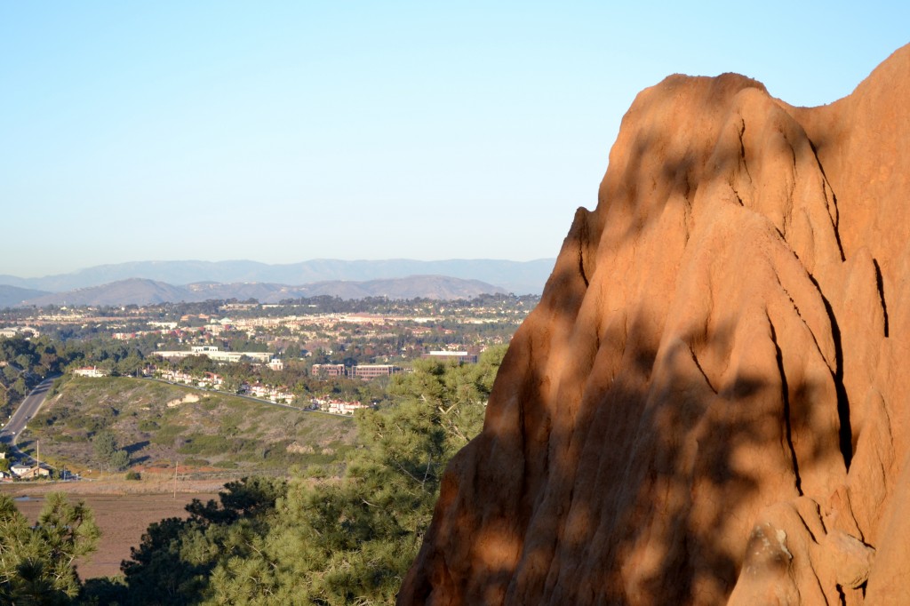
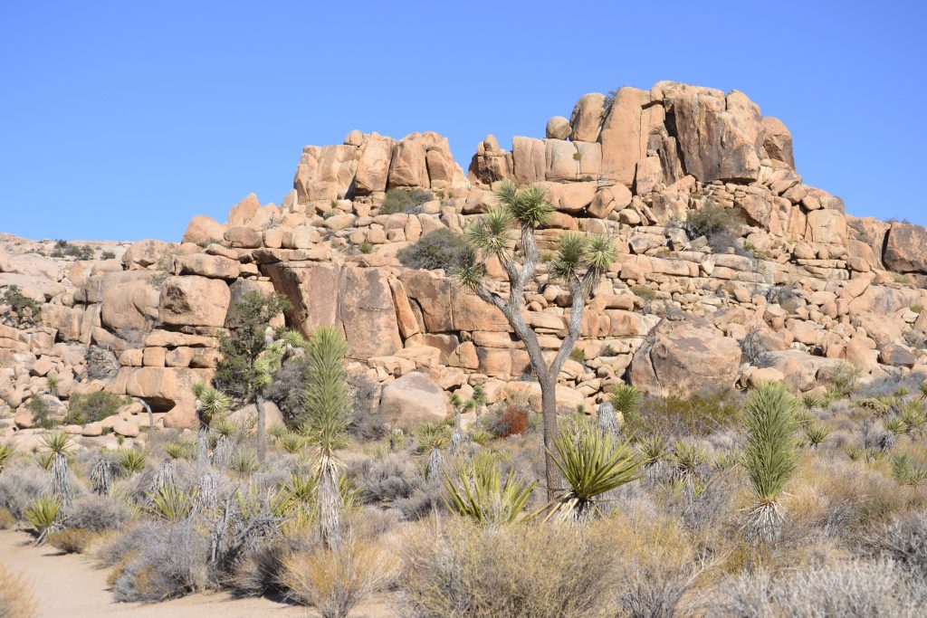
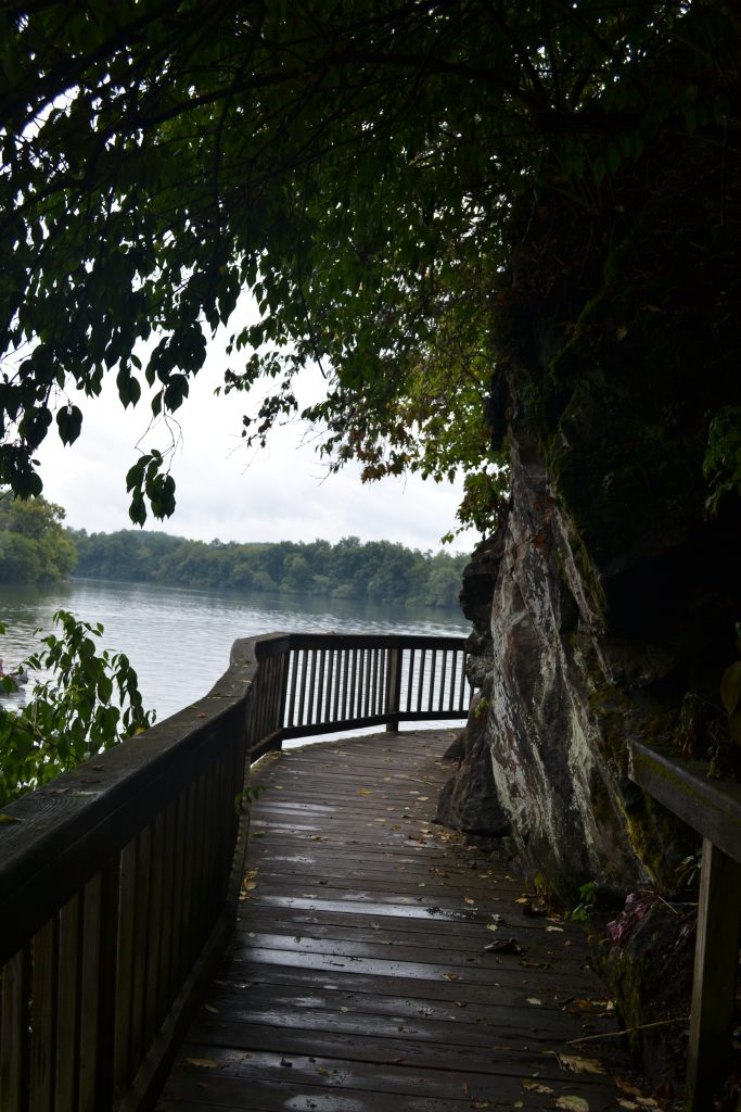
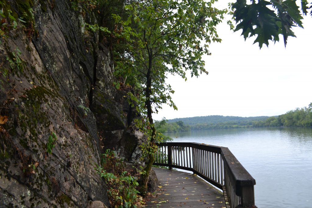
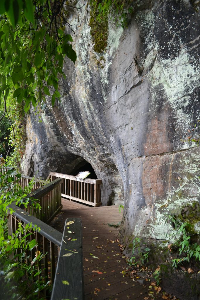
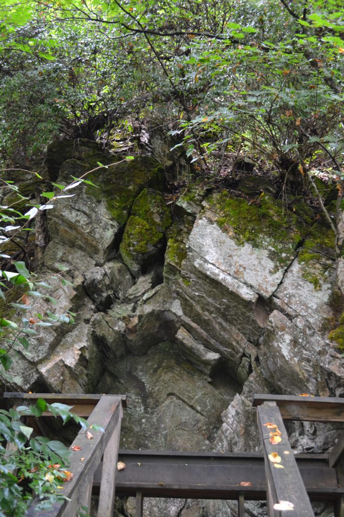
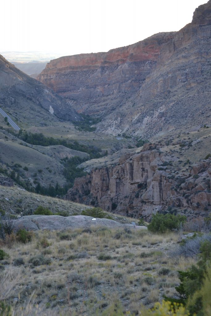
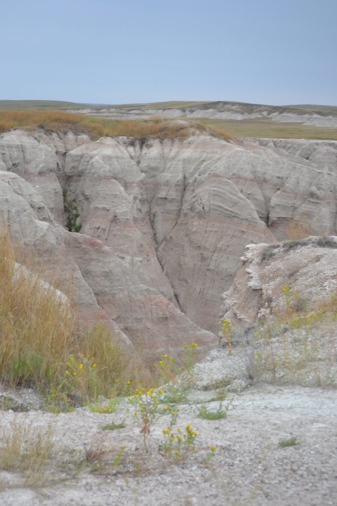
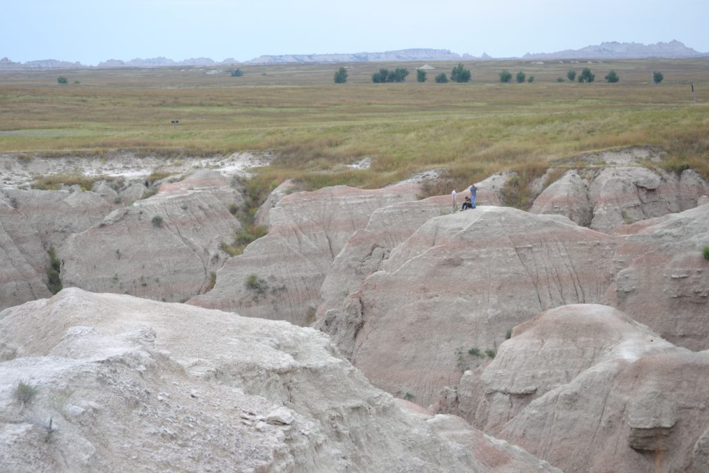
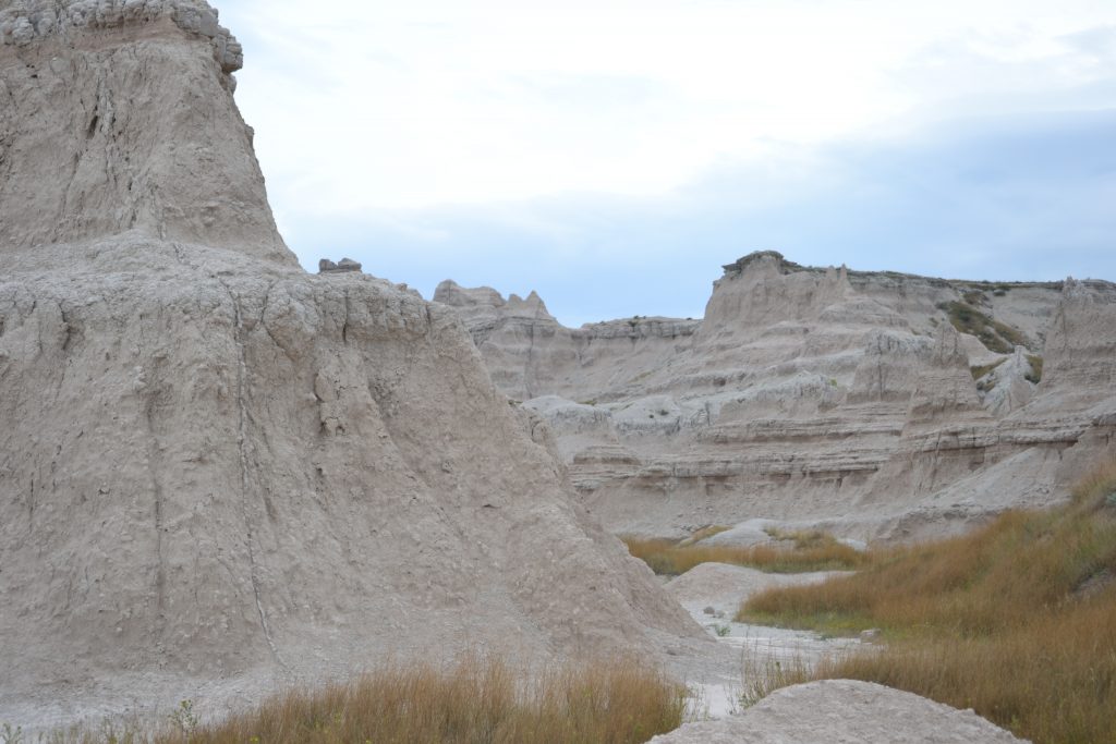
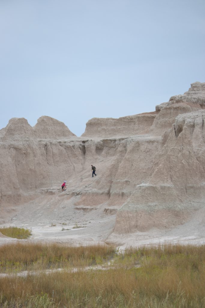
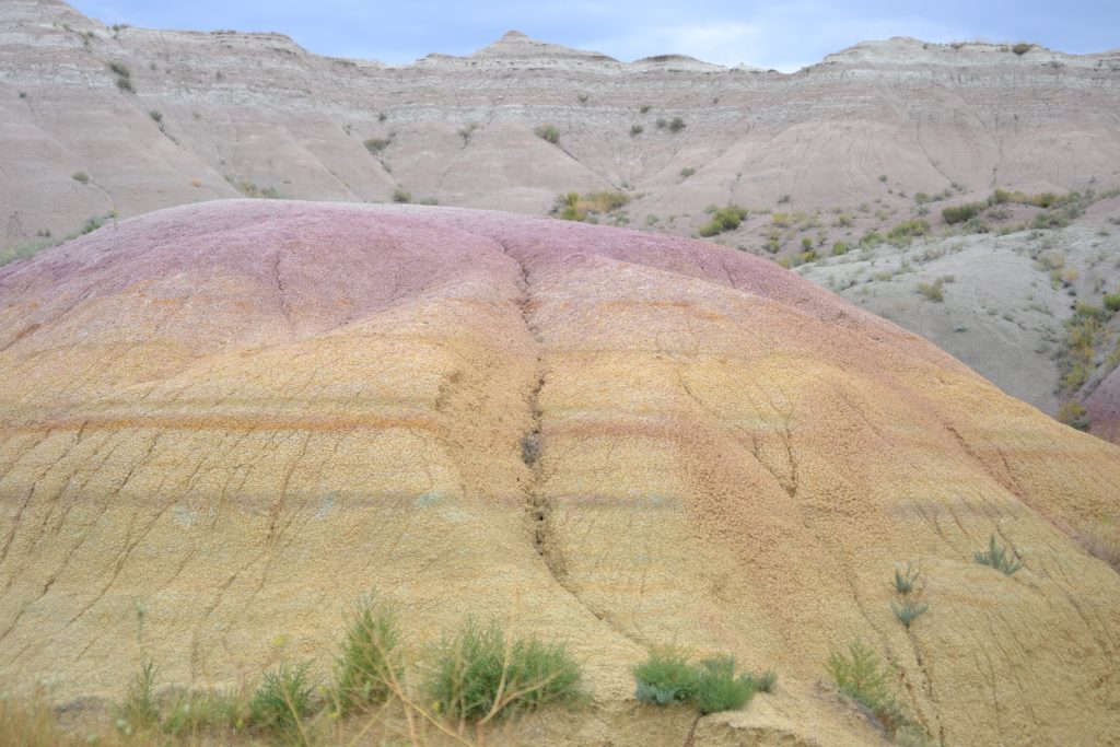
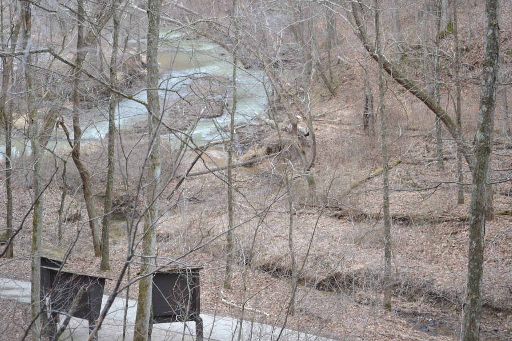
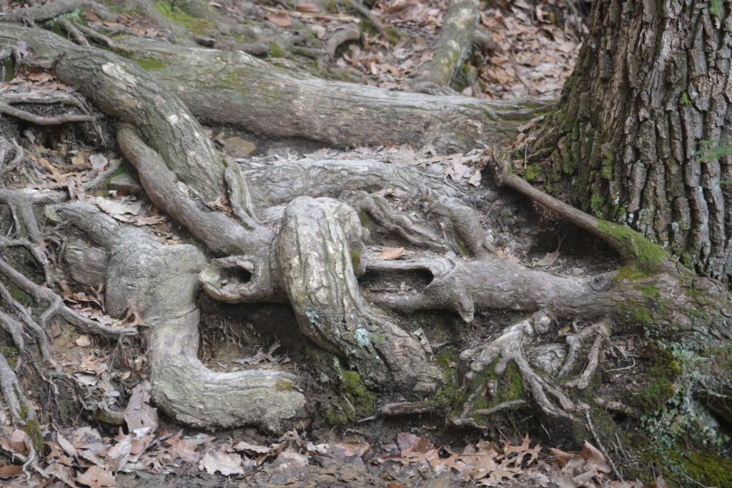
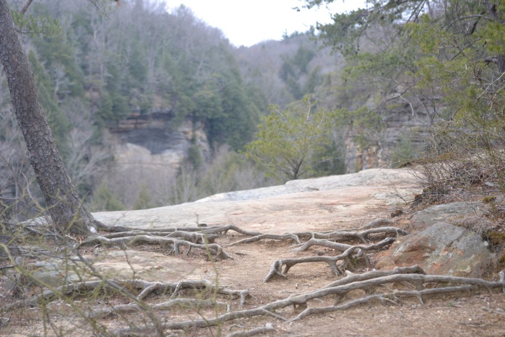
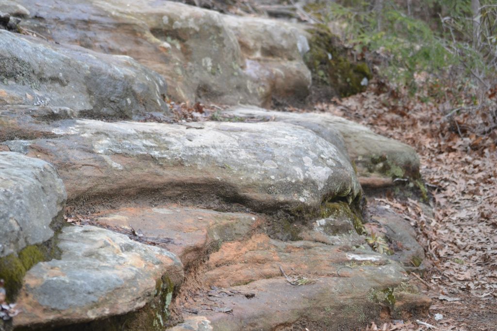
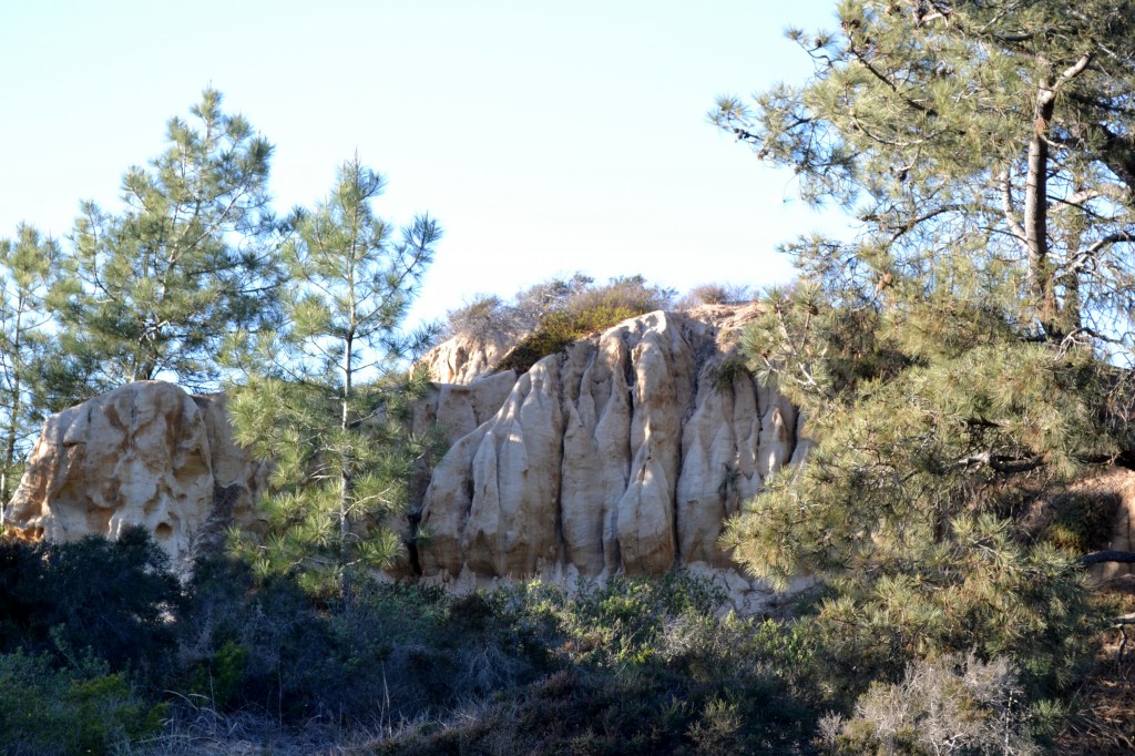
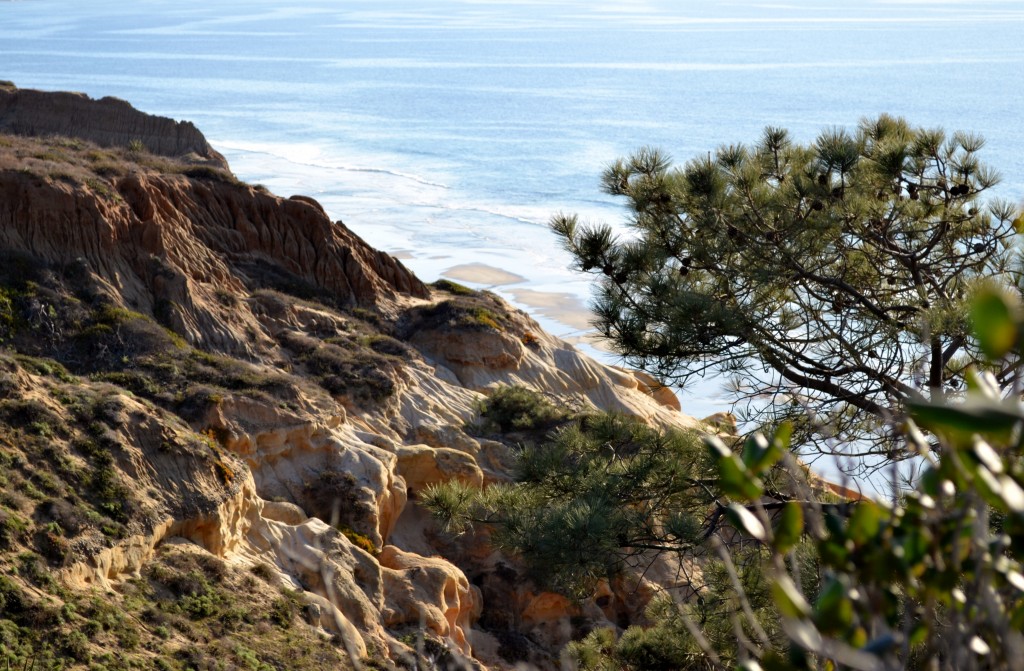
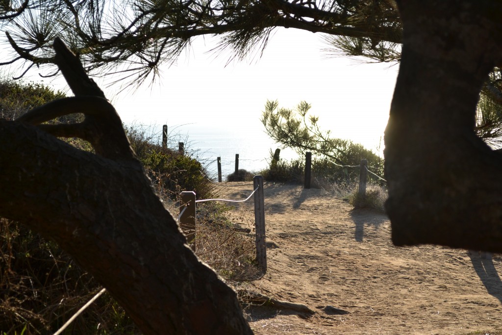
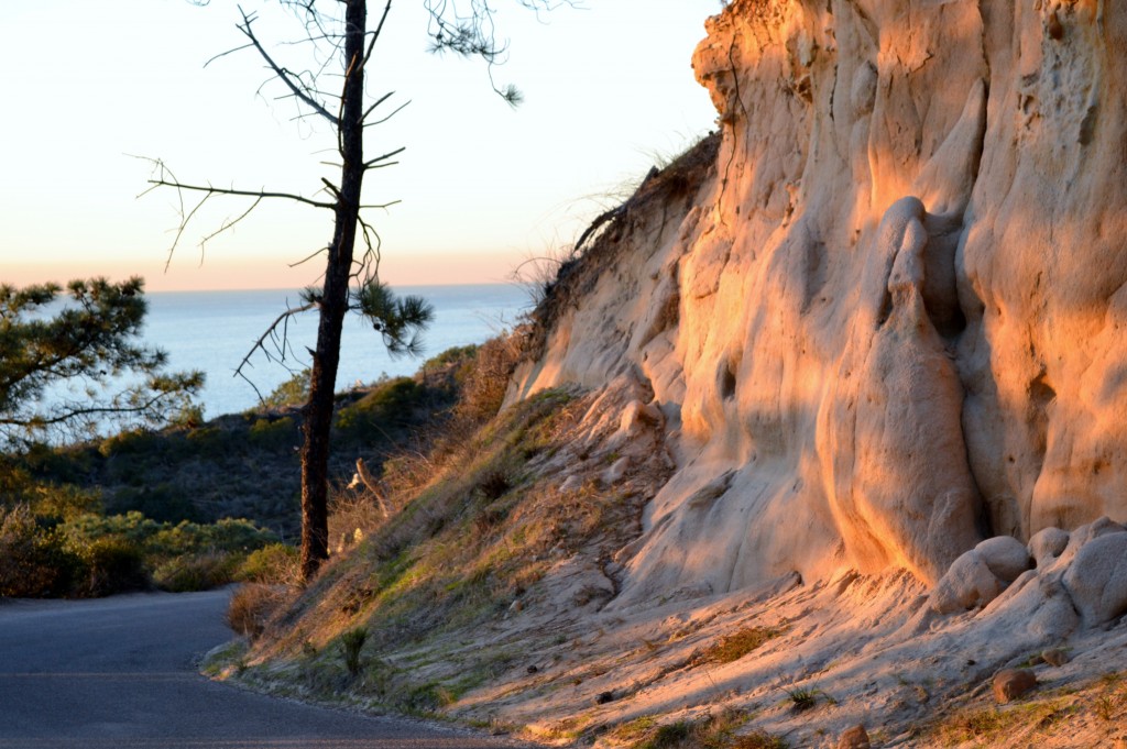
Torrey Pines surprisingly reminds me of the Badlands.   Approaching the trailhead, we walked up the hill along the paved roadway, but soon turned into a dirt trail.  Parts of the hike were somewhat unstable due to water erosion from a previous rain, so we knew to tread carefully and stay away from the edge.

4 ZBerries 1, Torrey Pines State Park, San Diego

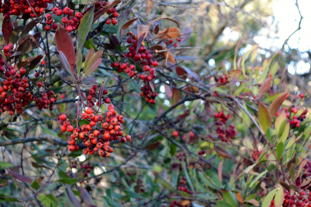
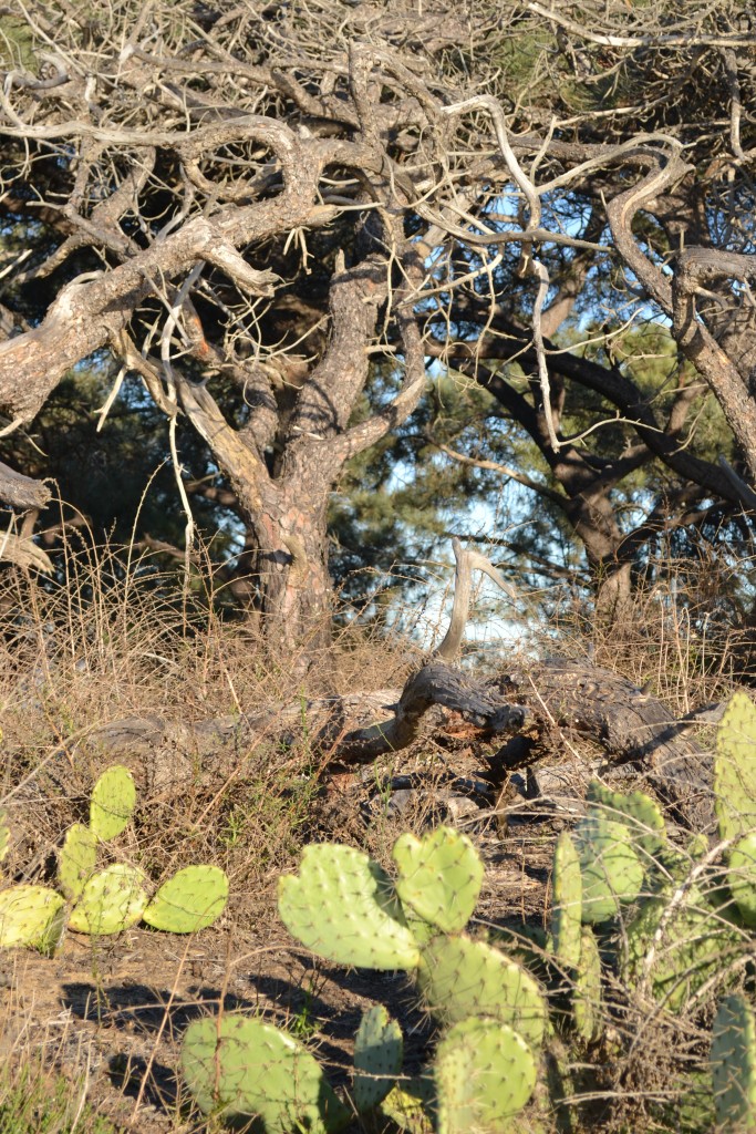
Shortly into the hike, we noticed the berries along the path and the diversity of plant life that grows  in Southern California.  The best time to see the blooms are during the spring season but there is always some type of vegetation to see throughout the year.

7 Rock Formations Torrey Pines

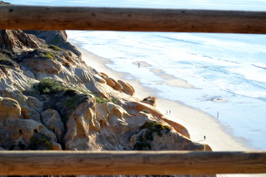
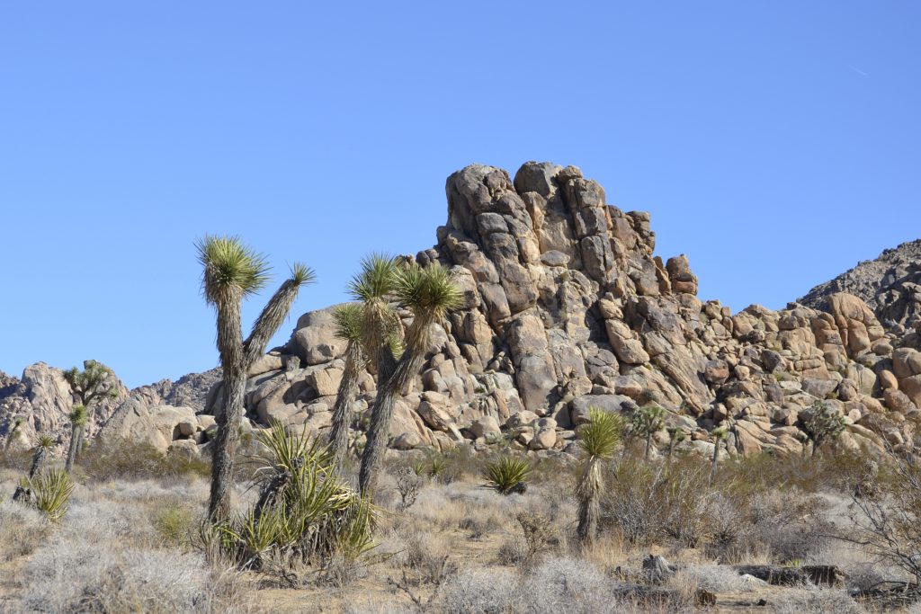
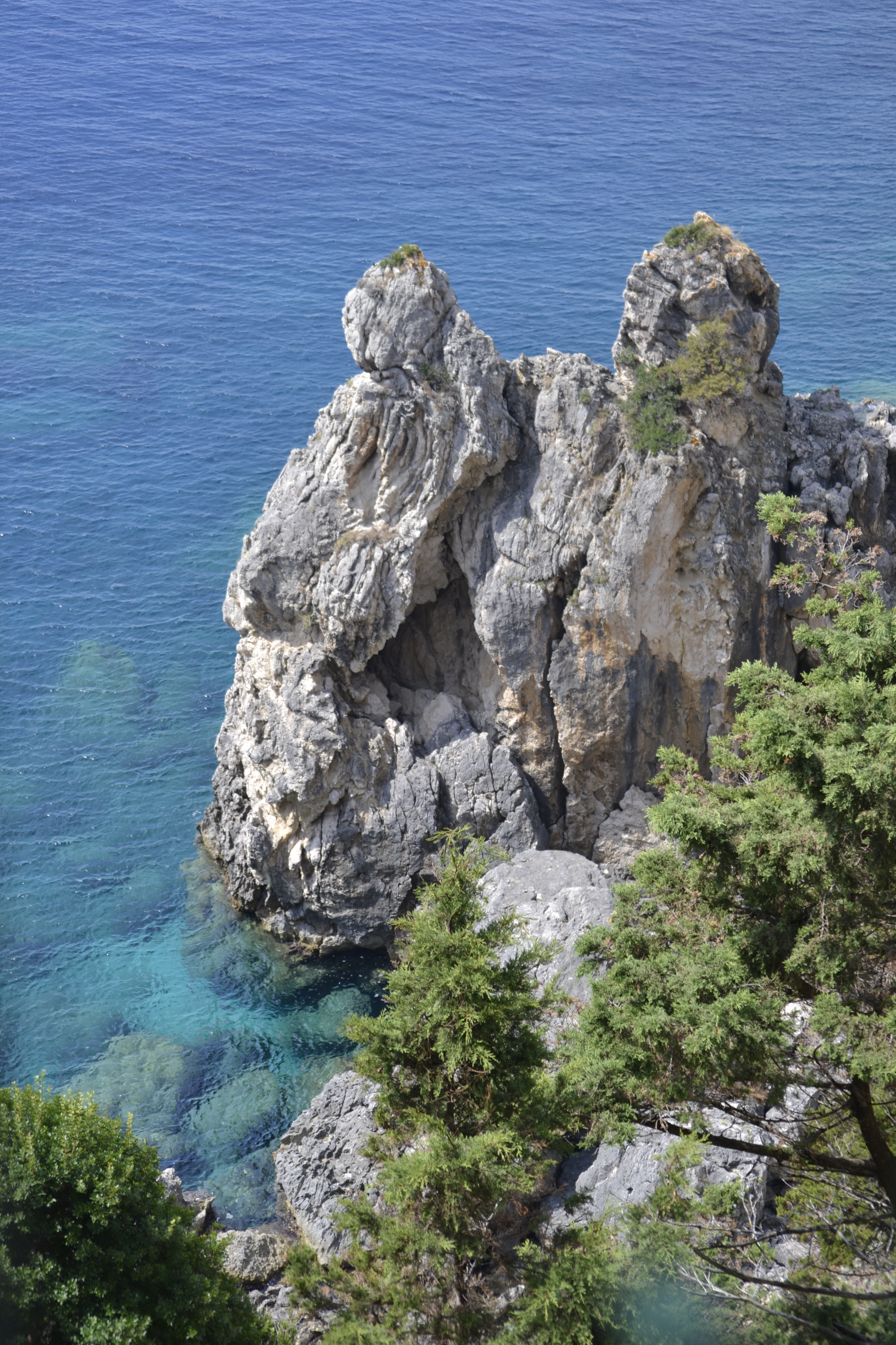
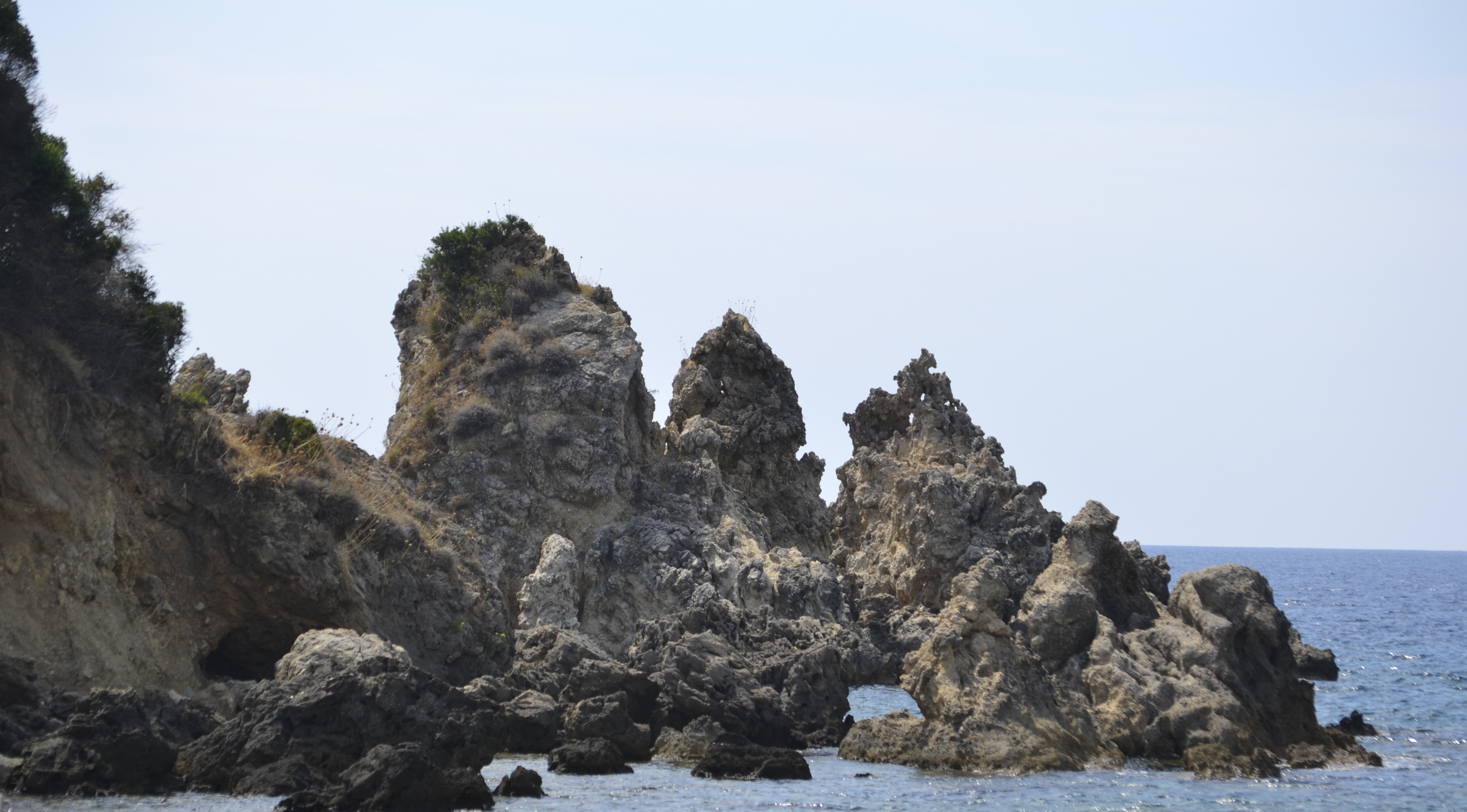
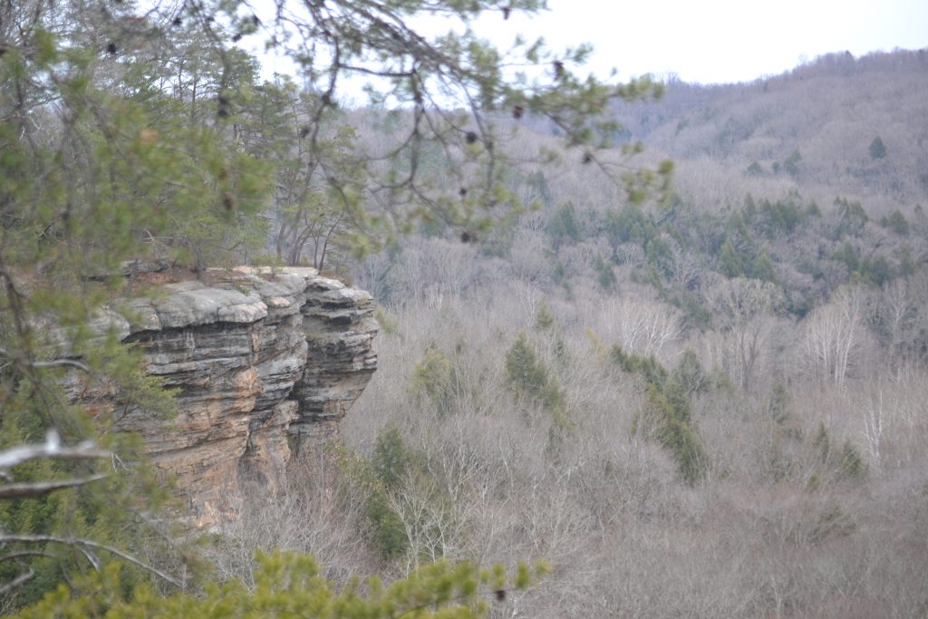
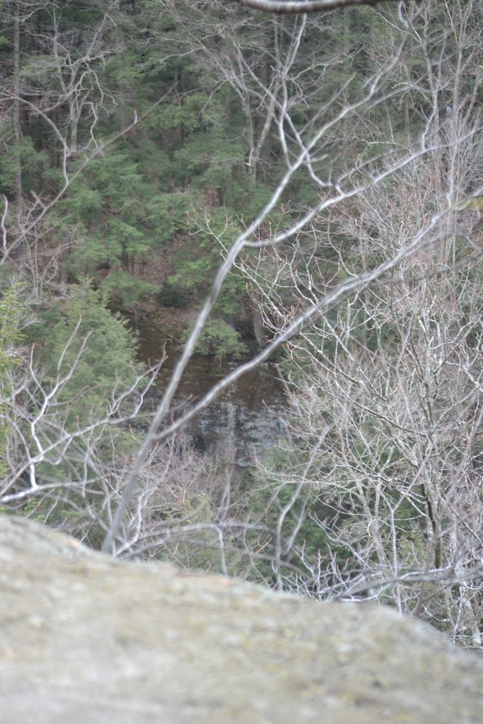
It became clear that we were nearing the edge of the cliff as we caught glimpses of the ocean through the thick vegetation.  I was looking forward to the scenic views once I arrived closer to the shore where we could look out into the horizon, or count the number of people strolling the beach below.  Ghoulish rock formations hiding between the trees appeared as we continued heading west towards the coast.

8 111207 Light Shadow, Torrey Pines

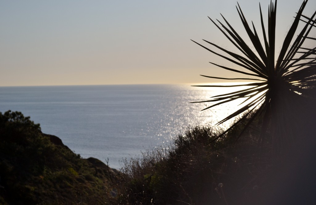
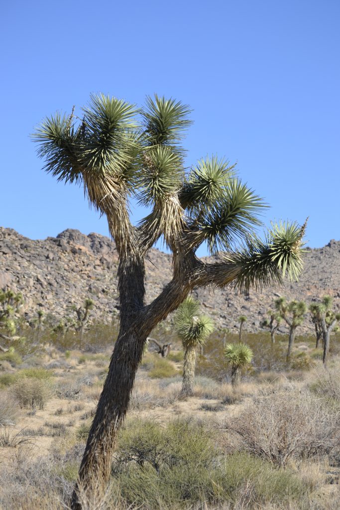
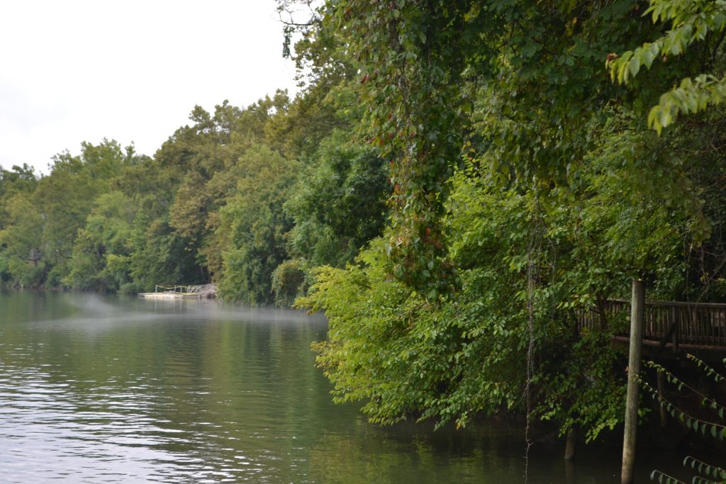
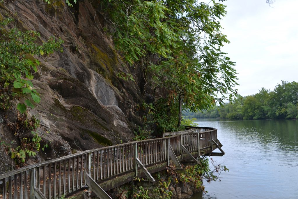
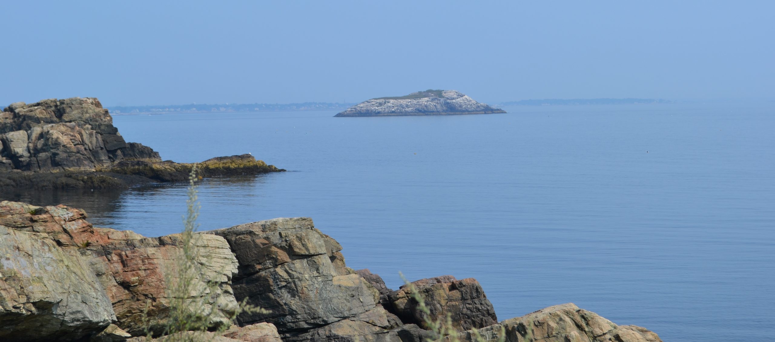
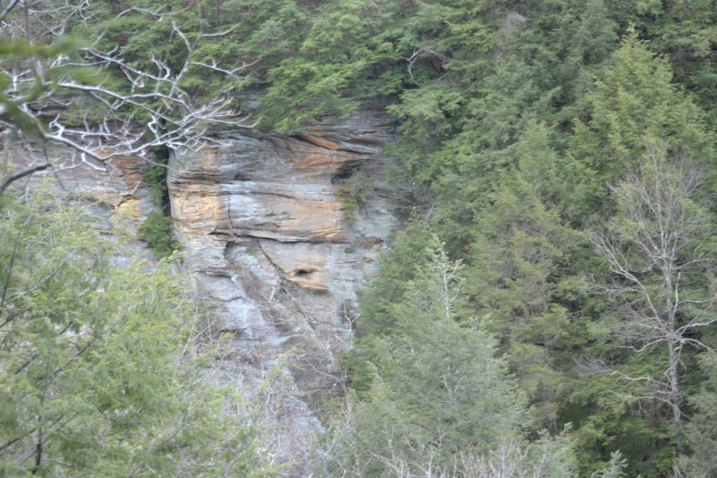
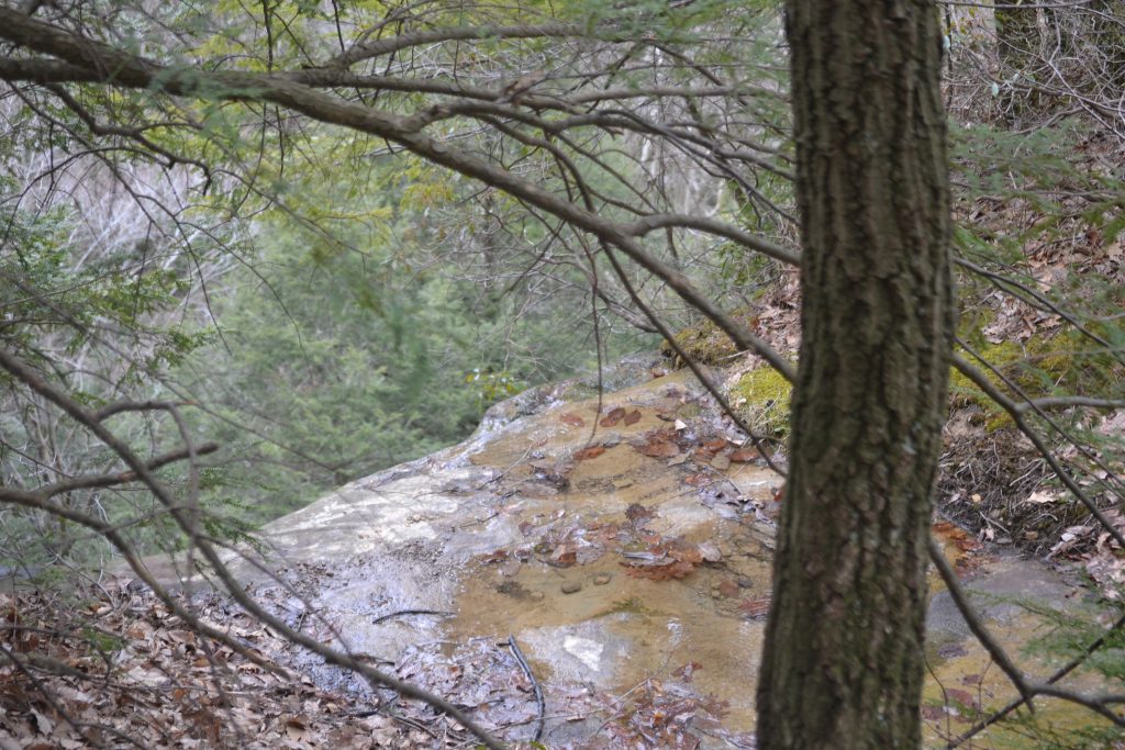
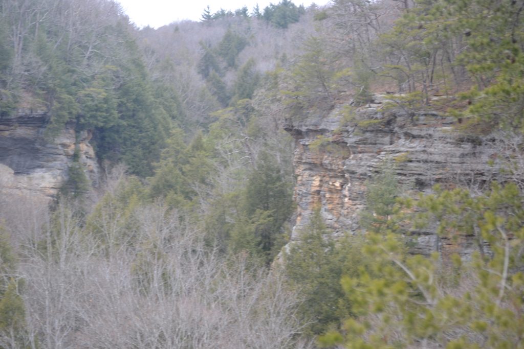
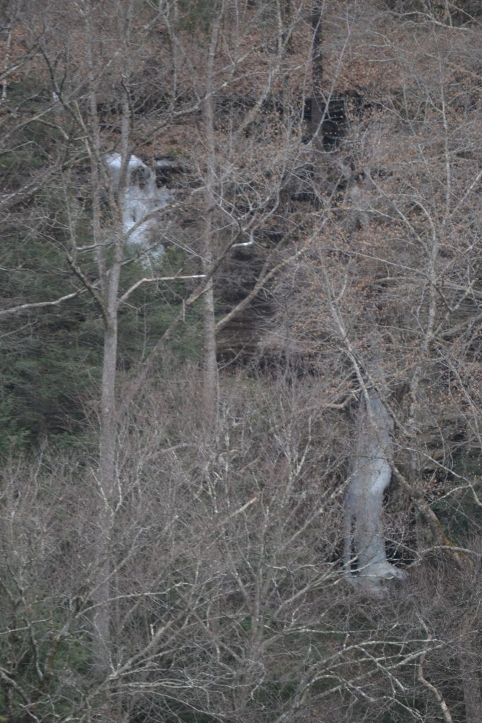
Along the path were Mojave Yucca plants growing along the trail and we began to hear the crashing of waves along the Pacific Coast.    Looking down towards the beach we noticed the sculpted sandstone canyon.  The rocks and vegetation were an interesting desert-like contrast against the ocean and beach below.

10 Vegetation at Torrey Pines

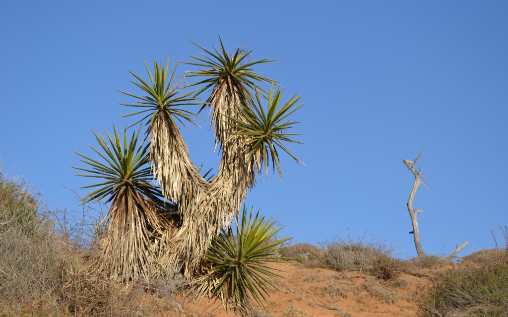
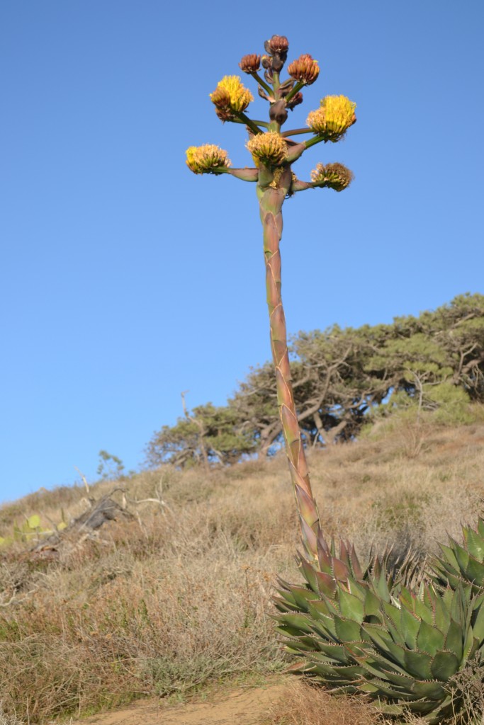
The Mojave Yucca plants looked like scarecrows standing along the trail.  Adding to the interesting landscape, they appeared as fireworks sprouting out from pillars of hay.  The yucca bloom between the months of April to May exhibiting green capsules with white flesh that eventually dry up in the late summer months.

11 View of Pacific at Torrey Pines

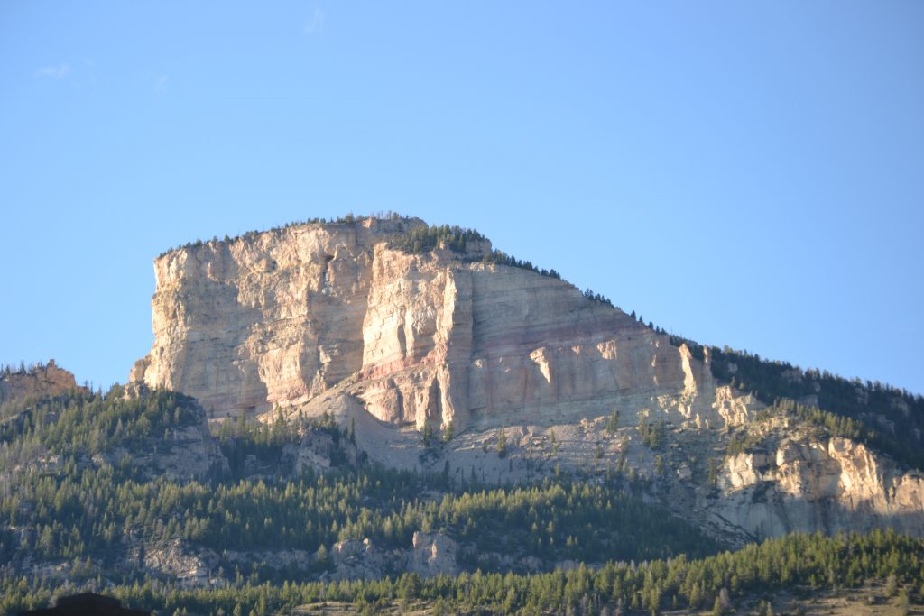
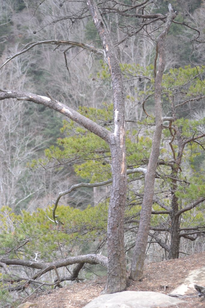
This area is home to the rarest tree in North America, the Torrey Pine, for which the preserve is named.  Indigenous to southern California, these pines also grow in Santa Barbara, but only in these two locations.  It is for this reason, the Torrey Pines Preserve was designated to protect these trees from further city development.

13 View of TPSP Lookout

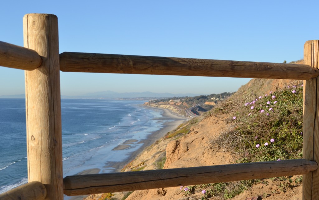
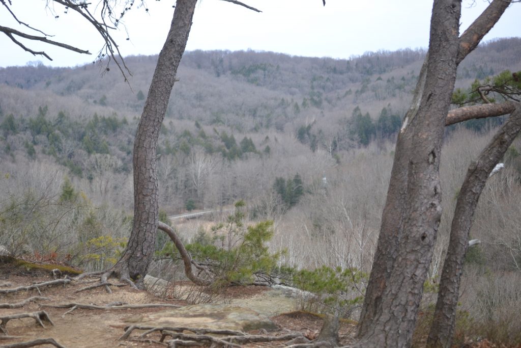
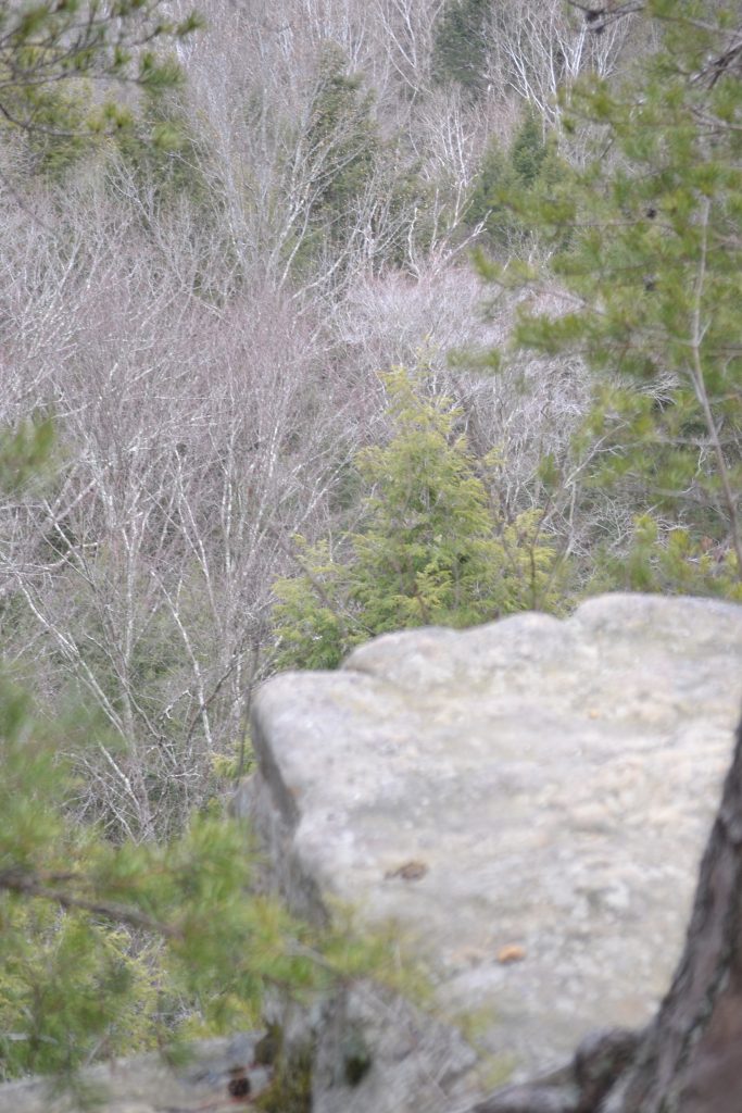
Along the trail were several scenic lookouts where we stopped to admire the coastline.  Looking towards the north, I was able to see Del Mar’s Peñasquitos Marsh which is a part of the preserve.  The name is Spanish for little cliffs and forms a natural border between San Diego and Del Mar.

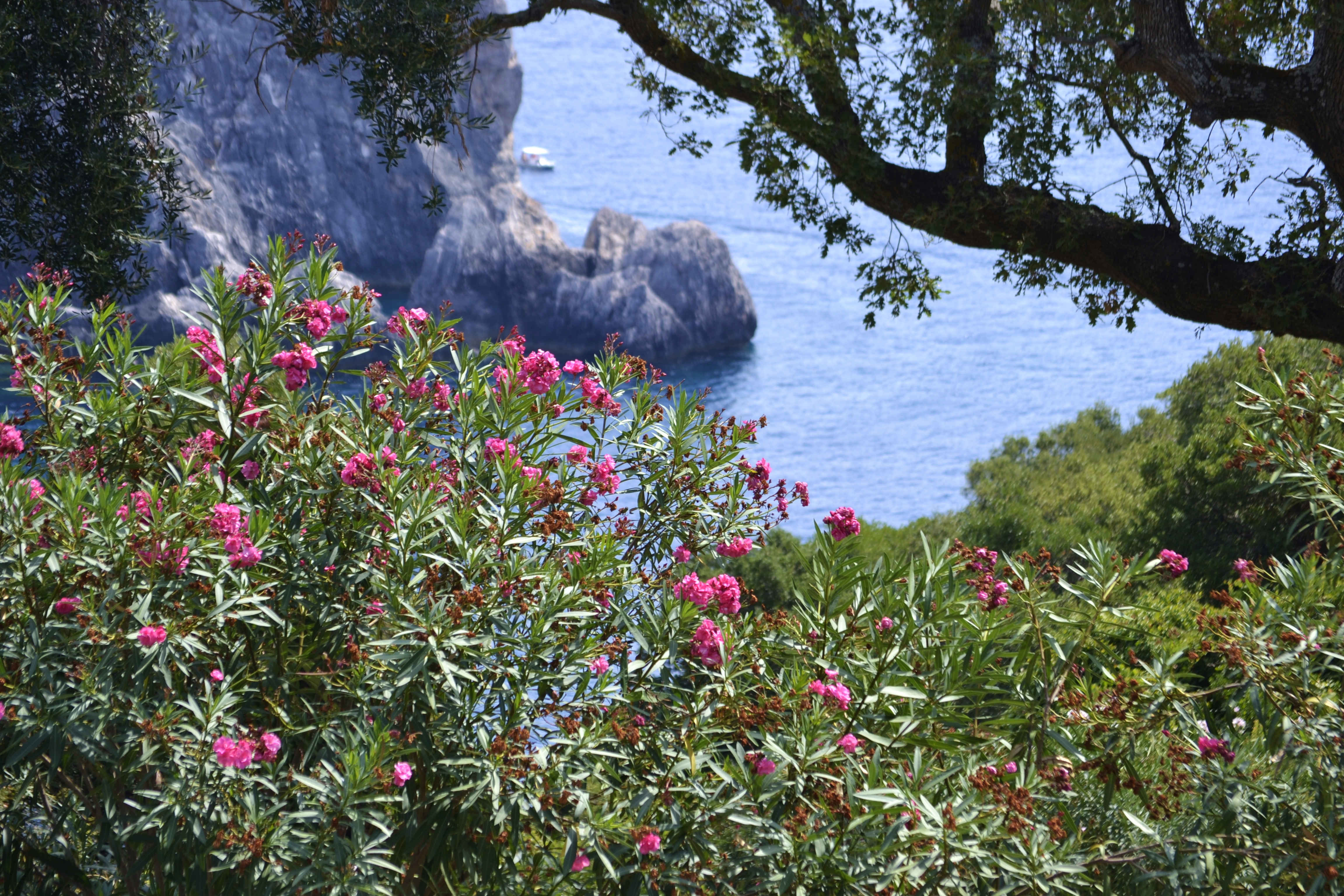
Growing among the rocks were pink sand verbenas that added vibrant color to the clay hues of the sandstone.

15 View for the Torrey Pines Path

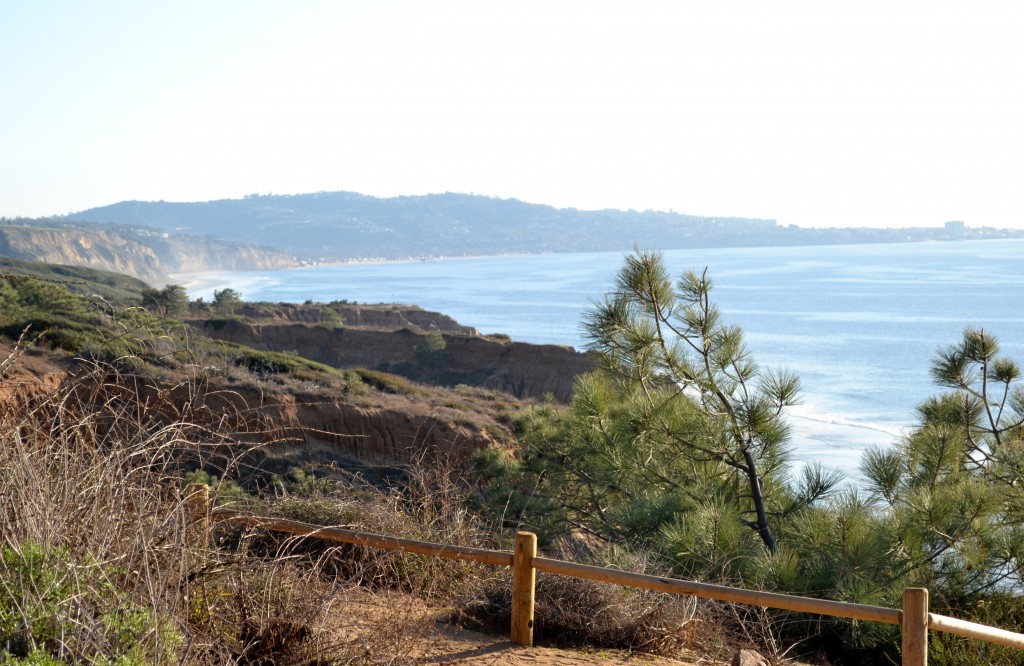
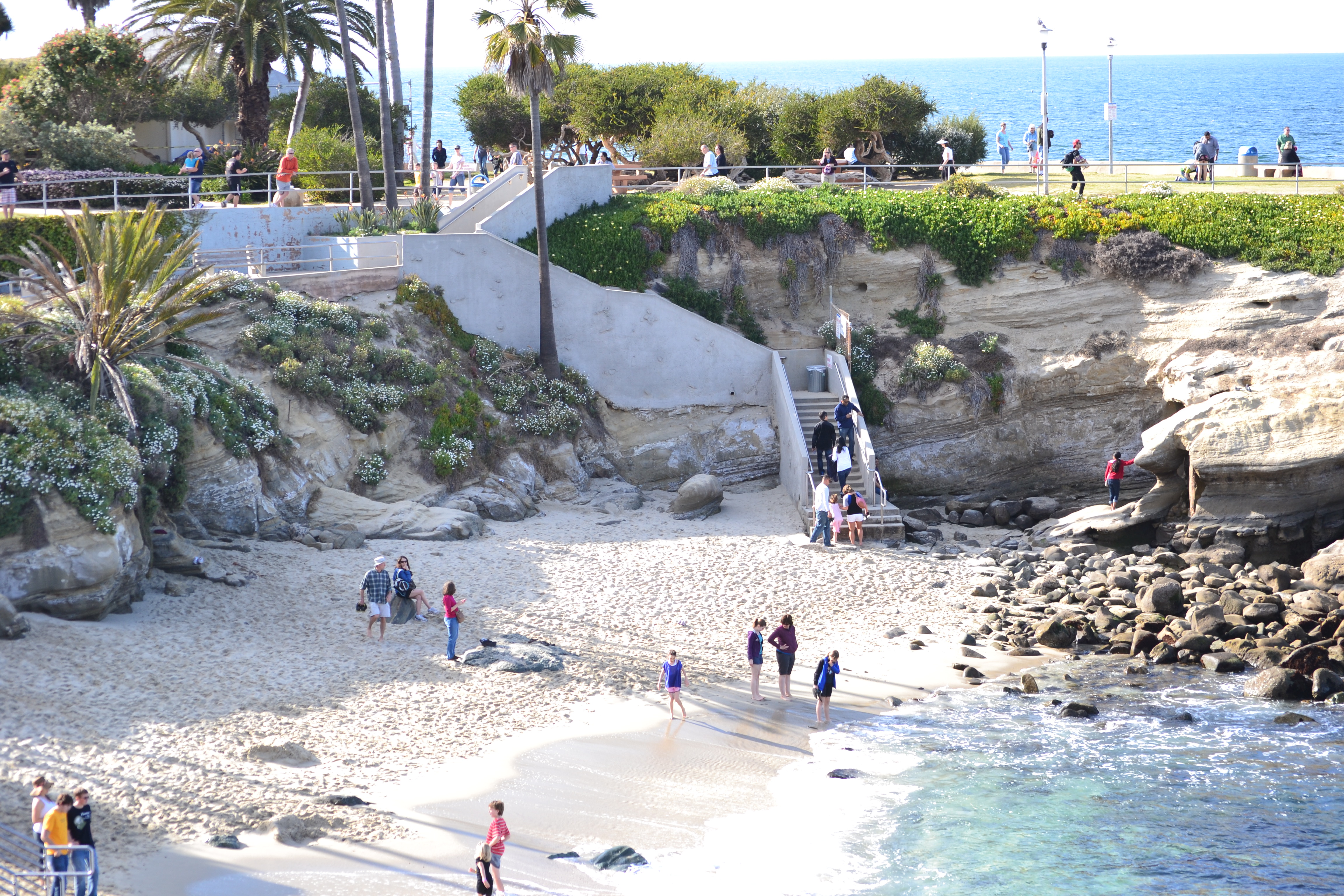
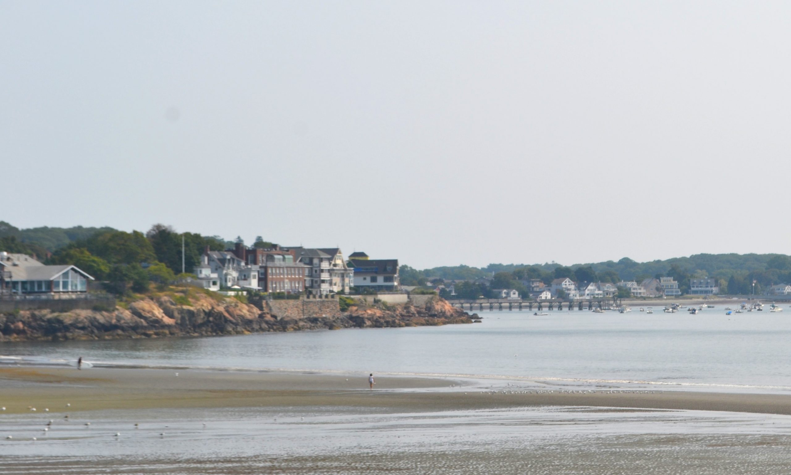
Off in the distance, I could see  La Jolla Cove as I looked south from the trail.  On a clear day, San Clemente and Catalina Island can be seen from here as well.

16 PCH View 2, TPSP

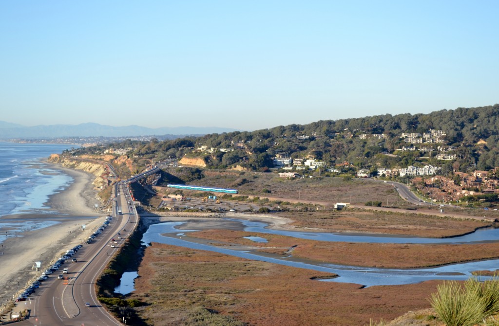
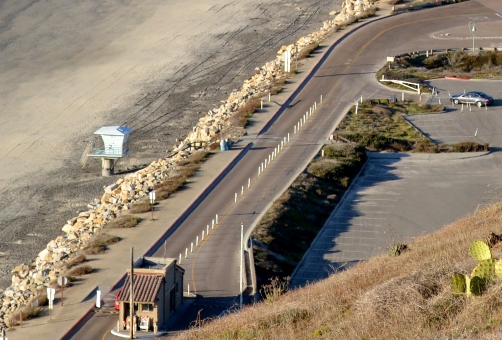
Peering down from the trail towards the parking lot and entrance station, we were  looking up the coast towards the north.  From here, we could once again see a small section of the Los Peñasquitos Marsh Natural Preserve and Lagoon.

17 Beautiful View of Ocean and Path, TPSP

We began to travel back inland on the trail through a small forest of Torrey Pines.  Looking closely at the pines we noticed that their needles grow in bundles of five which is unique to its species.  The Kumeyaay Indians collected the pinon nut from the Torrey Pine as food while the needles were used to make baskets.

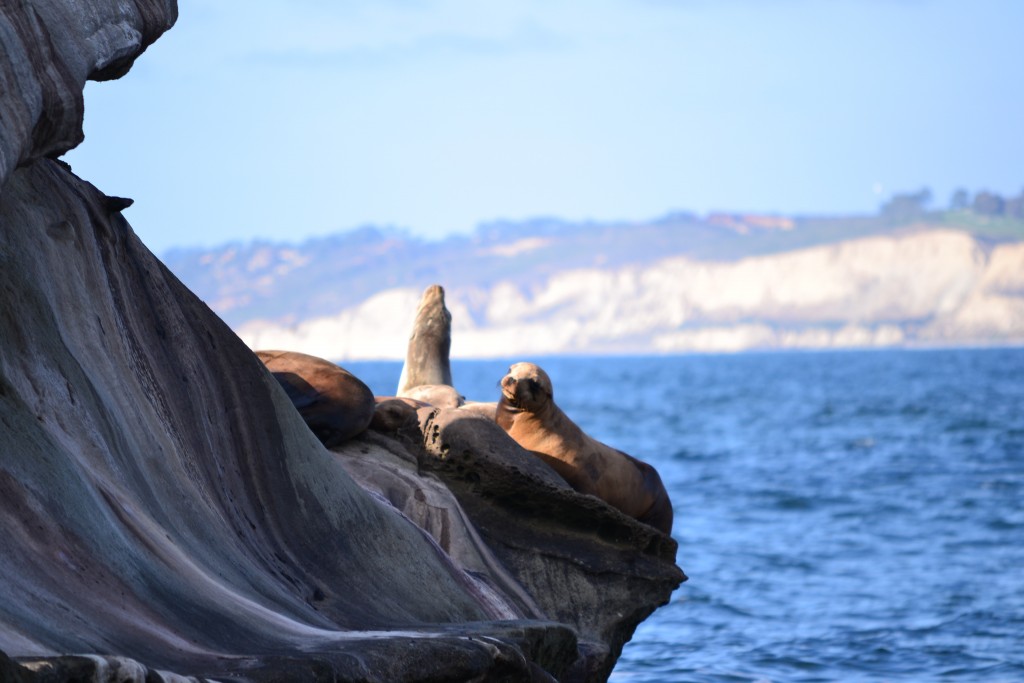
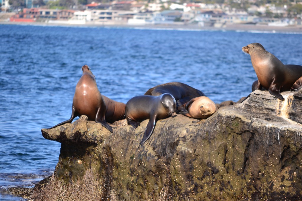
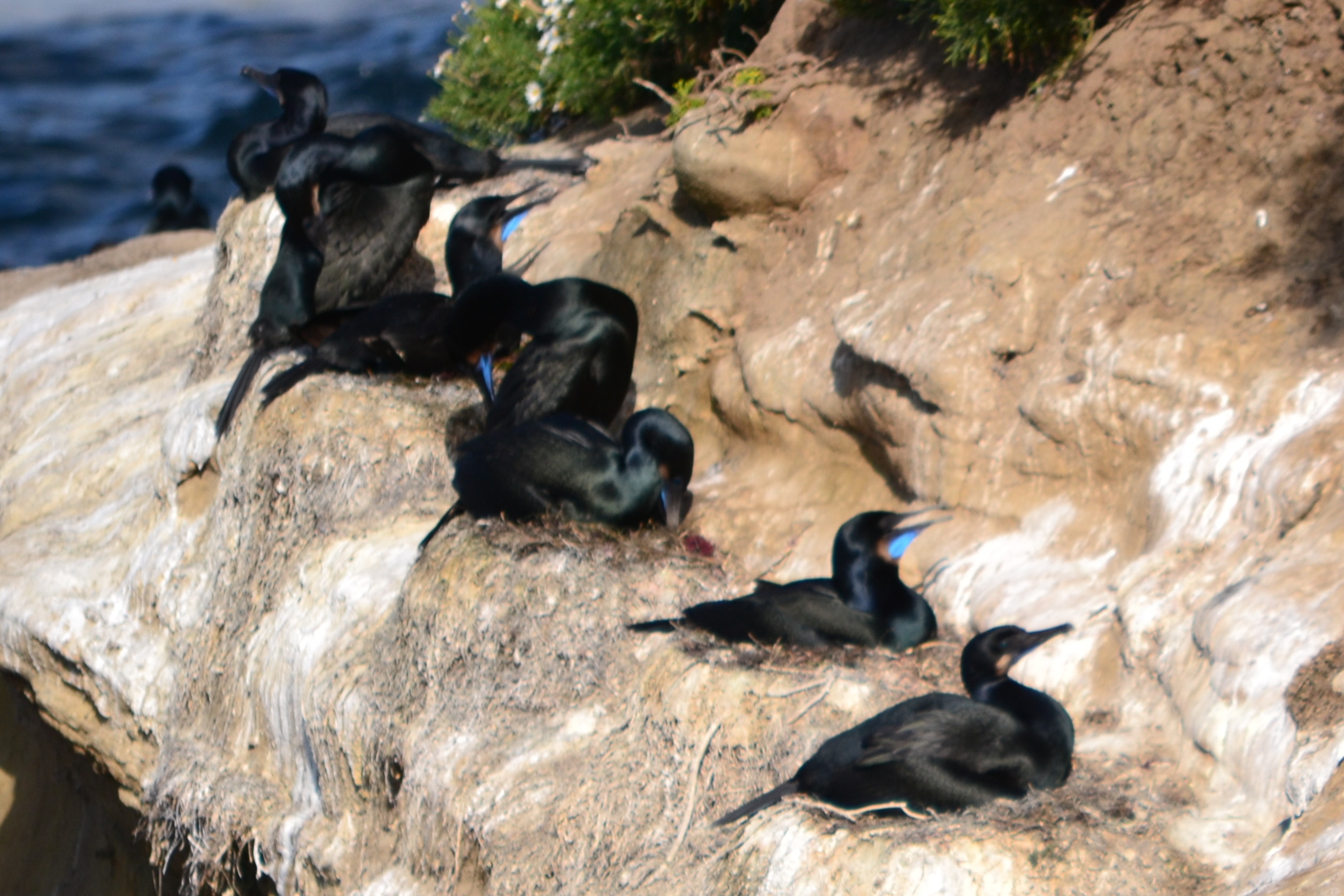
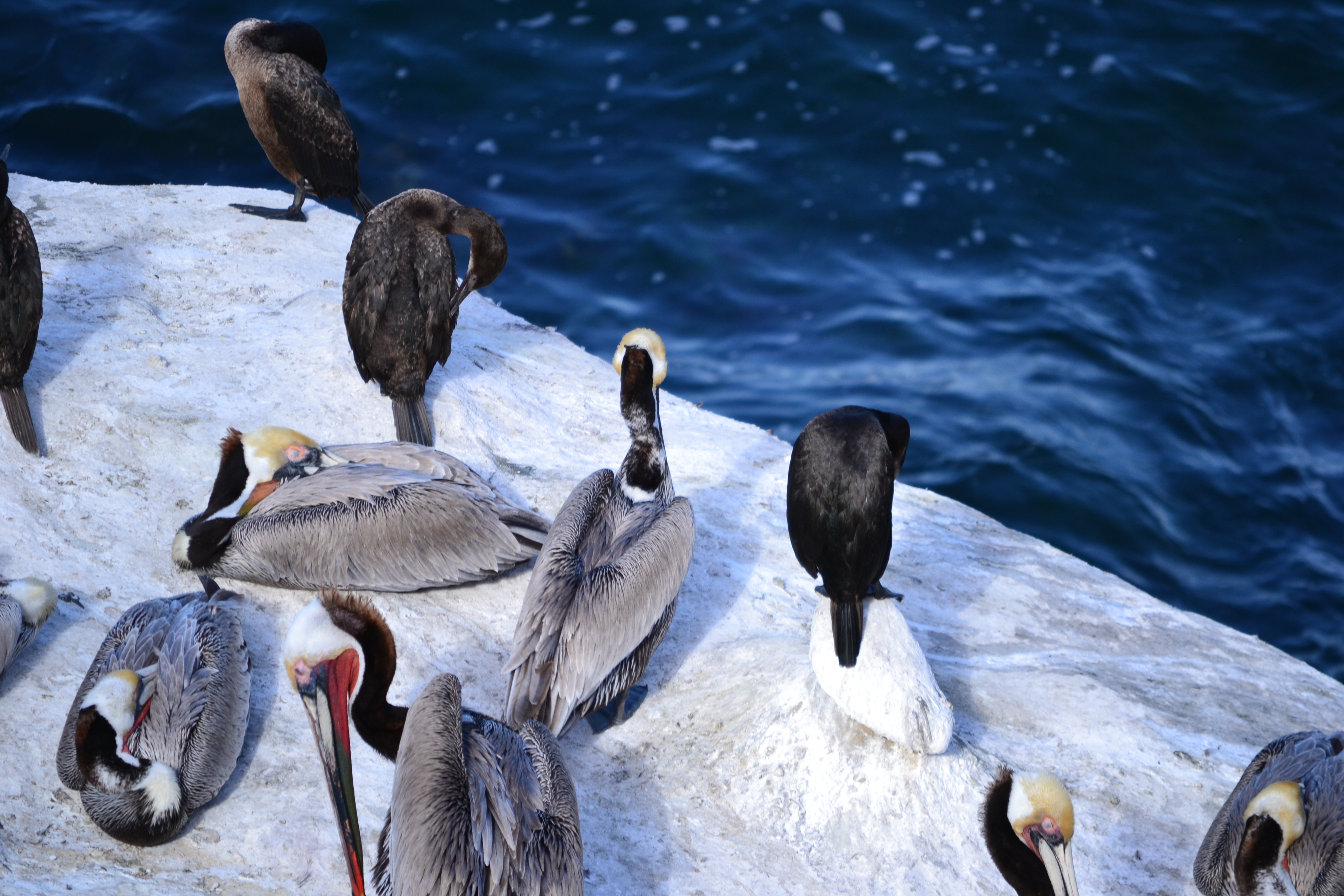
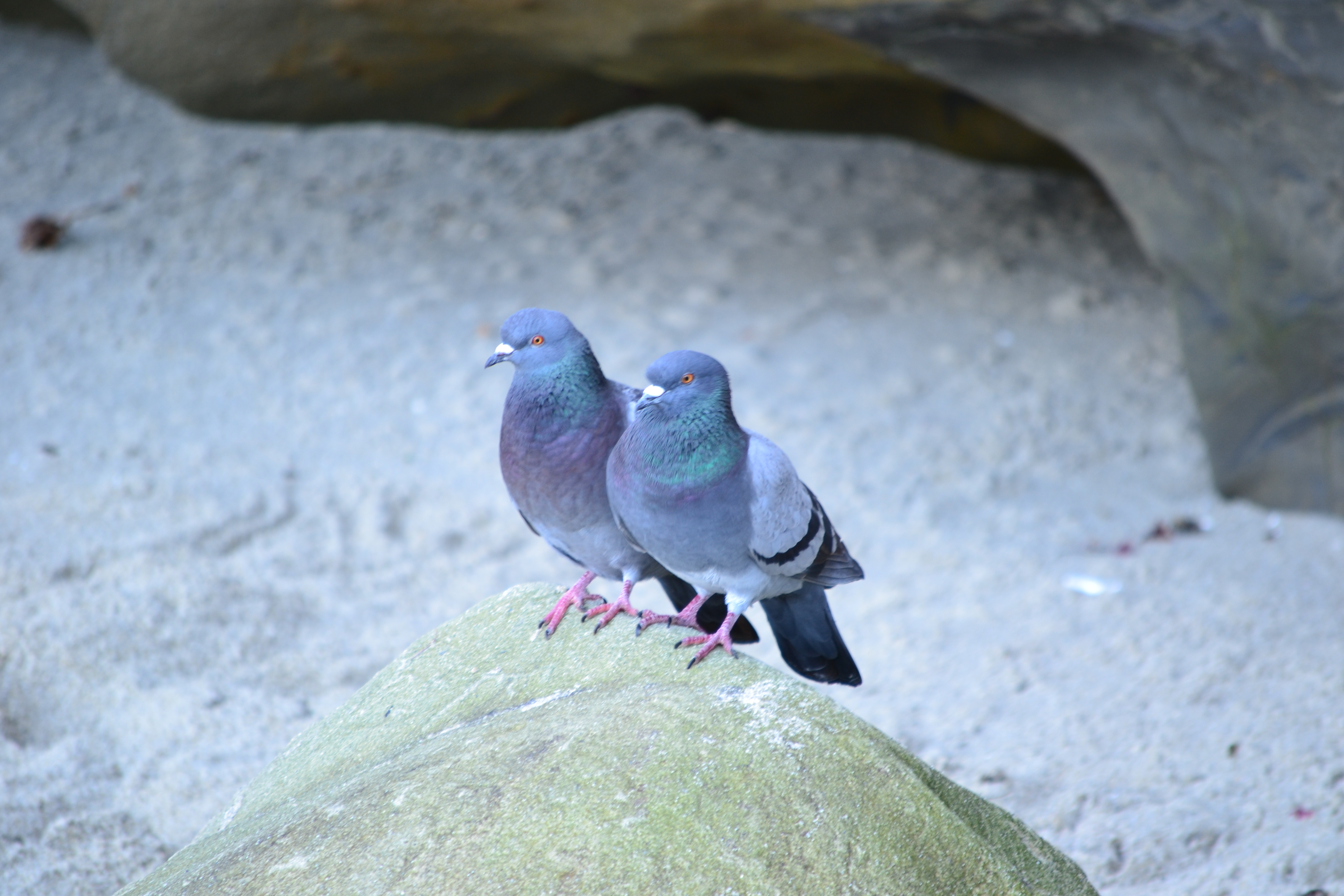
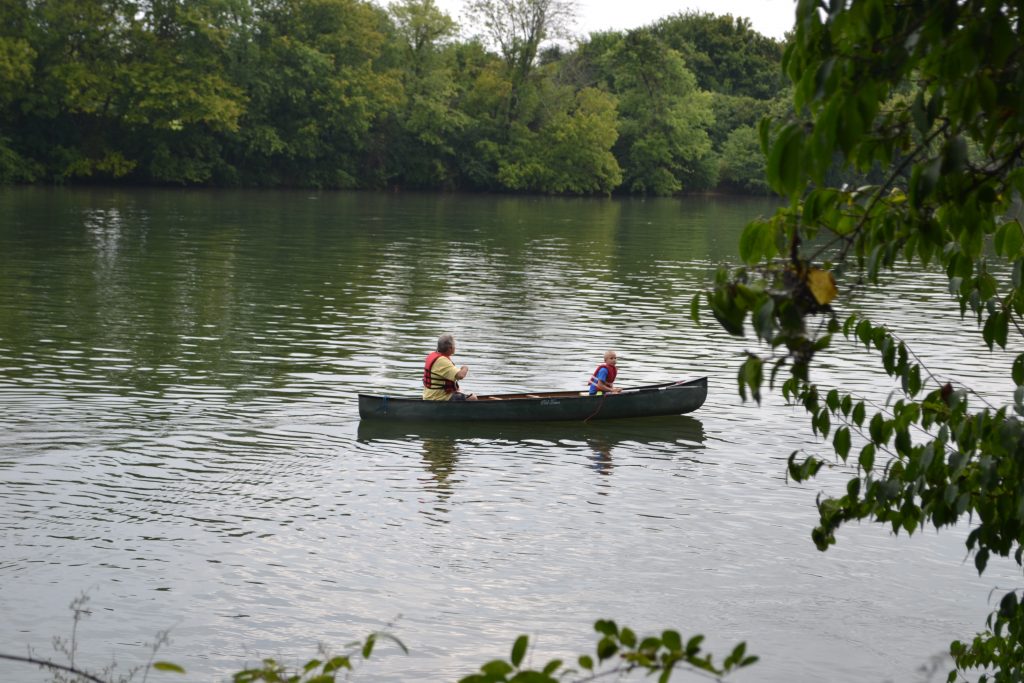
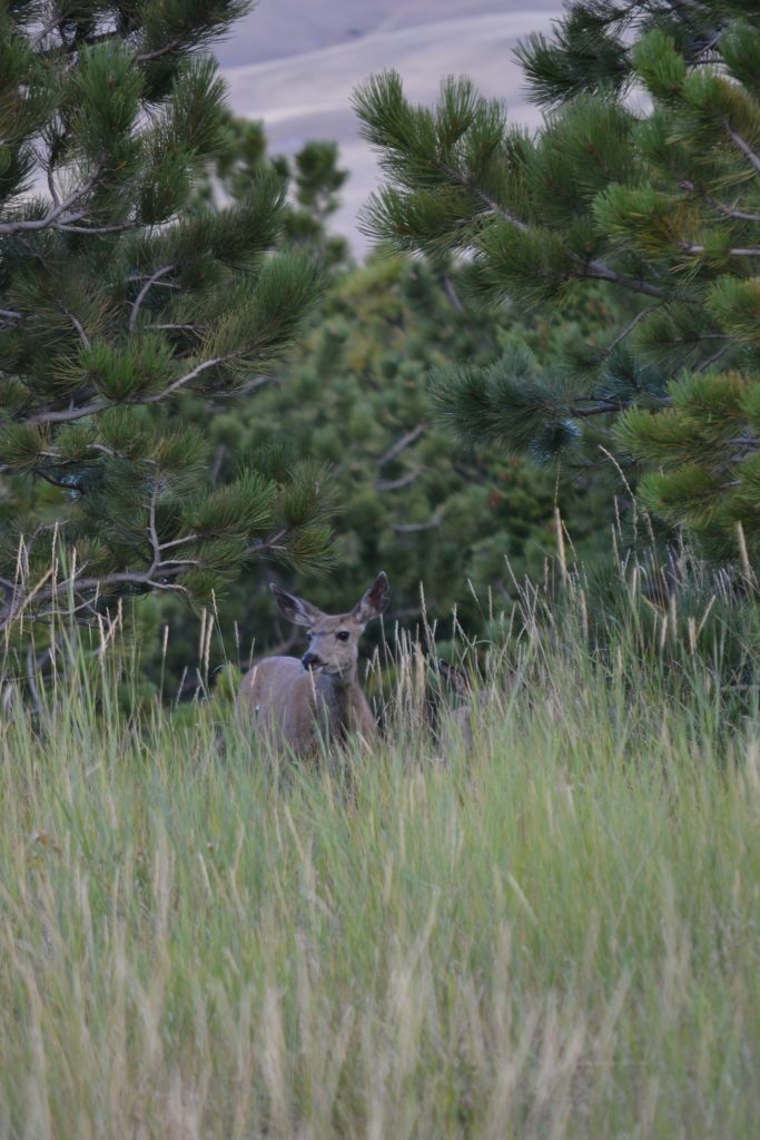
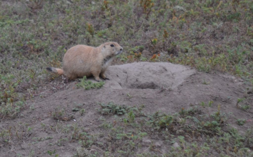
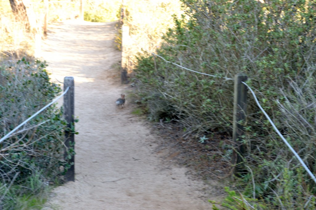
We were hoping to come across some of the local wildlife on the trail because there were not many hikers that day.  The only encounter we had was a small bunny hopping across the path, but foxes and mountain lions have been spotted on the preserve.

18 Bunny Rabbit on the Trail

We returned to where we had first started our hike and happened to notice shafts of sunlight creating shadows on the rock formations.  We had eventually reached the paved road with only a ten minute walk to the entrance gate up the steep Torrey Pines Park Road.  With plenty of time to arrive at the beach, I was on schedule to watch the glorious sunset.

What trails have you hiked in Southern California?  I would love to hear about your experience if you would kindly leave a message in the comments section below.  Many thanks for reading about my hike through Torrey Pines and wishing you many Happy Travels!

What to See and What to Do:

Torrey Pines Natural Preserve
12600 North Torrey Pines Road
San Diego, CA  92307
Telephone:  858 755 2063

  • Admission Fee:  The facility use fee depends on which parking lot you use.  South Beach parking during high season (starting at Spring Break until the end of September) costs $15 from Monday – Thursday and $20 from Friday – Saturday.  Low season begins in October until Spring Break where fees are $12 from Monday – Thursday and $15 from Friday to Sunday.  Note that high season prices may be charged during holidays, so be prepared.  For parking on the North Beach, high season (from Spring Break to end of September_ are $10 from Monday – Thursday and $15 from Friday – Sunday.  Payment is accepted at the Automated Pay Machine if no staff is available at the kiosk.  Low season rates are $3 from Monday – Thursday and $10 from Friday – Saturday.  Annual passes are available for $195.
  • Hours:  Open all year from 7:15AM to sunset
  • Amenities:  Visitor center, museum shop, guided nature walks, fishing, parking
  • Scenic View:   Gorgeous views of the coast from the hiking trails and this is the perfect place for watching the sunset.
  • Length of Visit:  3 – 4 hours, but there are hikes that will take under 1 hour
  • Tips for Your Visit:  This is a popular location for sunset and holidays can be extremely busy.  Bring water especially if you are hiking.  Food and drink (with the exception of water) is not permitted on the Reserve, but are permitted on the beach. No alcohol on the Reserve and the beach.  Dogs are not permitted and there is no smoking allowed.  Drones are also banned from the Reserve and beach.

Where to Stay:

San Diego Marriott La Jolla
4240 La Jolla Village Drive
La Jolla, CA  92037
Telephone:  858 587 1414

Where to Eat:

Nozomi La Jolla
4150 Regents Park Row #190
La Jolla, CA  92037
Telephone:   858 452 7778

I absolutely LOVE Nozomi’s Famous Chirashi Salad!

What to Eat: 

  • Burritos at Fred’s on Pacific Beach
  • Ceviche at Karina’s Ceviches & More
  • Fish Tacos at Wahoo!
  • Uni at Pacific Beach’s Sushi Ota

What to Read: 

  • From What I Remember, by Stacy Kramer
  • Beat, Slay, Love by Thalia Filbert
  • The Tombs, by Clive Cussler
  • How to be an American Housewife, by Margaret Dilloway

Photo Guide for La Jolla: 

  • La Jolla Cove
  • La Plaza La Jolla
  • The beautiful architecture of La Valencia Hotel
  • View from the Park Bench at the Museum of Contemporary Art
  • Salk Institute
  • Scoops Ice Cream
  • Scripps Pier and La Jolla Shores

19 Sun beginning to Set at TPSP

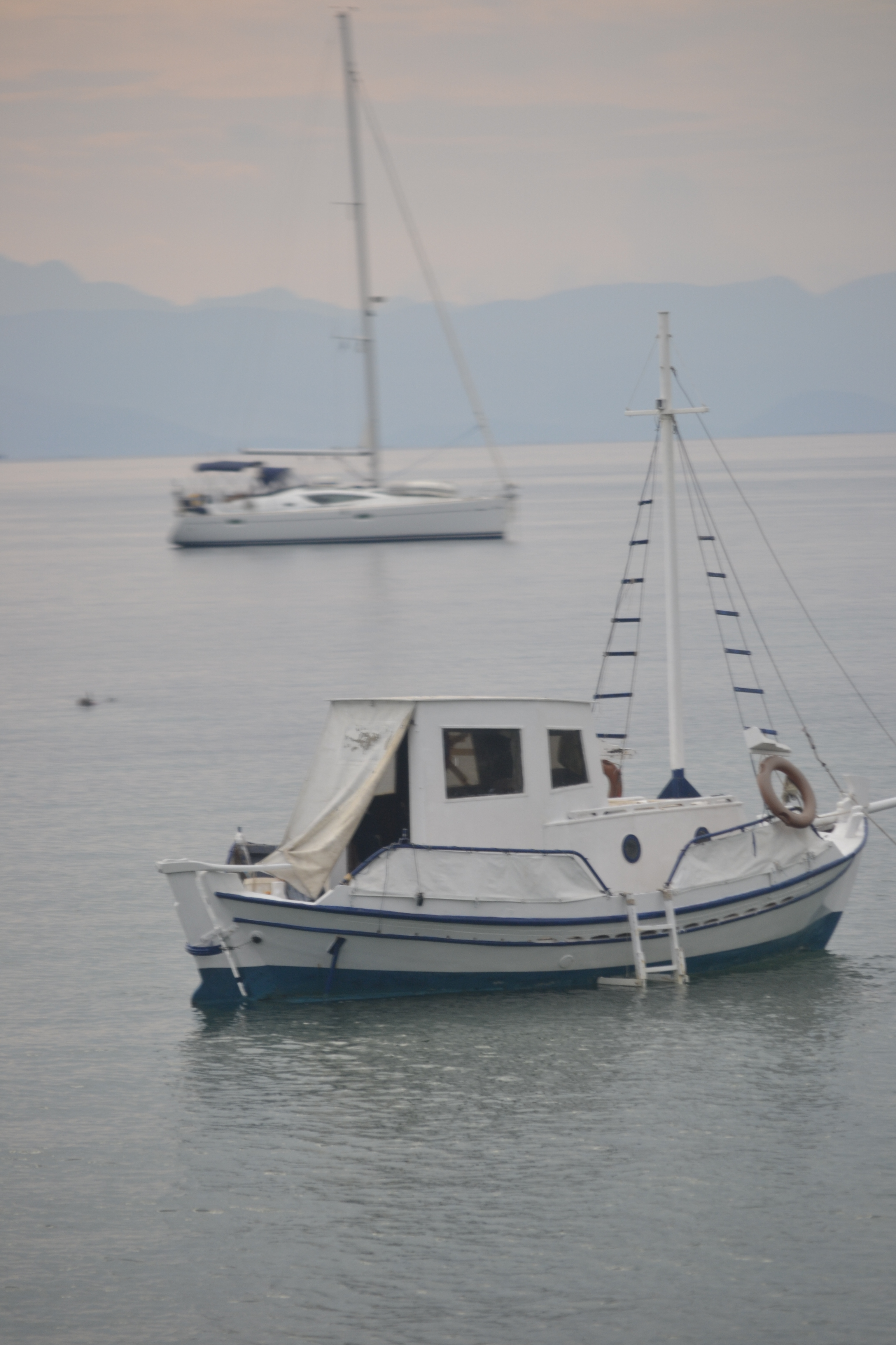
The Sun Setting in Torrey Pines

20 Sunset 2 TPSP

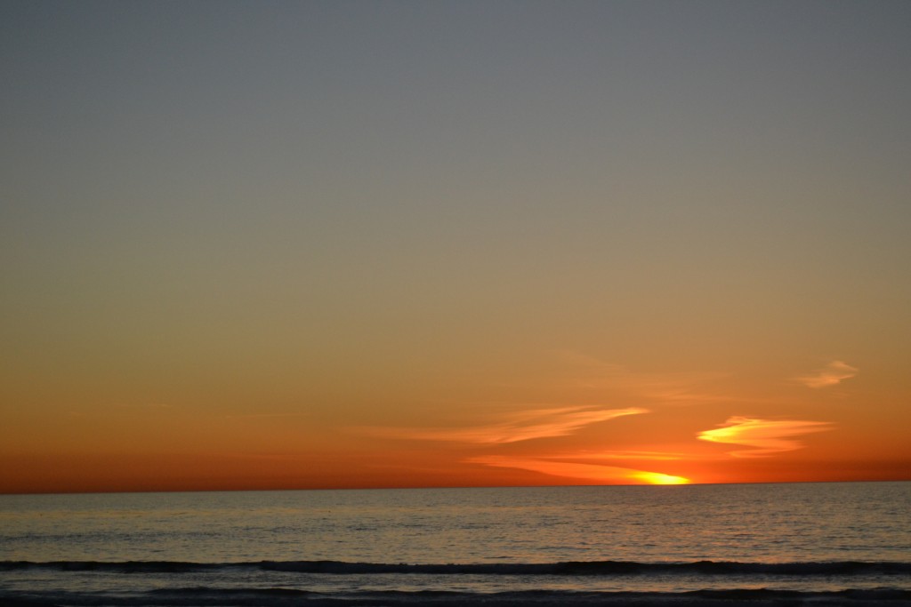
The Sunset from the Beach at Torrey Pines

21 111207 Clear night with Moon, TPSP

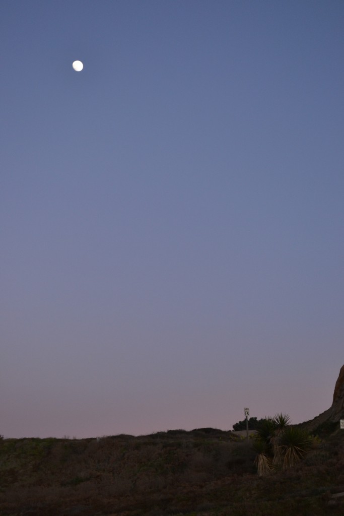
Dusk at Torrey Pines State Preserve

BCheck out more photos of Torrey Pines State Preserve in the Gallery below

Leave a comment
Share
  • Pin it
  • Share
  • Tweet
  • Share
  • Email
  • Print

La Jolla, California, the Jewel of the West Coast

1 April 20253 May 2025

+120312 La Jolla Cove Beach

After a long day of hiking in Poway, my friends and I decided to spend the rest of the afternoon in La Jolla, an exclusive, upscale suburb of San Diego.   La Jolla means “the Jewel” in Spanish which is befitting its name with perfect weather year around, high end fashion boutiques, picturesque coastal bluffs and a scenic seaside.

My favorite hangout is La Jolla Cove, a sandy beach inlet with crystal clear water.  This beautiful harbor is also home to sea lion colonies, pesky pelicans and gorgeous blue Brandt’s Cormorants.  I enjoyed the time I spent at the beach, watching the noisy sea lions bark for a spot on the rocks.  More often than not I would stroll out to the craggy coastline to watch them fight for their small piece of high end real estate.   Along the beach, there is a small, cave-like cluster of rocks where I could have a much closer view of the seals.  The opening into the cove provides a perfect frame for some amazing wildlife photography.

Often times I would check out the walking path above the cove where I could take in the dramatic cliffs.  The stunning views of the shoreline and the cove below are the reason why some refer to this area as the California Riviera.

We decided to stop for drinks at Duke’s La Jolla, to enjoy the views of the upper level which look out into the Pacific.  We thought about booking tickets at the La Jolla Playhouse or even playing a round of golf at Torrey Pines Golf Course, but since we were celebrating my friend Kristy’s birthday, we made reservations at George’s at the Cove which gave us plenty of time to stroll Prospect Street with its upscale shops and boutiques.

I never tire of the scenery at La Jolla cove, nor strolling the streets of its downtown. This is truly a Southern California paradise.

Have you had the opportunity to visit La Jolla, California?  What are your favorite restaurants and shops? I would love to hear about your experience if you would kindly leave your message in the comments section below!  Many Thanks for checking out my fun evening in La Jolla and wishing you many Happy Travels!

Disclosure:  Please refer to our blog disclaimer tab for more information.

What to See and What to Do:

La Jolla Cove – stroll the beaches and check out the amazing wildlife at The Cove!

La Jolla By the Sea – explore the boutique shops and enjoy a fabulous meal in La Jolla!

Where to Stay:

La Jolla Cove Hotel & Suites
1155 Coast Blvd.
La Jolla, CA  92037
Telephone:  858 459 2621

Where to Eat:

George’s at the Cove
1250 Prospect Street
La Jolla, CA  92037
Telephone:  858 454 4244

Duke’s La Jolla
1216 Prospect Street
La Jolla, CA  92037
Telephone:  858 454 5888

What to Eat:

  • Mexican cuisine, especially tamales
  • California wood-fired pizza
  • Southeast Asian foods
  • Sushi
  • Seafood
  • Local Wines

What to Read:

  • The Dawn Patrol, by Don Winslow
  • San Diego Noir, by Maryelizabeth Hart
  • I So Don’t Do Mysteries, by Barrie Summy
  • Under the Perfect Sun: The San Diego Tourists Never See, by Mike Davis

Photo Guide for La Jolla and nearby San Diego:

  • La Jolla Cove
  • Downtown La Jolla
  • The Botanical Building and Lily Pond at Balboa Park
  • Greetings from San Diego mural on the sidewall of Belching Beaver Brewery
  • Sunset Cliffs
  • Old Town San Diego

+120312 Seals on the South End of La Jolla Cove

Massive Seals at La Jolla Cove

120312, Close to the Seals

So Many Birds, La Jolla Cove

120312, Close Up of Birds with Blue Beak

120312, Penguins at La Jolla Cove

Flowers with La Jolla Cove in the Background+Birds on a Rock at La Jolla Cove, March_2012

Leave a comment
Share
  • Pin it
  • Share
  • Tweet
  • Share
  • Email
  • Print

Finding Solitude at Joshua Tree National Park, California

18 March 20253 May 2025

1 Light behind Tree, JTSP

My last visit to Joshua Tree National Park was last November, a perfect time of the year for a hike.  The weather had begun to cool down in comparison to the summer heat and I was ready to set out for an amazing adventure. There are so many fabulous parks in southern California where you can feel like you are the only one in the world.  This is one of them.   The surroundings are just as unique as its unpredictable environment that each visit can bring about a whole new experience.

2 Joshua Tree State Park

The whimsical Joshua Tree, for which the park is named, is an indigenous plant that reminds me of a furry cactus with starburst pompoms. These plants were used by the American Indians for food (their seeds and flower buds), household items and clothing (baskets and sandals).

The ground cover was scarce in most parts with clumps of brush, predominantly creosote bush.  Colorful ocotillo and cactus were intermittently scattered throughout the vast expanse of the desert.

3 Joshua Tree Landscape

In addition to the Joshua Tree, what I found so fascinating about this park were the endless rock formations and twisted boulders shaped by geologic forces.  According to the national park, these rocks rose from the ground beneath as a result of volcanic activity.  As the boulders were pushed up from the earth, they cooled down and crystallized.  Over time, the water from the ground rounded the edges and widened the cracks, resulting in heaps of monzogranite that look similar to toy blocks in a stack.

4 The Eagle Rock at Joshua Tree

During the scenic drive, I took the time to find images in the rocks.  If there was a large pile of them, I would pull over to see what shapes and figures appeared out of the monoliths.  I had imagined a variety of objects from eagles, rabbits, horses and even people.

5 Joshua Tree State Park Activities

About halfway to Barker Dam, I met up with a rock climber to see if I could make the climb.  I felt safe with the guide I hired, knowing that he would be there in the chance that I slipped and fell.  We met in a safe location and one that was not too difficult for a first try.    I was surprised that the rocks, for the most part, were fairly stable.  It was exhilarating to reach the top and look out into the distance of the park. I wished I would have done this sooner.

6 Rock Climbing at JTSP

Many people come to Joshua Tree National Park for a variety of outdoor activities.  During my scenic drive I noticed bikers, hikers and the occasional rock climber.  This is a perfect location for rock climbing and there are a few outfitters available to take out the adventurous for an adrenaline-filled afternoon.  I hired an excellent guide from Joshua Tree Outfitters, who was specialized in working with novice climbers.

7 Barker Dam Trail

I had also set aside some time for a hike, so I decided on the Barker Dam Nature Loop, just over a mile long.  This trail took me through parts of the desert where cattlemen built dams as a water source for their livestock back in the 1800s.  Later, miners arrived in search of gold until the 1930’s when the land was parceled out to homesteaders.

8 Landscape on the Barker Dam Trail

I enjoyed the vast diversity of hiking the trail with rock formations that took on a wide variety of shapes.  The dried out flora and fauna were at the mercy of the hot sun. and trees provided a brief solace from the scorching heat.

12 Wide Angle Landscape on the Barker Dam Trail

The landscape was extremely spacious with small rocks and boulders, while hills in the distance were low lying and desolate.  The hike remained unsteady with stones until I finally reached the dam.  I tried to look down into the wall but there was not a way for me to approach it any closer without falling over the edge.

14 Petroglyphs on the Barker Dam Trail

I was nearing the end of the trail when a boulder appeared in the middle of nowhere.  As I closed in on the site, I noticed there were petroglyphs painted in red and black.  I learned that there were actual Indian markings in the rocks, but they had been painted over and were not authentic.

15 Chipmunk at the Park

My day at Joshua Tree had come to a close and as I was crossing the parking lot, I saw a little chipmunk dart out from one underneath a car.  There is nothing better than seeing animals in their natural habitat.  Such a highlight of my day.

An area slightly larger than the state of Rhode Island, Joshua Tree National Park begs to be explored.  Offering activities for all types of outdoorsmen, this is a wonderful way to explore the deserts of California.

Have you visited Joshua Tree National Park?  I would love to hear about your experience if you would kindly leave a message in the comments section below!  Many thanks for following my journey through Joshua Tree National Park!  Wishing you many Happy Travels!!

What to See and What to Do:

Joshua Tree National Park
74485 National Park Drive
Twentynine Palms, CA  74485
Telephone:  760 367 5500

  • Admission Fee:  $30 for a 7 day vehicle permit, admitting the passengers of a single, non-commercial vehicle on the day of purchase and for the next six days.  Motorcycles:  $25 for a 7-day entrance permit, per motorcycle; Individual Entrance Fee: $15 7-day entrance fee, per person on foot or bike; Non-commercial groups: $15 per person charged to non-commercial groups entering in a vehicle with a capacity of 16 passengers or more. Joshua Tree Annual Pass is $55 valid for 12 months from the month of purchase.
  • Hours:  Open all year
  • Amenities:  Campsites are available for camping and overnight backpacking, rock climbing, birding, mountain biking, horseback riding.  There are tours offered such as a Geology Motor Tour or a tour of Keys Ranch.
  • Scenic View:   Views throughout the desert are incredible, but are amazing from the top of the rocks after a great climb. Stargazing is another spectacular opportunity for outstanding scenic views.
  • Length of Visit:  To visit the full park would take at least a couple of days, but even a day visit is well worth the trip.
  • Tips for Your Visit:  There is no cellular service throughout the park.  Bring plenty of water and sunscreen as the desert can become quite hot during the day.  In the evening, temperatures can drop, so it is also recommended to bring along a jacket. There are limited gas stations as well, so ensure that you have fueled up your vehicle.  Refer to the park’s website ahead of time to note any closures and stop by the visitor’s center for any updates regarding the park.

Where to Stay:

Hilton San Diego Bayfront
1 Park Boulevard
San Diego, CA  92101
Telephone:  619 564 3333

Where to Eat:

Parq Restaurant
615 Broadway
San Diego, CA
Telephone:  619 727 6789

There were so many amazing items on the menu such as oysters, gnocchi, mussels and my favorite, the Charcuterie Board!  Since I was taking clients out for dinner, we ordered each one and shared…perfect for four.

What to Eat:

  • Mexican cuisine, especially tamales
  • California wood-fired pizza
  • Southeast Asian foods
  • Sushi
  • Seafood
  • Local Wines

What to Read:

  • The Land of Little Rain, by Mary Hunter Austin
  • Wonder Valley, by Ivy Pochada
  • Twentynine Palms: A True Story of Murder, Marines and the Mojave, by Deanne Stillman

Photo Guide for San Diego:

  • Arch Rock at White Tank Campground
  • Skull Rock a few dozen yards from Park Boulevard
  • Cholla Cactus Garden along Pinto Basin Road
  • Barker Dam
  • Indian Cove at Indian Cove Campground
  • The Joshua Trees
  • Rock Climbers

16 Blue Skies and Boulders

One of my favorite photos of Joshua Tree National Park

17 121112, Petroglyphs at JTSP

More Petroglyphs

Leave a comment
Share
  • Pin it
  • Share
  • Tweet
  • Share
  • Email
  • Print

The River Trail at Ijams Nature Center, Knoxville, Tennessee

5 May 20243 May 2025

A beautiful canopy of hardwood forest, The North Cove Trail off of the Visitor’s Center leads to the River Trail at Ijams Nature Center.  Depending on the season, there are blooms of silverbell and hydrangea or bloodroot and cut-leaved toothwort.  In late spring, the strong scent of bugbane acts as a natural insect repellent as hummingbirds feed off of the sweet-smelling trumpet creepers.

Halfway through the .2-mile trail is a bridge.  It is the scene of yellow-billed cuckoos and indigo buntings that look like blue, chubby cardinals. The sight of eastern box turtles during the warm summer months and sound of barred owls year around are what draw visitors to this trail throughout the year.

The River Trail was marked by a placard along the path and connected North Cove Trail with the Will Skelton Greenway. Along the .7 mile trek grew American bladdernut and the spicebush which produces bright red fruit in the fall.  Yellow trillium and yellow celandine poppy come into sight during early spring, while Christmas ferns appear during the holiday season.

Located on the trail is the Boardwalk that runs along the Tennessee River.  One of the highlights of this section of the walk is the geological rock formations and Maude Moore’s Cave.

A group of boy scouts paddle their canoes along the quiet, calm Tennessee River.  It was a cool, peaceful morning for earning their badges as they identified plants and trees on the banks of the waterway.  Along the river were sounds of the yellow and grey prothonotary warblers and swallows flying overhead.

Granite rock structures protruded from the cliffs.  The serene landscape and solitude were interrupted by the sounds of birds perched in the nearby sycamore trees. The area is home to the white-eyed vireos, common yellow-throats, bald eagles and ospreys.

It was early enough in the morning where the coolness of the day appeared as a mist hovering over the river.  We noticed a fisherman in a kayak trying his luck at catching bluegill and sunfish.

We soon approached one of the entrances to Cave Springs Caves, which were carved out by an underground stream.  These entryways have been boarded up with wood to protect the bats and salamanders that live inside.  Known by the locals as Maude Moore’s Cave, it was given this name because Maude, after having shot and killed Roy Harth, she hid in this cave system until giving herself up to law enforcement.  She was later found not guilty for acting in self-defense.

On occasion, we looked over the side of the Boardwalk into the Tennessee River to see if there were turtles, lizards or snakes resting along the rocks.   There was also the potential to see blue herons, belted kingfishers and crested cormorants that frequent the area to snack on a fish or two.

Although we couldn’t feel it, the earth beneath us was moving, creating  faults and folds that are eventually exposed at the surface.  Along the River Trail at Ijams Nature Center, there is a geological fold of rocks as a result of the pressure from the underground movement, but lucky for us, we hadn’t even noticed.

We came to a point where we had to decide whether to follow the River Trail or stay on the boardwalk.  A set of rock stairs led up into the sugar maples, but we opted to continue towards the gravel road that leads to an old quarry and cedar glade.  We eventually passed an obstacle course and noticed a placard  that informed us of the meadow habitat up ahead.

We crossed through the field and found a small pond, home to frogs, salamanders and newts.  The Visitor’s Center was within view, ending our hike and so we decided to go in for an opportunity to learn more about the Ijam’s nature center and its habitat.

Have you had the chance to visit Ijam’s Nature Center in Knoxville?  What was the most fascinating aspect of your visit?  I would be interested in hearing about your time spent at Ijam’s if you would kindly leave a message in the comments section below.  Many thanks for reading about my hike and wishing you many Happy Travels!

What to See and What to Do:

Ijam’s Nature Center
2915 Island Home Avenue
Knoxville, TN  37920
Telephone:  865 577 4717

Where to Stay:

Four Points Sheraton Knoxville Cumberland House
1109 White Avenue
Knoxville, TN  37916
Telephone:   865 971 4663

Where to Eat:

Babalu
412 S. Gay Street
Knoxville, TN  37902
Telephone:  865 329 1002

Check out my write up on this fabulous tapas restaurant, Babalu.

What to Eat in Knoxville:

  • Brunch at Bistro on the Bayou
  • Chicken pot pie
  • Fried Green Tomatoes
  • Mac and Cheese
  • Meatloaf
  • Tennessee Whiskey

What to Read:

  • Historic Knoxville: The Curious Visitor’s Guide to Its Stories and Places, by Jack Neely

Photo Guide to Knoxville: 

  • Bike Sculpture
  • Bridge Sunrise
  • CityView Sunset from SoKno
  • Fort Dickerson Quarry
  • Gay Street
  • Greetings from Knoxville Postcard Mural
  • House Mountain
  • Sunsphere
  • Tennessee Theater on the corner of Gay Street and Clinch Avenue
  • A View from the Bluffs
Leave a comment
Share
  • Pin it
  • Share
  • Tweet
  • Share
  • Email
  • Print

Corfu, Greece…the Favorite Vacation Destination for an Empress

8 May 20233 May 2025

D4 Corfu Fort in Old Town

Overlooking the Mandraki Harbor in Corfu, the old fort displayed evidence of Venetian influence with images of winged lions resting on its fortification.

Kerkyra, more commonly known to tourists as Corfu, is located just off the mainland of Greece, between the Adriatic and Ionian Seas.   Corfu Town is a popular port with a strong Venetian influence as exhibited in its architecture.

D4 Restaurants in Corfu Town

Throughout the maze of streets in the Old Town, there were several streetside cafes.

D4 The Liston Restaurant

One of the more interesting areas of Corfu Town was Liston.  Because it had once been occupied by the French, the country’s influence on Corfu was visible in its architecture.  Fashioned after the Rue de Rivoli, it was a replica of one of Paris’ most famous streets.  The French ruled here from 1797 to 1814 (with a brief rule by the Ottoman in between), and then later the British from 1814 to 1864.

D4 Promenade in Old Corfu Town

In the early days when the Venetians ruled Corfu, only the noble and aristocrats were permitted to walk among the arcades.

D4 Entrance to Spyridion, Corfu

Through the alleyways I caught a glimpse of the beautiful flowers cascading from archways and apartment balconies.  D4 Church Spyridion in Corfu Town

The Church of Agios Spyridon was located a few blocks behind the Liston.  Built in the 16th century, it displays ceiling murals designed by Panagiotis Doxaras.

D4 Lit Church candles

I love the Greek tradition of placing candles in the sand outside of the church.

D4 Corfu, famous for kumquats

There are many shops scattered among the streetside restaurants that offer local delicacies.  One of the shops provided samples of kumquats and kumquat liquor.  Kumquats are a fruit that comes from a tree.  They are small, about the size of an olive and resemble the orange in both appearance and taste.

D4 Boats in Corfu Harbor

It was time for us to board the bus headed to the Achilleion Palace.   Sailboats anchored off the scenic coast as we made our way south during our drive.

_DSC0511

The Achillion Palace was built for Empress Elisabeth in 1890 as a second home and retreat from her native Austria.  It was later acquired by German Kaiser William II in 1898 after she was assassinated.  The palace is now a museum displaying the belongings of both the Empress and Kaiser.
D4 Achilles at the Achillion Palace

Throughout the mansion there were statues and paintings of Achilles.  Achilles was a mighty warrior and Greek hero of the Trojan War.   He was killed when a poisoned arrow was shot through his heel, the only vulnerable part of his body.

D4 Statue of Achilles at the Achillion Palace

Another statue on the grounds of the mansion showed Achilles reaching towards his ankle in pain after having been shot.  Today we know the tender area behind our foot as the “Achilles Tendon”.

D4 Palace Painting of Achilles

In keeping with the Achilles theme throughout the mansion, the mural inside titled “The Triumph of Achilles” depicted Achilles’ defeat over Hector during the Trojan War. Achilles was riding a chariot dragging Hector behind._DSC0539

Empress Elisabeth had a tragic life.  A year after the death of her son, she decided to build a summer home on the island of Corfu.  She grew to love the Greek culture and language and the Achillion Palace was her favorite place with its panoramic view of the island.

_DSC0549

Elisabeth’s love of Greek mythology was evident in the entryway of her palace with statues depicting fairies and fauns.

_DSC0556

Once I had completed the tour of the Achillion Palace, I took a moment to have a drink at the Nova Bella Vista, a Mediterranean café.  It was the perfect opportunity to take in the coast.

We had a short bus ride to the town of Paleokastritsa on the east side of the island where we would visit a monastery, have a group lunch and then hang out at the beach if there is enough time.

D4 The Moni Theotokou Monestery

The Monastery of the Virgin Mary, also known as Panagia Paleokastritsa, is of Byzantine origin and was first built in 1228. It was a short uphill climb from the beautiful bay of Paleokastritsa. The current structure was from the 18th century and provided stunning views of the coastline.

D4 Bell Tower in the Monestery

Even today, there are Greek Orthodox Monks who reside here to hold mass and provide assistance to the local residents.  They offer tours of the monastery and grounds and are happy to answer any questions you may have regarding their home.

D4 Cats of the Monesteries

There are several resident cats who will take the time to play with you during your visit to the monastery.  They live here permanently and are cared for by the monks.

D4 Gas Lamps within the Church of the Monestery

As we approached the church, we were reminded that only those dressed appropriately (shoulders and knees must be covered) were permitted to enter.  They also requested that we provide a small monetary donation.

D4 Palaiokastritsa Grottoes

Leaving the village of Lakones towards the bay, I was rewarded with a magnificent view of Paleokastritsa and the fir trees.

D4 Plants framing the Grottoes

The crystal blue waters and rock formations below can be explored by kayak. There is a small beach here for those that have brought the proper attire, but soon we would board the bus to head back to the ship.

D4 Grottoes ready to Explore, Corfu

The bay of Paleokastritsa from the beach was full of craggy rocks. There were several restaurants across the street to enjoy a light lunch and there were a variety of menu items for sale.  I did not want to leave the beautiful blue sky and blue sea, the friendly locals and the relaxed atmosphere.  I can see why this island is perfect for an Empress.

Have you visited the island of Corfu?  Where did you go and what was your favorite activity?  I would be happy to hear about your adventures in Corfu if you would kindly leave a message in the comments section below.  Many thanks for reading about my visit and wishing you Many Happy Travels!

D4 Part 2 of the Achilles Painting

…dragging Hector behind…

Have you had the opportunity to visit the island of Corfu?  What was your favorite part of your visit?  I would love to hear about your experience if you would kindly leave a message in the comments section below.  Many thanks for reading about my amazing visit to Corfu and wishing you many Happy Travels!

What to See and What to Do: 

Old Venetian Fortress
Corfu, 491 00 Greece

  • Admission Fee:  6 Euros per person and 3 Euros for seniors
  • Hours:  Open daily from 8AM to 8PM
  • Amenities:   restaurant (expensive), restrooms, ice cream and refreshments
  • Scenic Views:  The views of Corfu Town and the Ionian Sea are spectacular from the fort.
  • Length of the Tour:  2 – 3 hours
  • Tips for Your Visit:  The entrance is located in front of the Liston near the Explanade.  The climb to the top to see the lighthouse is steep.  The walking paths are a bit slippery, so wear appropriate walking shoes.  When the cruise ship is in port, the fort can be quite busy and with only one restroom, the lines can be long.  The attraction is not handicap accessible.

Church of Agios Spyridon
Platytyra, Corfu, 49100
Telephone:  +30 26610 39912

  • Admission Fee:  No charge, but a small donation is much appreciated
  • Hours:  Open daily from 7AM to 8PM
  • Length of the Tour:  1 hour
  • Tips for Your Visit:  Wear appropriate dress which requires the shoulders and knees to be covered.

Achilleion (Achillion) Palace
Telephone:  +30 26610 56245

  • Admission Fee:  10 Euros per person
  • Hours:  Open daily from 8AM to 9PM
  • Amenities:   restaurant nearby, audio guides, gardens,  souvenir stalls, restrooms,
  • Scenic Views:  The views of Corfu Town from the gardens is beautiful.
  • Length of the Tour:  2 – 3 hours
  • Tips for Your Visit:   Have your passport/identification ready for renting the audio guide.  When the cruise ship is in port, the palace can be quite busy and they have priority over individual entries, so go early in the day or late afternoon to escape the crowds.

The Monastery of the Blessed Virgin Mary, also known as Panagia Paleokastritsa
Kavos, Greece

  • Admission Fee:  No fee, but be prepared to make a small contribution
  • Hours:  Open daily from 8AM to 9PM
  • Amenities:   restaurant  with stunning oceanside views.  udio guides, gardens,  souvenir stalls, restrooms,
  • Scenic Views:  Beautiful view of the Paleokastritsa up the climb and the restaurant also has amazing views
  • Length of the Tour:  1 – 2 hours
  • Tips for Your Visit:  The walk up the hill to the monastery is quite steep.   Wear comfortable walking shoes and bring water if the temperature is warm.  There is a monk available to answer any questions you may have.

Where to Stay:

MarBella Corfu
Agios Ioannis Peristeron
49084 Corfu, Greece
Telephone:  +30 26610 711836

Where to Eat:

Cafe Liston
Kerkiras 10
Kerkiras, 491 00 Greece
Telephone:  +30 2661 045528

What to Eat:

  • Baklava is layers of phyllo dough filled with nuts, spices and sweetened with honey
  • Greek Salad
  • Greek Wine from Santorini is unique as the grapes are grown in volcanic ash
  • Gyros
  • Lamb
  • Local Olives
  • Mashed Fava Beans (Fava me Koukia)
  • Moussaka is an eggplant or potato based pie with meat and cheese
  • Pomegranates
  • Saganaki is a phyllo pastry stuffed with cheese and covered in honey
  • Souvlaki are meat kabobs made from lamb, beef or chicken
  • Spanikopita is a phyllo pastry filled with spinach, cheese, and sometimes onion
  • Tomato Fritters made with tomatoes and onion, they are spiced either with oregano and peppermint then deep-fried
  • Tzatziki is a yogurt based sauce with bits of garlic, onion, cucumbers, olive oil and lemon. Pita bread is usually served with this dish for dipping.

What to Read:

  • The Rough Magic by Mary Stewart
  • The Raven Witch of Corfu by Effrosyni Moschoudi
  • The Holiday by Erica James
  • Stars of Fortune by Nora Roberts
  • Invincible  Summer by Alice Adams
  • The Venetian House by Mary Nickson

Photo Guide for Corfu, Greece

  • Old Town Corfu (Kerkyra)
  • St. George’s Church in Kerkyra
  • Achilleion Palace
  • Palaiokastritsa and the Monastery
  • The Gorge at Agni Bay
  • Cape Drastis
  • Vlacherna Monastery (near Mouse Island)
  • Canal d’Amour
  • Sunset at Loggas Beach
  • Porto Timoni Beach
Leave a comment
Share
  • Pin it
  • Share
  • Tweet
  • Share
  • Email
  • Print

The Bighorn Byway Drive Towards Devil’s Tower

3 November 201817 September 2024

Traveling out west, I had finally reached Wyoming and decided to take the scenic route towards Devil’s Tower. My initial plan was to travel the Medicine Wheel Passage, but it had rained the night before and I was concerned that this would have an affect on the roads as US Highway 14A is not well paved.  Instead, I decided to continue towards Devil’s Tower by way of the Bighorn Scenic Byway.

DSC_0369

I refueled in Sheridan at the Holiday Stationstores for $25 and began my scenic drive through the Bighorn Mountains with a stop at Shell Canyon and Falls.

Climbing the mountain, I noticed a lookout and decided to pull over for a short break, taking in the scenic Blue Sky drive.  Stretching my legs and walking towards the edge of the parking lot to take in the view, I happened to notice a small deer out of the corner of my eye. She was making her way down the hill so I slowly crept towards her direction for a closer look when I realized there was a young buck further down the slope.  While keeping my distance, I stood still in the lot, taking in the beautiful moment before returning to my drive.

DSC_0381

I was nearing the end of the byway when I noticed signs for the Shell Falls Interpretive Site.  Thirty miles east of the town of Greybull, I was excited to make this stop to see the falls and explore the educational center.

DSC_0384

Opening the car door, I immediately noticed the sound of the waterfall,  Long before reaching the entrance, I was surprised to see a mist emanating from the cascade with a spray that was lightly covering my windshield.  A donation box marked the start of the trailhead and within minutes, I was standing on the platform facing the falls. It was then that I realized I was too close to capture the falls it in its entirety as I had not brought the correct lens.   I stood against the handrail with my eyes closed, feeling the spray on my face.DSC_0415

After a refreshing stop and a boost of energy, I continued along the interpretive trail.  Rounding the corner and towards my left, a pathway opened up to a canyon  Rock formations seemed to rise up from inside of the valley.

DSC_0382

In the distance stood a limestone and dolomite rock feature known as Copman’s Tomb, the precipice was so named in memory of local settler, Jack Copman whose dream was to launch a glider over the side of the cliff.  Unfortunately, he was unable to complete his dream, but locals have named this immense stone in Copman’s honor.

I had finally reached the end of the quarter a mile trail where I spent about twenty minutes.  Not only was the trail a perfect break during my long journey towards Devil’s Tower, the mist from the falls provided me with a much needed car wash.

Have you had the opportunity to drive the Bighorn Scenic Byway or stop by Shell Falls?  I would love to hear about your experience if you would kindly leave a message in the comments section below!  Many thanks for reading my post about the Bighorn Scenic Byway and Shell Falls!  Wishing you many Happy Travels!

For more information about the Bighorn Scenic Byway, visit the Bighorn National Forest website at http://www.travelwyoming.com/article/big-horn-scenic-byway.

Leave a comment
Share
  • Pin it
  • Share
  • Tweet
  • Share
  • Email
  • Print

First Wild Animal Sightings in The Badlands

25 August 201821 September 2024

1 The Road to the Badlands

Approaching the Badlands on Interstate 90, I began to notice the fascinating geological formations that makes up this unique region of the United States.  I realized soon that I would be reaching the highway exit to the entrance of Badlands National Park, one of the several national parks I would be visiting on my ten-day vacation.

2 Typical Badlands Photo

The exit to access the Badlands heading west on I-90 is Exit 131 (Interior) which leads to Badlands Loop Road (Highway 240), one of the country’s most beautiful drives.  My plan was to purchase the annual National Park Pass which would allow me entrance to several of the national parks I had scheduled to visit on this trip.

Within minutes upon entering the Badlands National Park, I noticed the scenic trail providing 180 degree views of the Badland’s geology.  A fairyland of soaring spires and pinnacles, the landscape is layered in spectacular color as a result of years of water erosion and is best viewed from the White River Valley Overlook.  Running more than sixty miles in length, I had come across “The Badlands Wall”.  Dividing the upper and lower prairies, the wall is in a state of attrition, washing away into the White River Valley.  I followed this wall along The Loop Road making frequent stops along the route and taking in the magical scenery and enjoying its short hikes.

3 The Badlands and its vegetation

The temperature continued to drop, and with a mist in the air, the park gave off an eerie vibe.  The boardwalk to the first overlook had a thin layer of ice and I noticed tourists sliding along the wooden planks careful not to lose their balance.  I had expected more visitors at the park by mid-morning, but realized that the weather may have kept them away and although the weather was to reach a high of 70 degrees, there was a threat of thunderstorms ahead.  The Badlands are known for its unpredictable hailstorms and sudden rain during the summer.

Taking in the view, I imagined the region during prehistoric times when the area was submerged beneath an ancient sea.  Over time, the sea receded and the land would become inhabited by saber-tooth tigers and three-toed horses.  Today, its rolling, rounded hills look like the perfect backdrop for a Star Wars movie with its colorful hues and sparse vegetation.

4 Getting a Perspective

Looking out onto the horizon, I could hardly see the group of hikers relaxing on one of the Badlands’ formations.  The contrast between man and rock provided a new perspective of my surroundings where everything looked miniature. This view brought about a realization of just how small I was against this vast, amazing landscape.

I had planned on spending at least three hours touring the park and hiking some of the trails.  I estimated that it would take about an hour to drive the loop road while most of the hikes were no longer than a mile, ranging from easy to moderate in level of difficulty.

5 DSC_0057

As a result of years of erosion from wind and rain, the Badlands contain a large number of spires, hoodoos, canyons, bluffs and other interesting formations.  Once inhabited by the Lakota Indian tribes, it was the French Traders who gave this area its name,  “mauvaises terres”, which translates to “Bad Lands”.

6 DSC_0072

Scientists have found fossils of prehistoric mammals throughout the park, many of which were displayed on the Fossil Exhibit Trail.  Several other trails lead into the interior for an up close exploration of the Badlands ecology and ecosystems.   My favorite trails included the Door Trail, a .75 mile boardwalk path leading to a break in the Badlands Wall and the Window Trail departing from the same trailhead passing a natural window in the Badlands Wall opening up for a view of the canyon.

7 DSC_0097a

I enjoyed the short jaunts and continued my drive on Dillon Pass where I noticed several cars pulled over to the side of the road.  I was so surprised to notice a bighorn sheep resting a short distance from where we had parked and it was one of the most beautiful sights I had ever seen.  Seeing wildlife in its natural habitat is exhilarating, but I knew I had to keep my distance.

Bighorn sheep are not the only animals that make the Badlands their home.  According to the National Park Service, there are coyotes, porcupine, bobcat, black-tailed prairie dog communities, herds of American bison, pack of red wolves, prairie rattlesnakes, mule deer, black-billed magpies, swift fox and black footed ferrets.

DSC_0146

I found it difficult to break away from the bighorn sheep, but the Yellow Mounds Overlook was just around the bend where I would be able to see the spectacular striations of colors on the Badlands formations.  From blue coal to red scoria, my favorite colors among the stria were pink and gold.

DSC_0123

Located off of Sage Creek Rim Road, I looked forward to visiting Roberts Prairie Dog Town.  I immediately fell in love with the active prairie dogs and their cute little mannerisms.  They were energetic, hopping in and out of their dens, mounds of dirt with entrances on the top.  Kicking up dust while digging holes, these little critters would pause only for a moment to let out a little chirp to warn of danger.  Posted signs warn humans that these seemingly docile little animals carry disease and touching them is prohibited.

It was an exciting visit to Badlands National Park and I was most excited about seeing all of the wildlife and ecological formations. Geologists predict that, in a half a million years, the Badlands will be gone.  I was so glad to have the opportunity to explore this spectacular park and overjoyed with the animal encounters.

For more information about the park, visit the Badlands National Park website and stop by the Ben Reifel Visitor Center to browse the displays.

Have you had the opportunity to visit Badlands National Park?  Did you hike or see any of the wildlife that live here?  I would love to hear about your adventure if you would kindly leave a message in the comments section below!  Many thanks for reading my post about my day at Badlands National Park and wishing you many and Happy Travels!

Badlands National Park is located in the state of South Dakota.  Entering the Badlands from the East, I was able to program the following address into my GPS:  21020 SD Highway 240, Interior, South Dakota 57750.  For more information about the park, visit the National Park Service website at www.nps.gov and search for the Badlands National Park.

What to See and What to Do: 

Badlands National Park
25216 Ben Reifel Road
Interior, SD  57750
Telephone:  605 433 5361

  • Admission Fee: All fees are valid for 7 days which includes a $20 fee for private vehicle, $10 for motorcycle, and $10 per person for individuals hiking, biking, etc.
  • Hours:  Open daily, 24 hours; The Ben Reifel Visitor Center is open from 8AM – 4PM during winter hours; open from 8AM – 5PM April & May; open from 7AM to 7PM during the summer hours and open 8AM – 5PM early September to late October. Closed on Thanksgiving, Christmas Day and New Year’s Day.
  • Amenities:  visitor center, scenic drive, ranger programs, guided hikes, exhibits, campground, scheduled tours, audio guides are provided in 10 languages, special exhibitions, restaurant, cafes, shops
  •  Scenic View:  The incredible geological formations throughout the park are incredibly scenic along the 38-mile Badlands Loop Road (Hwy 240) as well as the wildlife.  For a panoramic view of the White River Valley, hike the mile and a half Notch Trail.  Climb the log ladder up a cliff which leads to the top of a butte.  A notch in the canyon allows photographers the opportunity to capture the perfect photo.  Stick around for sunrise or sunset to photograph the beauty of the Badlands’ strata of color.  Other trails include the Fossil Exhibit Trail and the two-day Sage Creek Trail.
  • Length of Visit:  At least 2 hours but up to 2 days to explore the whole park.
  • Tips for Your Visit:  The best time to visit the park is during the spring and fall months when the number of visitors is much lower than summer.   The South Unit’s White River Visitor Center is only open during the summer months, so check its hours of operation at the Ben Reifel Visitor’s Center.  Wear comfortable shoes for hiking and be on the lookout for rattlesnakes.  The restrooms are scattered, so use them when you can.  Stay on the trails and be careful when walking out into the formations.  Trails can be slippery after rain or snow, so proceed with caution along some of the park’s sheer cliffs.

Where to Stay:

Days Inn, Sioux Falls Airport
5001 North Cliff Avenue & 1-90, Exit 399
Sioux Falls, SD  57104
Phone:  605 331 5959
Rate:  66.56 (AAA rate) + tax = 76.88  (includes $2 lodging tax)

Hotel Rating:

The hotel is acceptable for a short stay.  Although the rooms are very dated and the furniture is stained, the rooms are clean.  Smelled like cigarette smoke, but the air conditioning worked great.  It is close to Falls Park and various fast food and dining in restaurants.   Did not stay late enough for breakfast.

Badlands Inn, located at the park near the Ben Reifel Visitor’s Center, is the perfect front row seat for Badlands sunrises and sunsets.

Where to Eat:

Red Rock
506 Glenn Street
Wall, SD  57790
Telephone:  605 279 2388

A steakhouse with specialties such as Buffalo Steak, Prime Rib and Walleye Dinner.  A little on the pricey side, but there are several options.

Badlands Saloon & Grille
509 Main Street
Wall, SD  57790
Telephone:  605 279 2210

I hear the steak with whiskey glaze is worth a try and the Angus burgers come highly recommended.

What to Eat: 

  • Buffalo:  A meat substitute for beef which is much healthier to eat.
  • Chokecherries are a Native American cherry that is made into jam, preserves, butter, wine, jelly and sauce.  Wojapi is a chokecherry sauce.
  • Dakota Martini is made of three-fourths beer and one-fourth tomato juice
  • Fleisch Kuchele is a meat pie originating from Germans who lived in Russia.  The dough is filled with meat and onions, then deep fried until the pastry is hot and flaky.
  • Hot Beef Commercial, also known as hot beef sandwich, beef combination, hot beef combo and hot beef combination.  This is a sandwich made of real mashed potatoes and chunks of seasoned roast beef sandwiched between two pieces of white bread and smothered with homemade gravy until it floods the plate.
  • Indian Fry Bread is the state bread of South Dakota, a recipe of the local Indians.
  • Indian Tacos are made with a specially spiced beef and beans, cheese, lettuce, sour cream, tomatoes, onion, black olives and house made picante sauce on the top.
  • Kolache is an amazing Czech dessert made from pastry and filled with fruit filling such as apple, cherry, lemon, apricot, prune and strawberry.
  • Kuchen is German for cake and in South Dakota, visitors can enjoy this pastry filled with custard and fruit.
  • Lefse is a flat potato bread coming from Norwegian-American origin and served with butter
  • Mocha Cakes, also known as Blarney stones, are square or rectangular blocks of light and airy white cake.  Frosted on all sides with vanilla buttercream, they are rolled in lightly salted crushed peanuts for ideal flavor and texture.
  • Pasties are savory hand pies.
  • Tiger Meat is South Dakota’s answer to steak tartare.
  • Wasna is a buffalo and berry dish passed down by the Lakota Indians.
  • Zebra Donuts are marbled chocolate and vanilla donuts that is fried, dunked in sweet glaze and hand-dipped in homemade chocolate frosting which feeds 15.

What to Read: 

  • Death Where the Bad Rocks Live, by C.M. Wendelboe
  • Badlands, by C.J. Box

Photo Guide for the Badlands: 

  • Photograph the sunrise at Badlands Overlook
  • Hike the short trails for beautiful views
    • Badlands Wall on the Door Trail
    • Notch Trail:  climb the ladder for outstanding views
    • Natural window on the Window Trail
  • White River Valley Overlook
  • Panorama Point for the sunrise
  • Yellow Mounds Overlook for phenomenal colors

Stay tuned as I explore Mount Rushmore, Custer’s Wildlife Loop Road and the Peter Norbeck Scenic Highway!

Entrance to Badlands

Entering Badlands National Park

Leave a comment
Share
  • Pin it
  • Share
  • Tweet
  • Share
  • Email
  • Print

And the Drive In Between: East Coast Driving (Massachusetts)

29 December 201716 September 2024

When my friend Dave asked me to join him on a trip to his childhood home, I was so excited to meet his family and to see where he had grown up outside of Boston. Our first day, we would hang out in Boston and Salem and then we had also made plans for a trip to Portland, Maine to meet up with his childhood friend, Alan.

We arrived early in the morning, loaded up the rental car and began our journey heading north.  The scenic coastline was dotted with historical buildings, beautifully built of stone and brick.  Reminiscent of a Norman Rockwell painting, we stopped on several occasions to take photographs and enjoy the scenery.

Stained glass windows, colorful siding and delicate roof tiles added so much character to our drive.  We played a game trying to guess the year in which each year they had been built based on their architecture.  From churches and chapels, we were completely entertained and amusing ourselves over the next couple of hours.

The further north we drove, the natural beauty of the coastal rock formations popped up along the Atlantic.  The occasional inlet would appear filled with yachts and sailboats and I wished we had more time to hang out or at least stop for lunch, but we decided that we would stop at Kelly’s Roast Beef in Saugus for their infamous roast beef and lobster rolls and I couldn’t wait.

I loved seeing all of the old signs in Saugus, like the Hilltop Steakhouse which had been opened by local businessman, Frank Giuffrida in 1961.  The restaurant was a popular spot from the 60s through the 90s expanding to 1500 seats.  I learned that it had recently closed and thought of all of the patrons the restaurant must have served over the years.  It also made me think of how hungry I was and couldn’t wait to order some lobster….are we close to Kelly’s?

It was such a great day driving the coast.  Do you enjoy road trips?  What is your favorite activity when you travel?  I would love to hear about your travels if you would kindly leave a message in the comments section below. Thank you for reading about my drive around the NE coast and wishing you many Happy Travels!

What to See and Do:

Take a Coastal Drive!

Where to Stay:

Red Roof Inn Plus+ Boston-Logan
920 Broadway, I-93 North to Rt. 1
Saugus, MA  01906
Telephone:  888 665 1356

Where to Eat:

Kelly’s Roast Beef
410 Revere Beach Blvd.
Revere, MA  02151
Phone:  781 284 9129

What to Eat:

    • Boston Baked Beans
    • Cape Cod Potato Chips
    • Clam Chowder
    • Fluffernutters – a sandwich with peanut butter and marshmallow fluff….amazing!
    • Fresh Seafood
    • Fried Clams
    • Grilled Blueberry Muffins
    • Hoodsie Cups – baby cups of ice cream
    • Lobster Rolls, of course
    • Seared Scallops

What to Read:

  • Mystic River, by Dennis Lehane
  • Sacred, by Dennis Lehane
  • The Handmaid’s Tale, by Margaret Atwood

Photo Guide for Boston:

  • Acorn Street
  • The Amazing Coast
  • Boston Athenaeum
  • Boston Common
  • Boston Public Library
  • Café Susu
  • Fan Pier Park
  • Isabella Stewart Gardner Museum
  • Louisburg Square
  • Marshall Street & Union Oyster House
  • Old Signs Along Saugus
  • Public Garden Foot Bridge
  • Rouvalis Flowers

Leave a comment
Share
  • Pin it
  • Share
  • Tweet
  • Share
  • Email
  • Print

Conkle’s Hollow Rim Trail

26 February 201614 September 2024

Conkle’s Hollow State Nature Preserve is a part of the Hocking Hills State Park system.

There are two trails within the nature preserve and I began my hiking adventure with the rim trail which is 2.5 miles long and promises some spectacular views.

A set of stairs leads to the start of the trail taking me along the top of the gorge.

Conkle Hollow’s Rim Trail

At the beginning of the trail there is a steep climb so a set of chains have been installed for hikers who may need some assistance to make it up the hill.

Colorful rock formations hide behind the trees.

Looking down into the gorge from the rim trail, it is no surprise that some believe this to be the deepest gorge in the state of Ohio.

Gnarly tree roots occasionally appear along the trail so it is important for hikers to be aware of them so they don’t trip, fall or become injured.

I carefully looked over the cliffside to determine how high I was standing above the gorge below.  The views from here are breathtaking.

There are moments along my hike where I stop to take in the amazing scenery.   I can only imagine this hike and how spectacular it must be in the fall when the leaves are changing.

Stunning Scenery

Cliff-Hanging Scenery

In the distance, frozen water hangs along the cliff of the gorge.

Another view looking down into the gorge

Fir trees stretching up from the gorge below

The challenges of hiking the Conkle’s Hollow Rim Trail

The Conkle’s Hollow Rim trail took me about 2.5 hours to complete which left me plenty of time to hike the Gorge trail below, a 1.2 mile loop.  I am looking forward to exploring the gorge after having seen it from above.  This will give me the opportunity to photograph some of the frozen waterfalls along my route.

Have you hiked Conkle’s Hollow State Nature preserve Rim Trail?  I would love to hear if you enjoyed it as much as I did if you would kindly leave a message in the comments section below!  Many thanks and Happy Trails!

What to See and What to Do:

Conkle’s Hollow State Nature Preserve
24858 Big Pine Road
Rockbridge, OH  43149

  • Admission Fee:  There is no fee for hiking the trail.
  • Hours:  Open daily
  • Length of the Tour:  2 – 3 hours
  • Tips for Your Visit:  Wear comfortable shoes for hiking.  The rim trail can be very dangerous, so check out the trail before bringing children with you.  Stay on the trail.  Visit the nature preserve’s website for a map.

Where to Stay:

Hocking Hills Treehouse Cabins
22784 Purcell Road
South Bloomingville, OH  43152
Telephone:   614 599 1899
Website:  https://www.hockinghillstreehousecabins.com/

Where to Eat:

JimBo’s Burgers and Beer
23356 State Route 52
South Bloomingville, OH  43152
Telephone:  740 332

What to Read: 

  • Hocking Hills, by Doreen McMillian
  • Hocking Hills Day Hikes, by Mary Reed
Leave a comment
Share
  • Pin it
  • Share
  • Tweet
  • Share
  • Email
  • Print

About Me!

I have had a passion to travel for as long as I can remember and landed my dream job at the age of 19 on a cruise ship. The Suite Life of Travel is about those experiences as well as my future endeavor to explore this amazing world!

Categories

  • 2016 Trip Out West (26)
  • Africa (3)
  • Arizona (10)
  • Asia (23)
  • Bali (13)
  • Belize (2)
  • California (24)
  • Caribbean (34)
  • Central America (18)
  • China (1)
  • Costa Rica (1)
  • Egypt (1)
  • Europe (29)
  • Florida (17)
  • France (3)
  • France (1)
  • Greece (11)
  • Israel (3)
  • Italy (7)
  • Jordan (3)
  • Las Vegas (18)
  • Louisiana (4)
  • Maine (4)
  • Massachusetts (2)
  • Mexico (6)
  • Michigan (21)
  • Middle East (3)
  • New York (1)
  • North Carolina (12)
  • Ohio (200)
  • Pennsylvania (9)
  • Philippines (6)
  • South Africa (3)
  • Tennessee (24)
  • Texas (2)
  • Travel Tips (14)
  • Turkey (6)
  • Turkey (6)
  • Uncategorized (5)
  • United Kingdom (7)
  • US travel (399)
  • Wineries (53)
  • World travel (105)

Recent Posts

  • South Beach, Brunch and Island Gardens
  • Featured Ohio Winery: Markko Vineyard
  • Things to Do in Ohio in the Month of May

Instagram

Pins

  • Document Travel-Ways to Remember the Adventure - The Boho Traveller
Follow Me on Pinterest
Site made with ♥ by Angie Makes
Angie Makes Feminine WordPress Themes