- November 1st: Trek through Ohio’s Conkle’s Hollow Rim Trail for gorgeous views
- November 2nd: Hike Southeast Ohio’s Conkle’s Hollow Gorge Trail
- November 3rd: Picture-perfect Cedar Falls is an amazing hiking location…check it out!
- November 4th: Brewfontaine in downtown Bellefontaine was voted #1 beer bar in Ohio
- November 5th: Use this Visitor’s Guide to explore Mount Adams in Cincinnati
- November 6th: Order a Detroit-style pizza from The Merchant House in Greenville
- November 7th: Sip some wine at Powell Village Craft Winery
- November 8th: Find Yourself Crossing Two States on Cincinnati’s Purple People Bridge
- November 9th: Watch how Dum-Dums are Made at the Spangler Candy Factory
- November 10th: Grab a cold beer at Mother Stewart’s in Springfield
- November 11th: Hike the Dyer’s Mill Trail at Battelle Darby Creek near Columbus
- November 12th: Enjoy a Home-Cooked Meal at Cecil and Lime in Springfield
- November 13th: Leisure Time Winery is the perfect way to enjoy Wine Wednesday
- November 14th: Choose from several amazing donuts at Stan the Donut Man
- November 15th: Happy Hour is best spent at Brandeberry Winery in Yellow Springs
- November 16th: Breakfast at Boyd and Wurthmann is a great way to start the day
- November 17th: Can’t resist Clifton Mill’s selection of desserts? Have two!
- November 18th: Listen for the train while sampling wine at Barrel Run Crossing Winery
- November 19th: Bring a cooler to stock up on snacks at Grandpa’s Cheese Barn
- November 20th: Explore Malabar State Park near Mansfield
- November 21st: Sample locally produced beers at Father John’s Brewery in Bryan
- November 22nd: Red Brick Tavern in Lafayette has served several US Presidents
- November 23rd: Create your own Wine Pairing at Sarah’s Vineyard
- November 24th: Dine at historic Kewpie Hamburgers in Lima
- November 25th: Arcanum’s A.R. Winery offers unique wines that are sure to please
- November 26th: Search out Eagles’ nests at Highbanks Metro Park
- November 27th: Historical John Rankin House was a safe haven for slaves on the Underground Railroad
- November 28th: Order wings and locally distilled brews at Deadlow Brewery
- November 29th: It’s a great day to hike Cantwell Cliffs in Hocking Hills State Park
- November 30th: Visit Ferrante Winery in Geneva that offers several local sweet wines
Tag Archives: national park
Waking Up to the Beauty of the Grand Tetons
Having arrived in Jackson around midnight, I missed the opportunity to experience the extraordinary splendor of the Grand Tetons. I was so excited to begin exploring the ethereal beauty of this national park and wildly anticipated the journey that was ahead of me over the next couple of days.
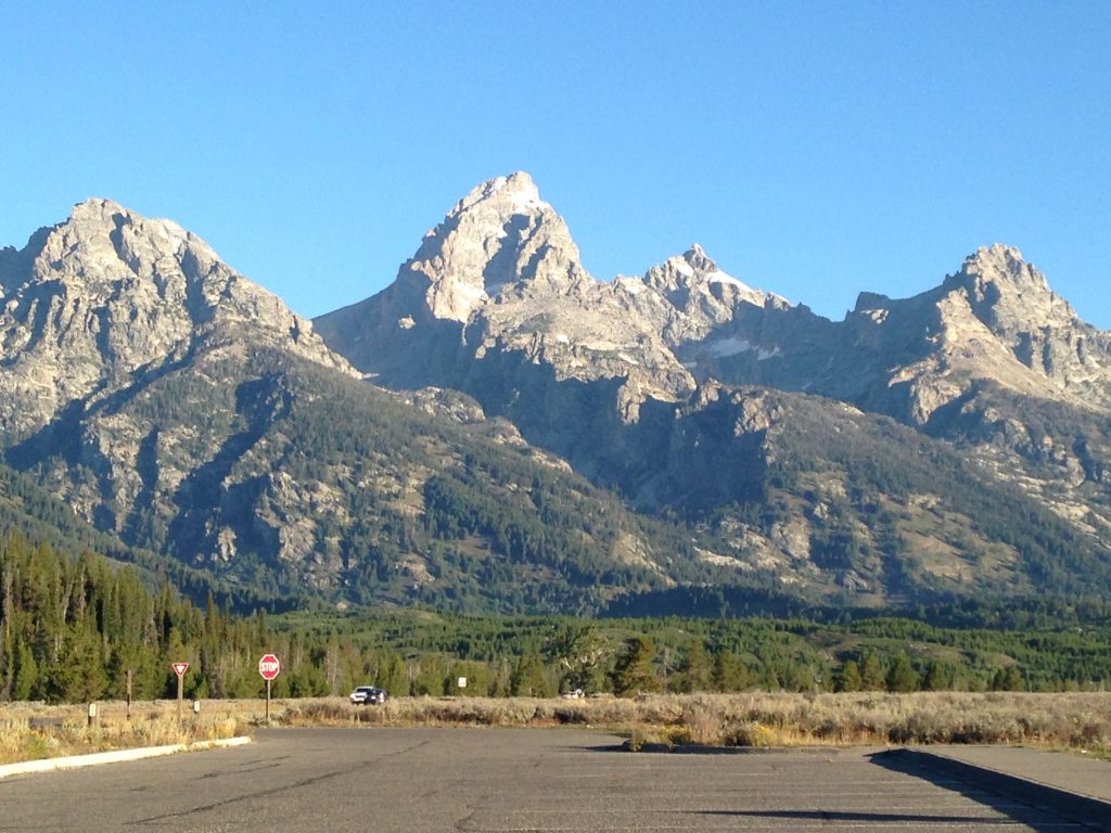
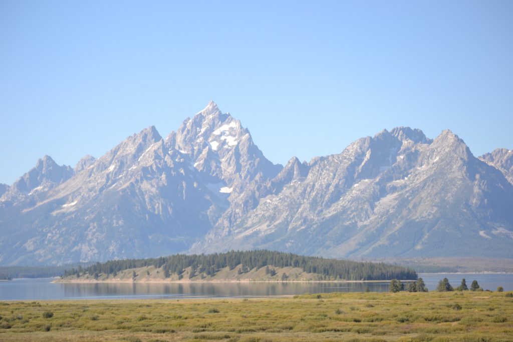
Entering the park from the south, the first glimpse of the magical peaks were spectacular. With scenery as gorgeous as this, I knew I was about to embark on an adventure of a lifetime.
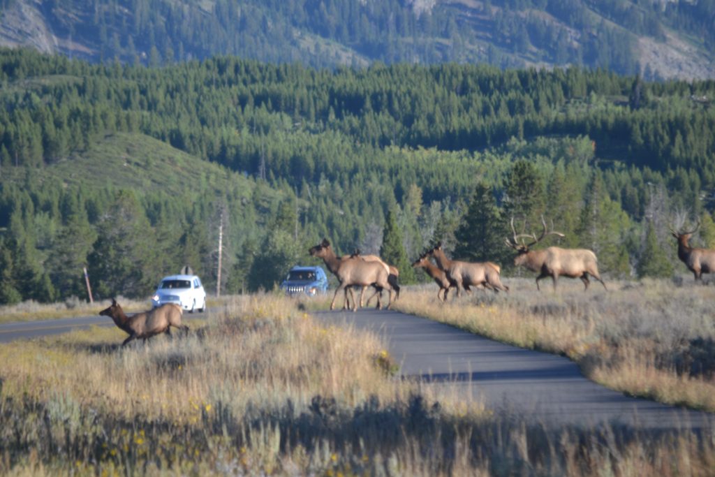
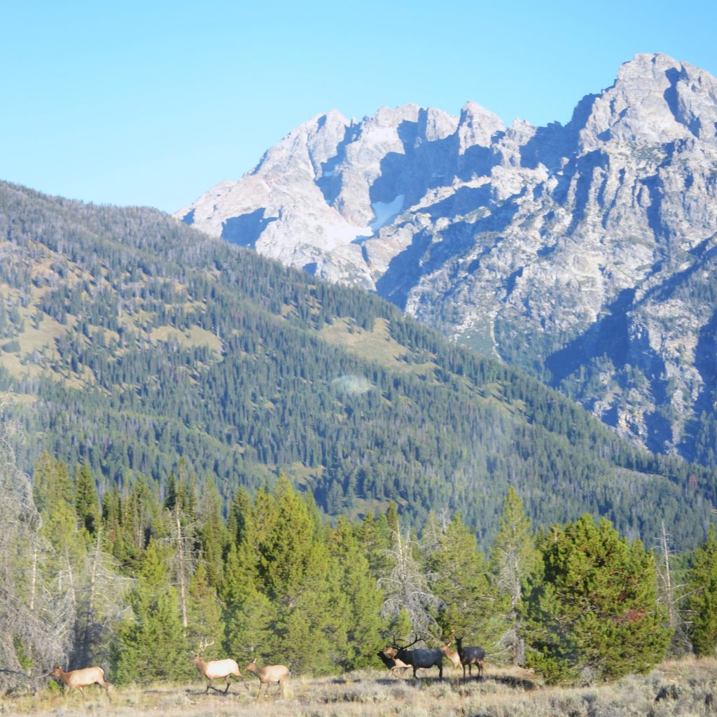
Within minutes of my drive, a herd of elk crossed the road, hardly noticing the cars coming to a stop. The eloquence in their gait was one of careless grace as they reached the grassy knoll on the opposite side. The bull, imperiously leading his harem of does, stood out among the pack with his eight point rack identifying him as the leader of this domain.
My plan for the day was to drive as far north of the park as possible and backtrack through the Grand Tetons before heading east towards home. My first stop on this agenda was Colter Bay where I would hike the short trail near the marina.
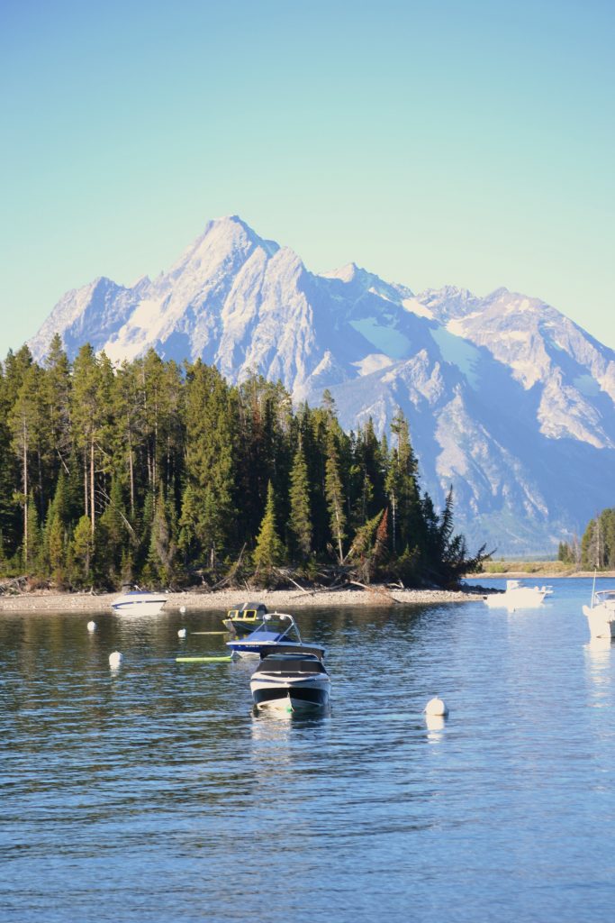
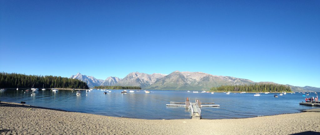
Strolling the serene path I realized that, regardless of where I am, the Grand Tetons are a central fixture within the park. Robust and dominating the skyline, their snowy peaks are a welcome site. I could not resist the gorgeous backdrop against the beautiful sailboats anchored in the cove.
The weather was perfect for hiking the Lakeshore Trail. The trailhead, originating at the marina, was a 45-minute figure eight path. I strolled along the beach and crossed over the causeway which led to an island on the other side.
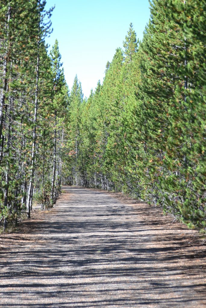
The trek took an unexpected shift through the woods where fir trees lined the path on each side. The shadows from the morning light offered protection from the sun and there was a momentary coolness to the air.
I completed the hike and after standing in awe of the marina, began my trek towards Jenny Lake. I was so excited to board the ferry to explore Inspiration Point and Hidden Falls. Reaching the southern part of the lake, I was just in time for the water taxi which runs every fifteen minutes. The round trip fare was $18 and well worth the serene trek across the water. The ferry arrived on the west side of Jenny Lake and drops visitors off at Cascade Canyon trailhead.
The afternoon was spectacular spent hiking, but I had only a short time to visit Mormon Row and the Snake River Lookout. With a half a day ahead of me, I had so much more to explore and I felt I was just getting started.
Have you visited the Grand Tetons? What were some of your activities during your stay? I would love to hear about your adventure if you would kindly leave a message in the comments section below! Many thanks for reading my post about the Grand Tetons and I hope you stick around to check out my next post about this fabulous location! Happy Travels!
What to See and What to Do:
Grand Teton National Park
PO Box 170
Moose, WY 83012
Telephone: 307 739 3399
- Admission Fee: Each entrance fee covers 7 days of park entry. Private Vehicle: $35; Motorcycle: $30 and Hiker/Biker: $20 which only applies to visitors 16 years old and older entering the park by foot, bicycle, etc. An annual Pass for Grand Teton National Park is $70 which is valid for one year through the month of purchase. The Grand Teton National Park accepts the America the Beautiful Pass which allows access to over 2,000 federal recreation sites for a cost of $80 which is valid for one year through the month of purchase. Check out their website for more information: https://www.nps.gov/planyourvisit/passes.htm
- Hours: Open daily, 24 hours; Refer to the Grand Teton National Park website for the operating hours of the Visitor Centers.
- Amenities: camping, hiking, boating, skiing, biking, bird watching, climbing and mountaineering, fishing, horseback riding, scenic drives, wildlife viewing, Visitor’s Centers which provide interpretive exhibits and park information and Ranger programs. Guided tours are also available in the park.
- Scenic View: Scenic drives throughout the park include the Teton Park Road, Jenny Lake Scenic Drive and Signal Mountain Summit Road.
- Length of Visit: To maximize your visit to Grand Teton National Park one would need at least a couple of days to experience all that the park provides.
- Tips for Your Visit: The park is open year around, but winter time can be a challenging during snow and ice. If you are looking for animals, winter is the time that they hibernate. Spring is a wonderful time to visit because you can see newborn babies. When viewing wildlife, you must stay 100 yards from bears and wolves, and 25 yard from all other animals in the park. For photographers, you may already know that dawn and dusk are the best times to photograph animals and you will want to bring a telephoto lens for capturing them from far distances. Signal Mountain is perfect for sunsets.
Where to Stay:
Teton Mountain Lodge & Spa
3385 Cody Lane
Teton Village, WY 83025
Telephone: 307 201 6066
Where to Eat:
The Deck @ Piste
Rendezvous Mountain
Jackson Hole, Wyoming 83025
Telephone: 307 732 3177
I ordered the Southern Belle made from White Wine with Orange and Passion Fruit. In addition, I had a glass of Henry Estate Pinot Noir to accompany my House Meatballs and Fries.
What to Read:
- Where the Water Goes, by David Owen
- Great Alone, by Kristin Hannah
- Where the Forest Meets the Stars, by Glendy Vanderah
- Journey, by James A. Michener
- The Cocktail Hour in Jackson Hole, by Donald Hough
Photo Guide for The Grand Tetons and Jackson Hole:
- Oxbow Bend
- Schwabacher Landing
- Mormon Row
- Snake River Overlook
- String Lake Roadway
- Willow Flats Overlook
- Elk Ranch Flats Turnout
Finding Solitude at Joshua Tree National Park, California
My last visit to Joshua Tree National Park was last November, a perfect time of the year for a hike. The weather had begun to cool down in comparison to the summer heat and I was ready to set out for an amazing adventure. There are so many fabulous parks in southern California where you can feel like you are the only one in the world. This is one of them. The surroundings are just as unique as its unpredictable environment that each visit can bring about a whole new experience.
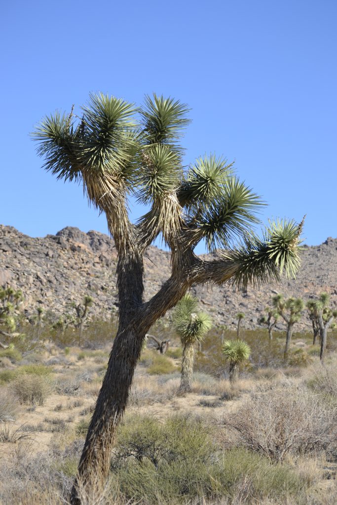
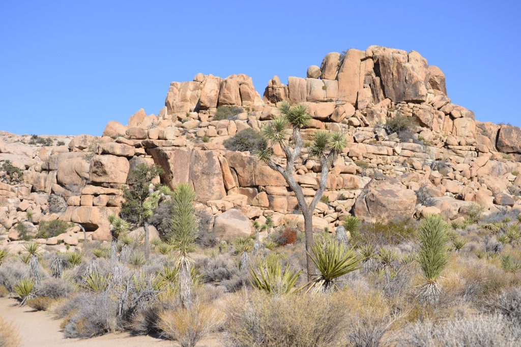
The whimsical Joshua Tree, for which the park is named, is an indigenous plant that reminds me of a furry cactus with starburst pompoms. These plants were used by the American Indians for food (their seeds and flower buds), household items and clothing (baskets and sandals).
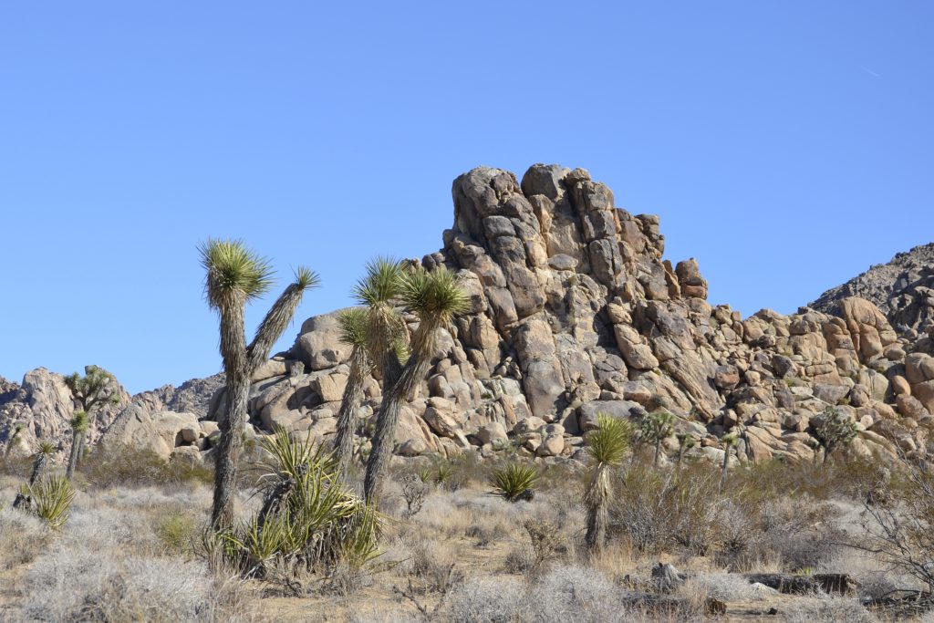
The ground cover was scarce in most parts with clumps of brush, predominantly creosote bush. Colorful ocotillo and cactus were intermittently scattered throughout the vast expanse of the desert.
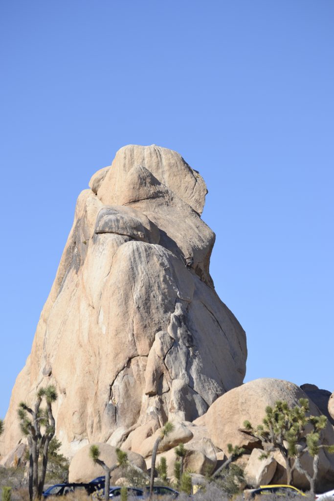
In addition to the Joshua Tree, what I found so fascinating about this park were the endless rock formations and twisted boulders shaped by geologic forces. According to the national park, these rocks rose from the ground beneath as a result of volcanic activity. As the boulders were pushed up from the earth, they cooled down and crystallized. Over time, the water from the ground rounded the edges and widened the cracks, resulting in heaps of monzogranite that look similar to toy blocks in a stack.
During the scenic drive, I took the time to find images in the rocks. If there was a large pile of them, I would pull over to see what shapes and figures appeared out of the monoliths. I had imagined a variety of objects from eagles, rabbits, horses and even people.
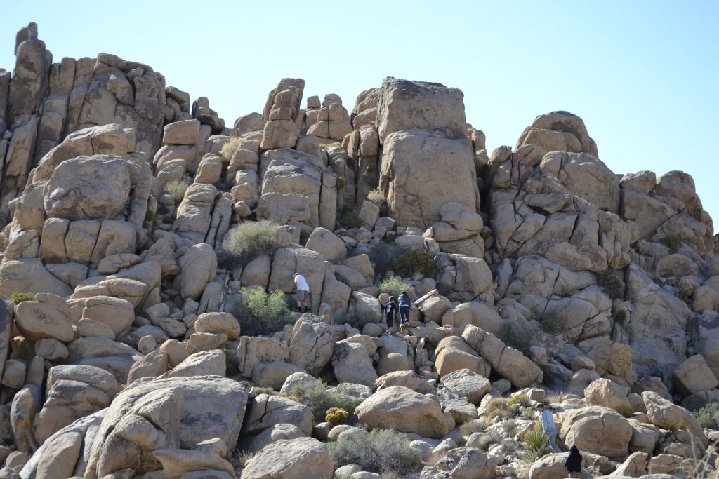
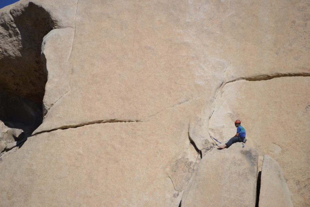
About halfway to Barker Dam, I met up with a rock climber to see if I could make the climb. I felt safe with the guide I hired, knowing that he would be there in the chance that I slipped and fell. We met in a safe location and one that was not too difficult for a first try. I was surprised that the rocks, for the most part, were fairly stable. It was exhilarating to reach the top and look out into the distance of the park. I wished I would have done this sooner.
Many people come to Joshua Tree National Park for a variety of outdoor activities. During my scenic drive I noticed bikers, hikers and the occasional rock climber. This is a perfect location for rock climbing and there are a few outfitters available to take out the adventurous for an adrenaline-filled afternoon. I hired an excellent guide from Joshua Tree Outfitters, who was specialized in working with novice climbers.
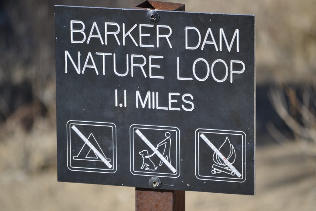
I had also set aside some time for a hike, so I decided on the Barker Dam Nature Loop, just over a mile long. This trail took me through parts of the desert where cattlemen built dams as a water source for their livestock back in the 1800s. Later, miners arrived in search of gold until the 1930’s when the land was parceled out to homesteaders.
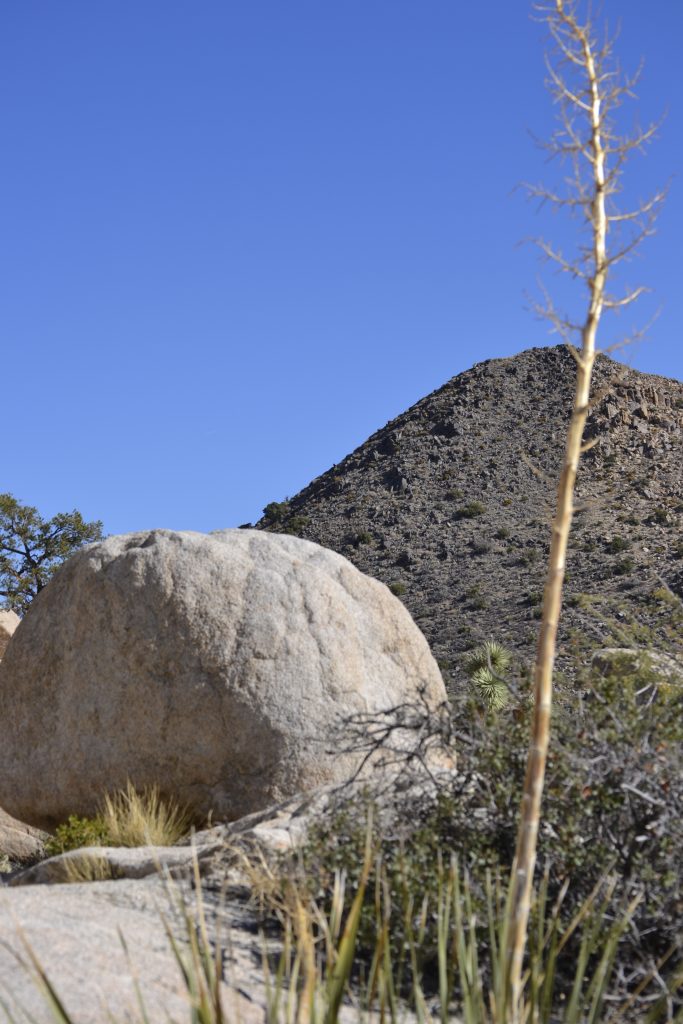
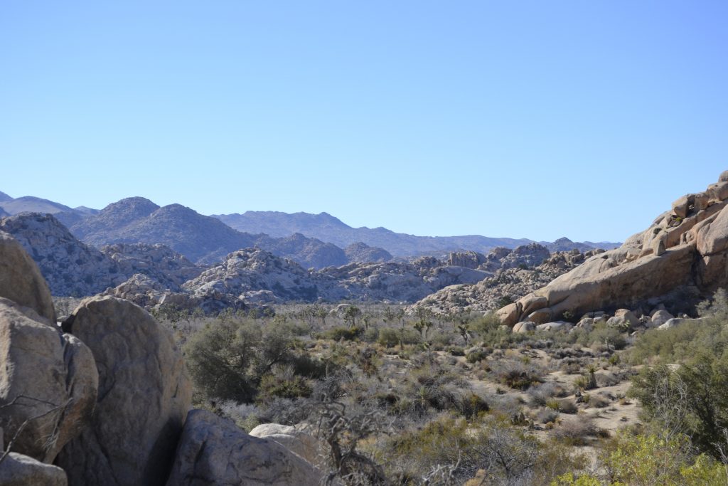
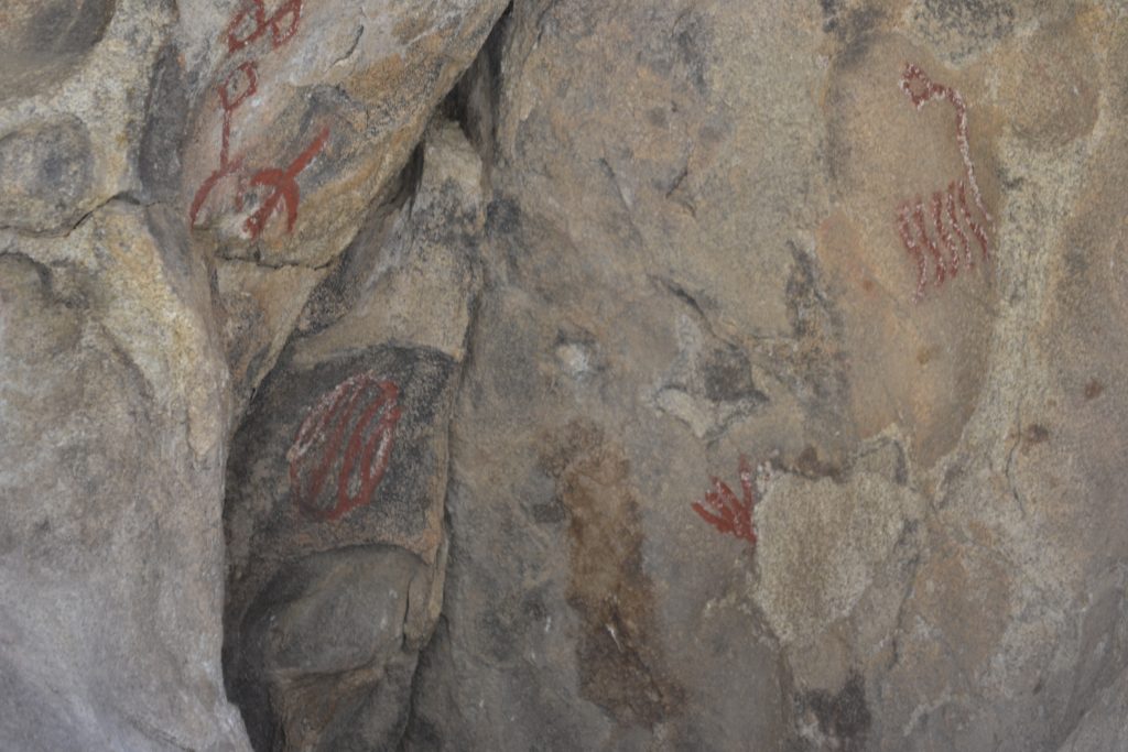
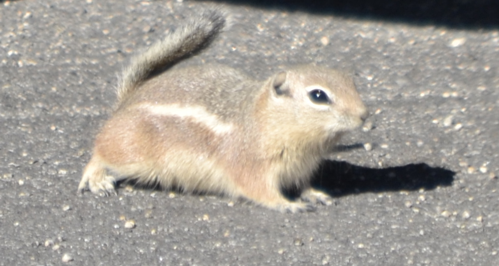
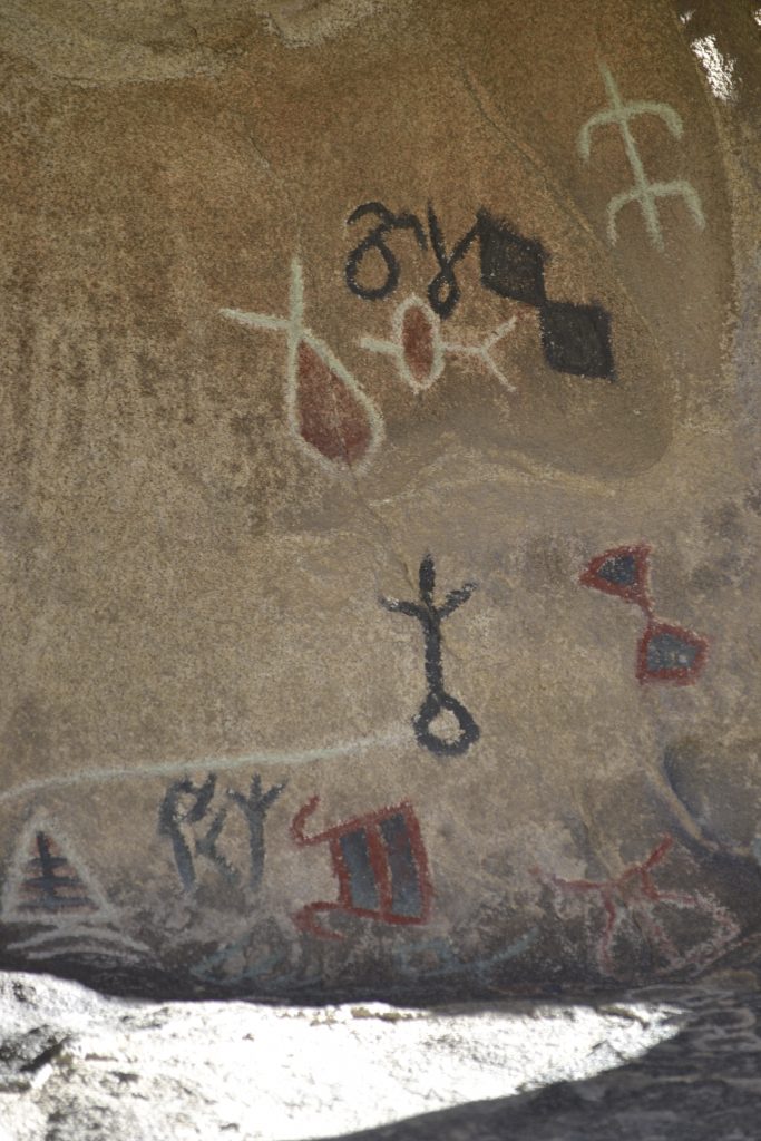
I enjoyed the vast diversity of hiking the trail with rock formations that took on a wide variety of shapes. The dried out flora and fauna were at the mercy of the hot sun. and trees provided a brief solace from the scorching heat. The landscape was extremely spacious with small rocks and boulders, while hills in the distance were low lying and desolate. The hike remained unsteady with stones until I finally reached the dam. I tried to look down into the wall but there was not a way for me to approach it any closer without falling over the edge. I was nearing the end of the trail when a boulder appeared in the middle of nowhere. As I closed in on the site, I noticed there were petroglyphs painted in red and black. I learned that there were actual Indian markings in the rocks, but they had been painted over and were not authentic. My day at Joshua Tree had come to a close and as I was crossing the parking lot, I saw a little chipmunk dart out from one underneath a car. There is nothing better than seeing animals in their natural habitat. Such a highlight of my day. An area slightly larger than the state of Rhode Island, Joshua Tree National Park begs to be explored. Offering activities for all types of outdoorsmen, this is a wonderful way to explore the deserts of California. Have you visited Joshua Tree National Park? I would love to hear about your experience if you would kindly leave a message in the comments section below! Many thanks for following my journey through Joshua Tree National Park! Wishing you many Happy Travels!! What to See and What to Do: Joshua Tree National Park
Where to Stay: Hilton San Diego Bayfront Where to Eat: Parq Restaurant There were so many amazing items on the menu such as oysters, gnocchi, mussels and my favorite, the Charcuterie Board! Since I was taking clients out for dinner, we ordered each one and shared…perfect for four. What to Eat:
What to Read:
Photo Guide for San Diego:
One of my favorite photos of Joshua Tree National Park More Petroglyphs |
The Great Smoky Mountains Laurel Falls Hike
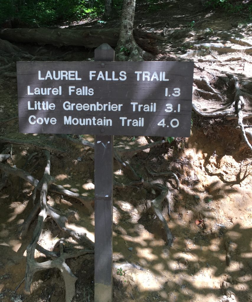
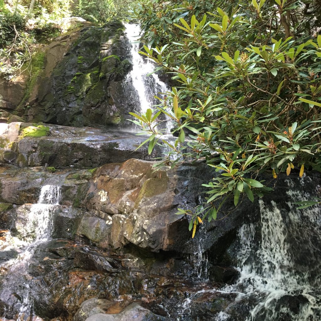
Laurel Falls is considered one of the most popular trails at Great Smoky Mountains National Park. The 2.6 mile round trip paved trail is considered easy and reaches the spectacular 80 foot high falls. For 50 cents I picked up a self-guided pamphlet which pointed out several places of interest and we set out for the trail surrounded by pine trees and oaks for an enjoyable trek through the mountain wilderness.
There are eleven markers that correlate with the trail brochure and the first stop describes the laurel plant which grows along the path. During the early summer its blooms range from pink to white. Rhododendron are also popular along the path displaying larger leaves and growing taller than the mountain laurel.
Having passed through the forest of pine, oak and hardwoods, the topography switched from ridge to ravine. Here the trail curved sharply with deep drop-offs to the left. We began to see more rocks and there were several places to take a break along the path.
We regrouped and continued upwards as the trail continued its gradual climb towards the falls. We crossed over a small creek that trickled down the hill, through large and small rocks providing water to the rhododendron, hemlock and beech plants along the trail.
Soon, there was a break in the trees creating a “picture window” at marker number seven. The rounded peak in the distance was covered with trees and there was a sharp drop from the edge of the pavement.
The further we continued up the trail, the more contorted the trees became due to high winds, lightning strikes and other severe weather conditions. Interestingly, the aggressive change in climate does not affect the lichen that attaches itself to rocks and trees.
The pathway changed drastically before reaching the falls. Steep cliffs dangerously hugged the narrow trail which alerted us that we were nearing our destination. We began to hear sounds of water rushing from Cove Mountain as we continued our approach and gave a sigh of relief that we had arrived safely.
The double-drop cascade was spectacular as its light spray lit upon our faces cooling us down from the hike. The rocks were slippery and we moved with caution to allow other hikers to pass by standing in awe of its beauty. We gave ourselves about fifteen minutes to revel in our accomplishment and curiously tested the temperature of the runoff before backtracking towards the trailhead. It would all be downhill from here.
Have you hiked the Laurel Falls Trail or other trails in the Great Smoky Mountains? I would love to hear about your experience if you would kindly leave a message in the comments section below. Many thanks for checking out my hike and wishing you many Happy Travels!
What to See and What to Do:
Laurel Falls
From Sugarlands Visitor Center, turn toward Cades Cove on Little River Road and drive 3.5 miles to the trailhead where there are parking areas on both sides of the road.
Telephone: 865 436 1200
- Admission Fee: There is no charge to visit Laurel Falls as it is a part of the Great Smoky National Park.
- Hours: The park is open year around, though access to Laurel Falls may be limited during the winter months.
- Amenities: Pamphlet for hike ($.50)
- Scenic View: Spectacular views of Great Smoky Mountains throughout the hike
- Length of Visit: 1 – 2 hours, depending on whether you can walk up the steep hill
- Tips for Your Visit: Wear comfortable shoes for hiking. Wildlife, such as bears, may be wandering around the property, so be on the lookout and do not approach them. We like to visit here in the afternoon as the trees provide shade from the warmer weather.
Where to Stay:
We stayed in a rental through VRBO called the Firefly Chalet.
Where to Eat:
Bennett’s Bar-B-Que
2910 Parkway
Pigeon Forge, TN
Telephone: 865 429 2200
I ordered the Carolina Pork Sandwich and the Salad Bar.
Yellowstone’s Geyser Basin is an Out of This World Experience
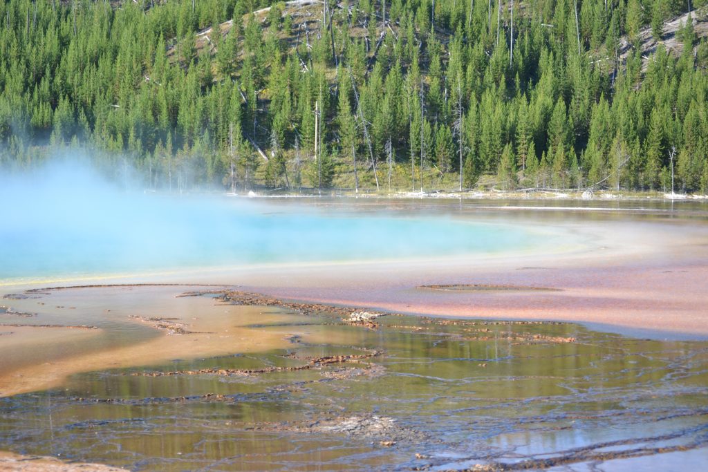
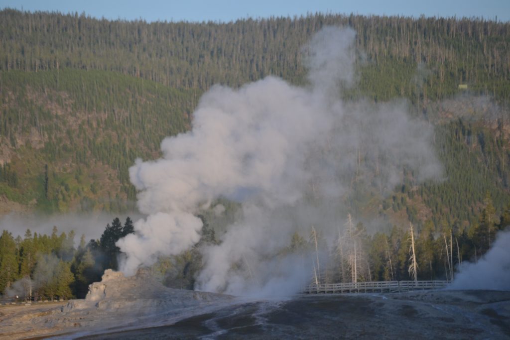
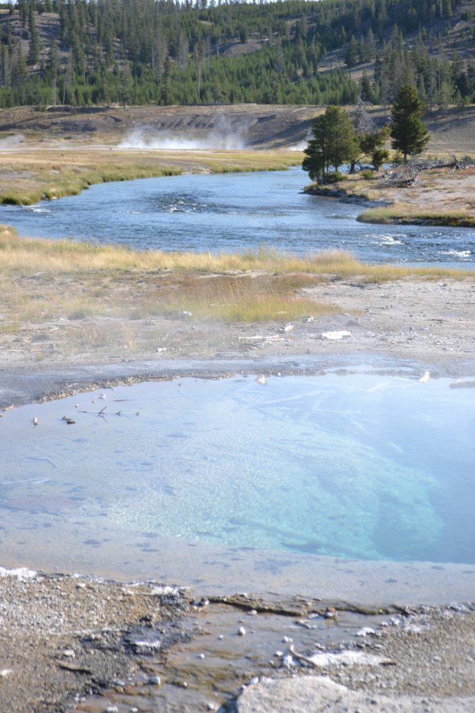
Managing to wake up early before the dew disappeared, I followed the Upper Geyser Basin’s wooden boardwalk that meandered through the world’s largest concentration of geysers. It is estimated that 25,000 spectators pass through this menagerie of exotic formations each day. I was completely mesmerized by the clear water features and pools of water as they bubbled and sputtered from the heat.
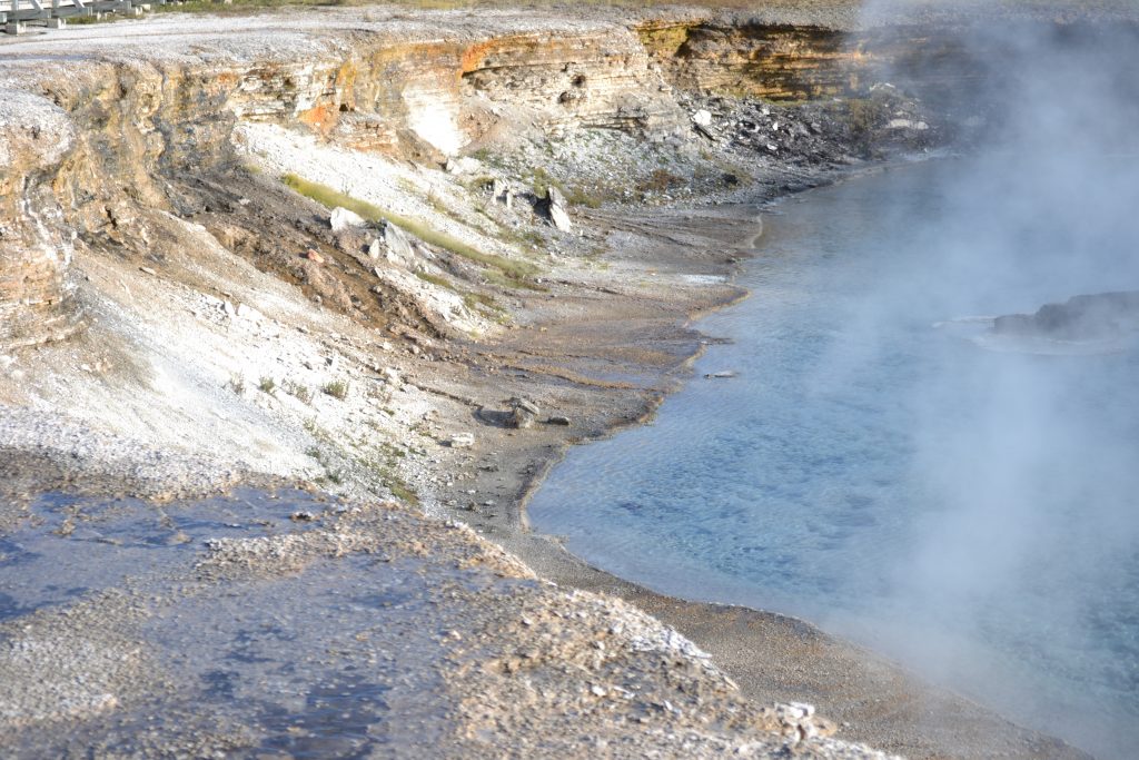
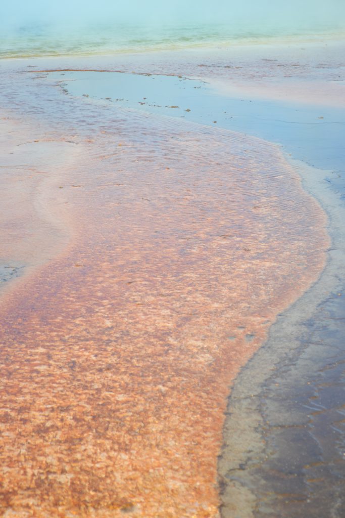
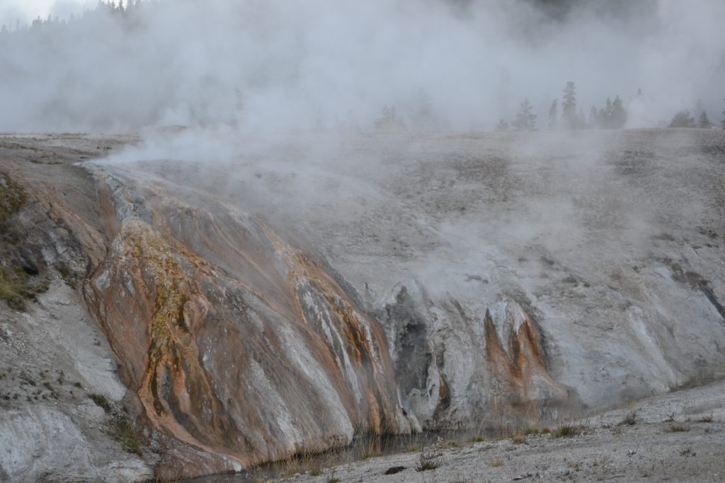
I strolled the boardwalk with its twists and turns. There was a sulfuric cloud that floated above the geysers and hot springs in the morning. This gaseous mist could be seen from miles away. A mixture of orange and white run off trickled down towards the Excelsior Pool, last active in 1986 when it erupted for a period of 48 hours.
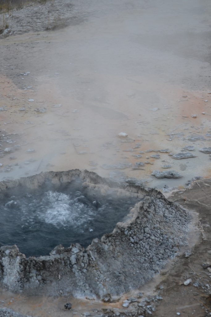
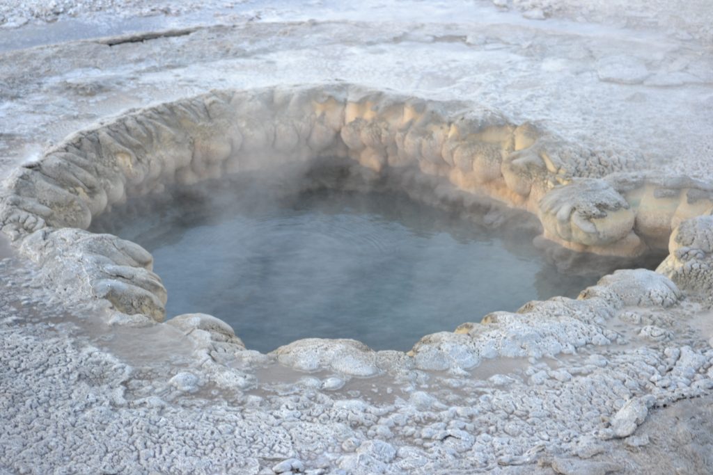
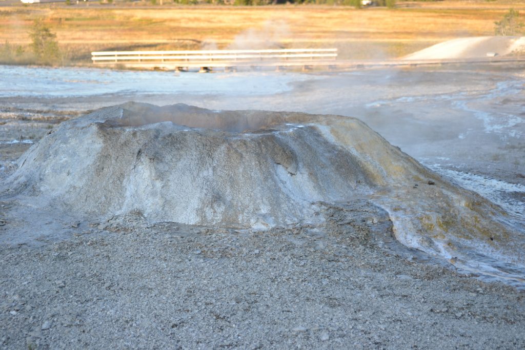
Exploring the features along the boardwalk, there was one in particular that caught my eye. It reminded me of a mini volcano with ashen sides and boiling water in its center.
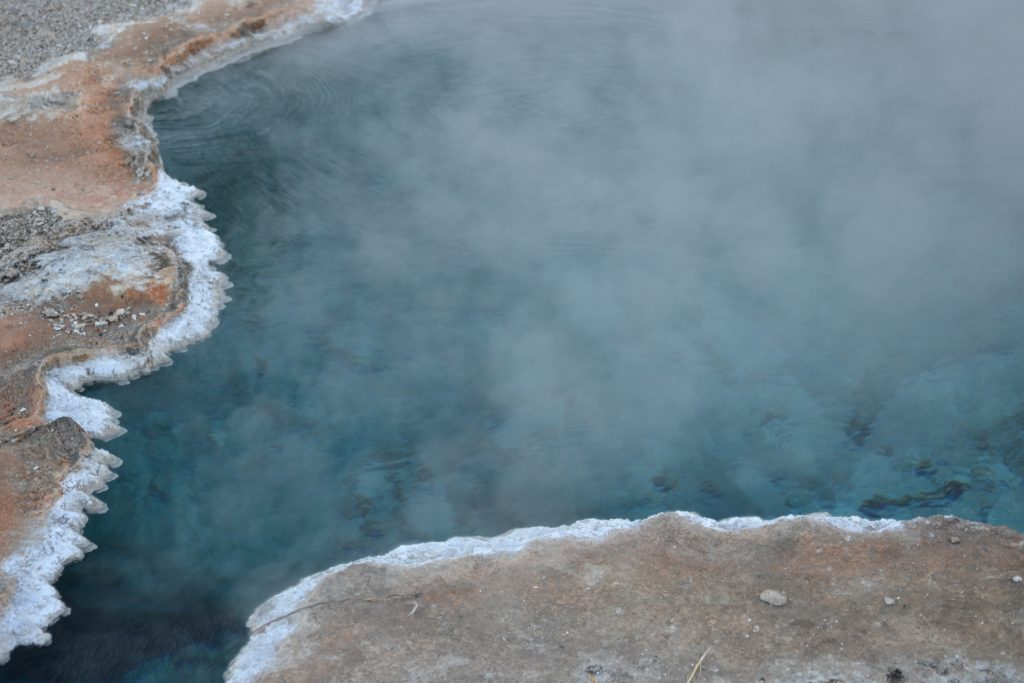
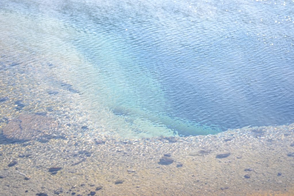
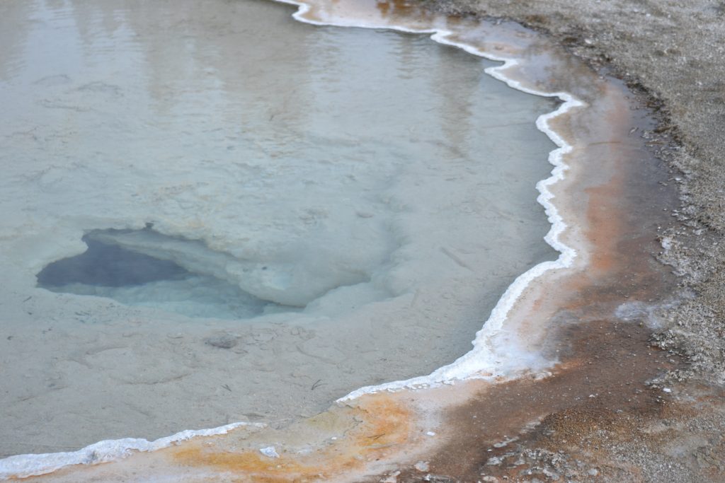
The pools were as blue as the waters of the Caribbean. More cliffs and crags below the waterline were visible with the passing mist. Individual in their own way, some had crystallized edgings that gave a deceptive coldness to their character.
The contrast of color was intensified by the green of the nearby forest. The light blue pool of water and its rising steam was spectacular in the midst of this land of geological splendor.
And splendid it was as I admiringly approached the Grand Prismatic Spring, one of the most beautiful of all the hot springs in Yellowstone. Just beneath its surface the volcanic magma heats the water reaching temperatures of 160 degrees Fahrenheit.
Having only spent an hour here, I was eager to move on to see the Grand Prismatic Spring feature of the Midway Geyser Basin. I was also looking forward to taking the Fairy Trail hike for a more scenic, unobstructed view of this beautiful place.
What is your favorite place to visit at Yellowstone? I would love to hear about your experience exploring this phenomenal National Park in the US if you would kindly leave your message in the comments below. Many thanks for reading my post about the Geyser Valley of Yellowstone! Wishing you many Happy Travels!
What to See and What to Do:
Yellowstone National Park
PO Box 168
Yellowstone National Park, WY 82190
Telephone: 307 344 7381
- Admission Fee: Each entrance fee covers 7 days of park entry. Private Vehicle: $35; Motorcycle: $30 and Hiker/Biker: $20 which only applies to visitors 16 years old and older entering the park by foot, bicycle, etc. An annual Pass for Yellowstone National Park is $70 which is valid for one year through the month of purchase. The Yellowstone National Park accepts the America the Beautiful Pass which allows access to over 2,000 federal recreation sites for a cost of $80 which is valid for one year through the month of purchase. Check out their website for more information: https://www.nps.gov/planyourvisit/passes.htm
- Hours: Open daily, 24 hours; Refer to the Yellowstone National Park website for the operating hours of the Visitor Centers.
- Amenities: camping, hiking, boating, skiing, biking, bird watching, climbing and mountaineering, fishing, horseback riding and llama packing, scenic drives, wildlife viewing, Visitor’s Centers which provide interpretive exhibits and park information and Ranger programs. Guided tours are also available in the park.
- Scenic View: Take in the view of Grand Prismatic Spring from the Overlook off of the Fairy Falls Trailhead. For the Lower Falls of the Yellowstone River, you can see this beautiful waterfall from several locations offering different views of the falls: Brink of Lower Falls, Lookout Point, Uncle Tom’s Trail and Artist Point. Check out the stadium seating at Old Faithful for a front row seat of this geyser that erupts every 35 to 120 minutes. The park’s Twitter account, @GeyserNPS, the Geyser Activity Page on their website or the Geyser App lists the predicted times for Old Faithful.
- Length of Visit: Three days is recommended to see all of the attractions at Yellowstone.
- Tips for Your Visit: The park is open year around, but winter time can be a challenging during snow and ice. If you are looking for animals, winter is the time that they hibernate. Spring is a wonderful time to visit because you can see newborn babies. When viewing wildlife, you must stay 100 yards from bears and wolves, and 25 yard from all other animals in the park. For photographers, you may already know that dawn and dusk are the best times to photograph animals and you will want to bring a telephoto lens for capturing them from far distances. Summer is the busiest time for the park you may find road construction and traffic.
Where to Stay:
I was fortunate enough to stay at one of the lodges at Yellowstone. I absolutely loved staying at the park and have Melba Coleman to thank for assisting me in my reservation.
Where to Eat:
Lake Yellowstone Hotel Dining Room
Yellowstone Park, WY 82190
Telephone: 307 344 7311
For a light lunch, I ordered the charcuterie plate which included meats, cheeses, olives, walnuts and whole grain crackers. It was the perfect location to enjoy the park sitting by a large viewing window, mesmerized by the spectacular view.
What to Eat:
- Bison
- Elk
- Trout
What to Read:
- American Wolf by Nate Blakeslee
- Empire of Shadows: The Epic Story of Yellowstone, by George Black
- The Wolverine Way, by Douglas H. Chadwick
Photo Guide for Yellowstone:
- Artist Point
- Excelsior Geyser Crater
- Fairy Falls
- Fountain Paint Pots
- Grand Prismatic Spring
- Great Fountain Geyser
- Minerva Terrace
- Morning Glory Pool
- Norris Geyser Basin
- Old Faithful
- Overlook Point
- Palette Spring
- Roaring Mountain
- Trout Lake
- Upper Falls View
A First Impression of Yellowstone National Park
The sky was a bountiful blue and the air smelled fresh and pure. The drive from Cody to the entrance of Yellowstone National Park took only about an hour, but there were a couple of stops in between. The sun was just rising as I passed through tunnels, taking in the hills, trees and streams of the countryside. It was a perfect day to explore Yellowstone and I was thrilled beyond measure for the adventure ahead.
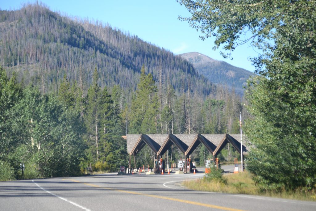
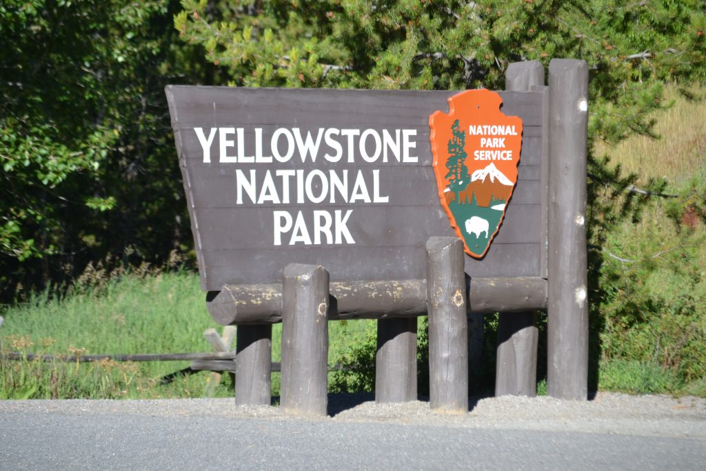
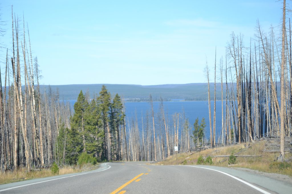
As the entrance sign came into view, I couldn’t believe I had finally arrived. I was excited to take my place in line with fellow travelers for my first photograph of America’s First National Park, Yellowstone. Forging on, I was prepared for my first stop at the Fishing Bridge, when I noticed the beauty of Sylvan Lake as I pulled over to the side of the road to map out my day. Yellowstone Lake was not far in the distance and soon I would be exploring one of the most amazing national parks in the United States. With its vast geological features and abundant animal sightings, this trip was sure to provide endless memories in the making.
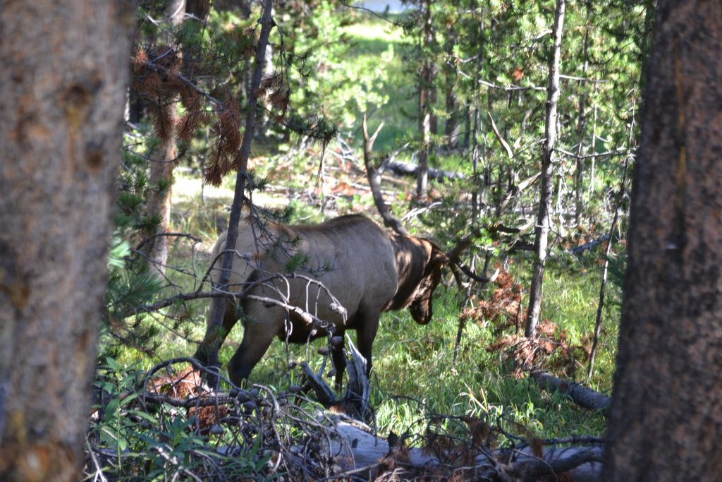
Known as the “largest high-altitude lake in North America”, Yellowstone Lake measures 136 square miles. Because the southern road of the park was closed for the season, I had to drive north towards Yellowstone’s Grand Canyon. Just inside LaHardy, I saw my first large bull elk wandering through the brush on the side of the road.
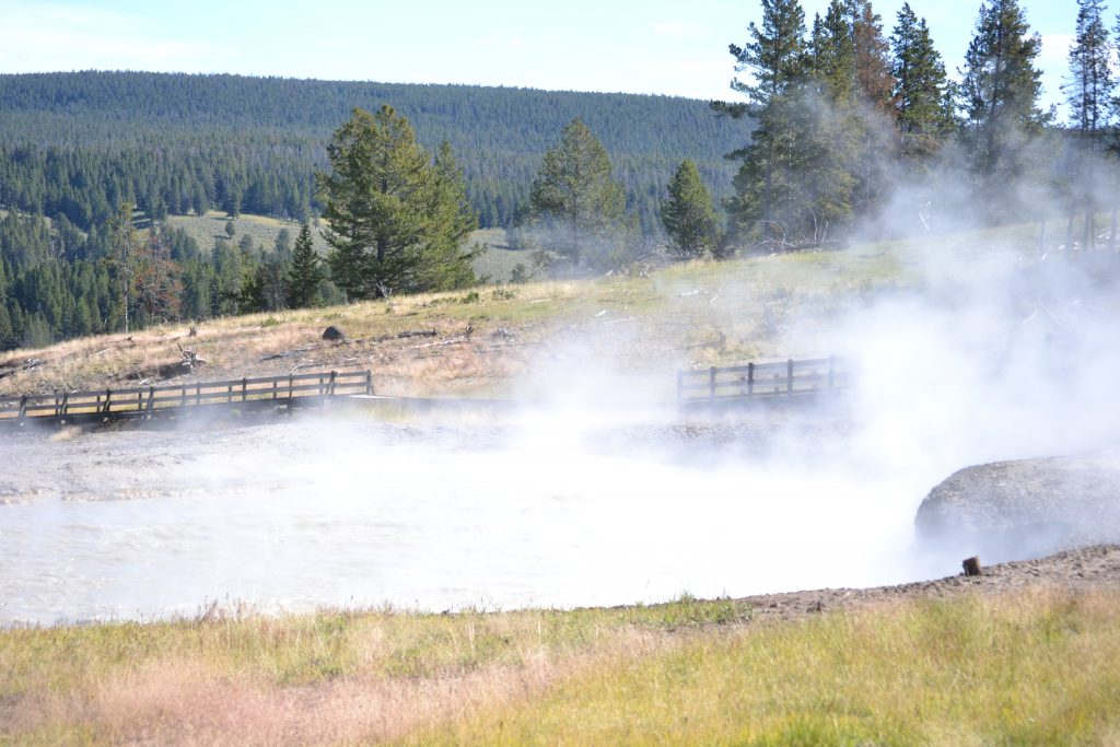
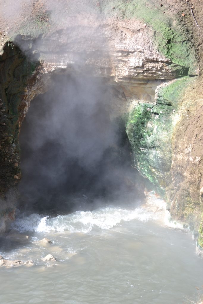
The pungent scent of rotting eggs, caused by the sulper springs, filled the air, far in advance of my approach to Mud Volcano. The bubbling mud pots, considered one of the most unstable properties within the park, was proof of the park’s volcanic power. With names such as Dragon’s Mouth Spring or Sulphur Cauldron, the 2.3 mile boardwalk winds through several active thermal features. It was a reminder that I was standing on a volcano that could erupt at any moment.
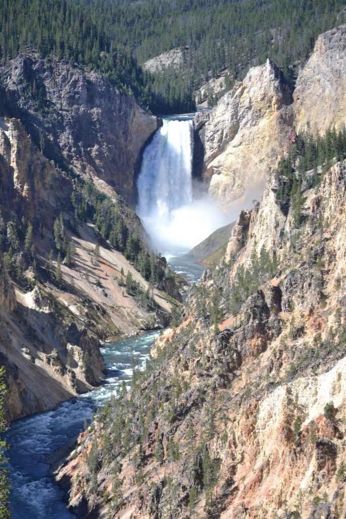
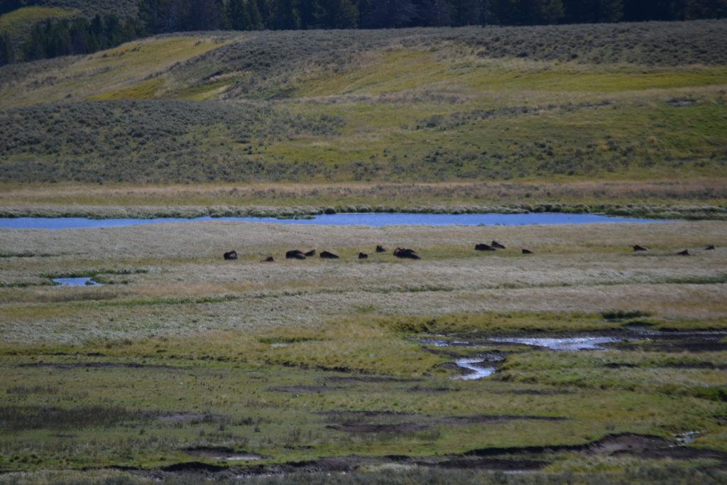
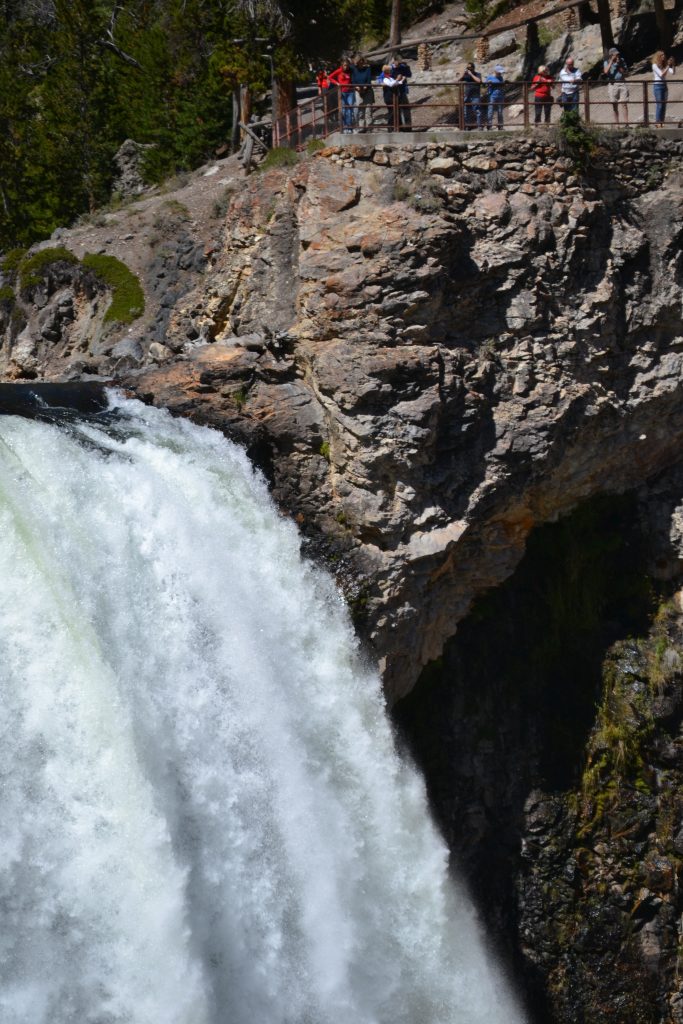
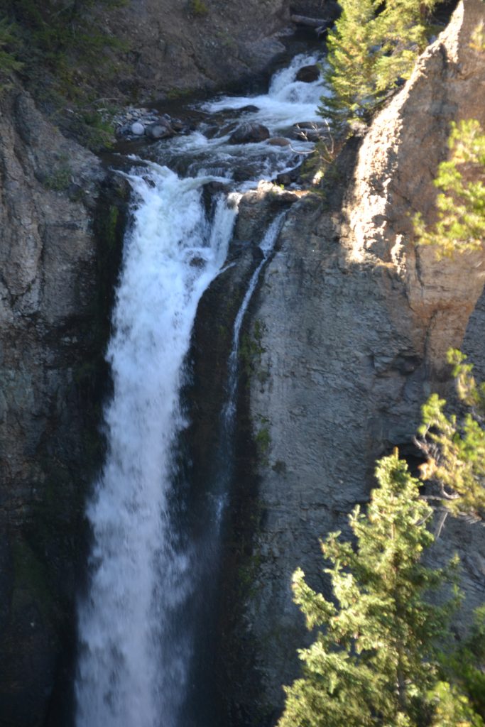
Looking forward to reaching the park’s most impressive waterfall, I passed through Hayden Valley. I stopped at several lookouts for wildlife as well as random falls throughout the park when I had finally reached the Falls of the Grand Canyon of Yellowstone. It was a breathtaking scene as the cascade, with its 308 foot precipice, could be heard long before reaching the overlook.
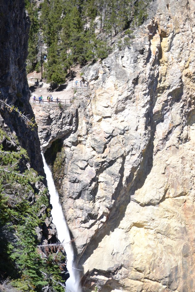
I arrived at a split in the road, with one leading to the North Rim and the other to the South. I had decided to hike Uncle Tom’s Trail for a closer look at the Upper Falls as well as Crystal Falls, plummeting 129 feet. Since the late 1800s, visitors to Yellowstone have made this trek with help from Tom Richardson, independent tour guide. As a part of his full day excursion, the rim of the falls included a “trail of wooden ladders and handrails to the mist of Lower Falls”. Today a metal staircase with 329 steps has replaced the ladders that once led to the lookout.
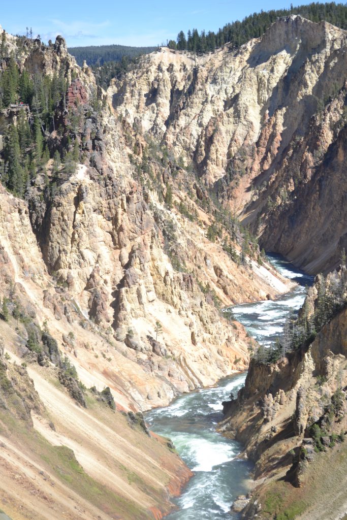
I stood at the overlook for several minutes admiring the mesmerizing beauty of the cascades. The water violently flowed beneath into the canyon. While this was the first excursion I had taken within the park, I realized I had not even begun to explore Yellowstone. This amazing national park offers so many opportunities to see nature in its own habitat, from geysers, waterfalls, wildlife and wonder.
Have you had the opportunity to travel to Yellowstone National Park? What were some of your favorite sites that you explored? I would love to hear from you if you will kindly leave a message in the comments section below. Many thanks for reading my post about Yellowstone and Happy Travels!
What to See and What to Do:
Yellowstone National Park
PO Box 168
Yellowstone National Park, WY 82190
Telephone: 307 344 7381
- Admission Fee: Each entrance fee covers 7 days of park entry. Private Vehicle: $35; Motorcycle: $30 and Hiker/Biker: $20 which only applies to visitors 16 years old and older entering the park by foot, bicycle, etc. An annual Pass for Yellowstone National Park is $70 which is valid for one year through the month of purchase. The Yellowstone National Park accepts the America the Beautiful Pass which allows access to over 2,000 federal recreation sites for a cost of $80 which is valid for one year through the month of purchase. Check out their website for more information: https://www.nps.gov/planyourvisit/passes.htm
- Hours: Open daily, 24 hours; Refer to the Yellowstone National Park website for the operating hours of the Visitor Centers.
- Amenities: camping, hiking, boating, skiing, biking, bird watching, climbing and mountaineering, fishing, horseback riding and llama packing, scenic drives, wildlife viewing, Visitor’s Centers which provide interpretive exhibits and park information and Ranger programs. Guided tours are also available in the park.
- Scenic View: Take in the view of Grand Prismatic Spring from the Overlook off of the Fairy Falls Trailhead. For the Lower Falls of the Yellowstone River, you can see this beautiful waterfall from several locations offering different views of the falls: Brink of Lower Falls, Lookout Point, Uncle Tom’s Trail and Artist Point. Check out the stadium seating at Old Faithful for a front row seat of this geyser that erupts every 35 to 120 minutes. The park’s Twitter account, @GeyserNPS, the Geyser Activity Page on their website or the Geyser App lists the predicted times for Old Faithful.
- Length of Visit: Three days is recommended to see all of the attractions at Yellowstone.
- Tips for Your Visit: The park is open year around, but winter time can be a challenging during snow and ice. If you are looking for animals, winter is the time that they hibernate. Spring is a wonderful time to visit because you can see newborn babies. When viewing wildlife, you must stay 100 yards from bears and wolves, and 25 yard from all other animals in the park. For photographers, you may already know that dawn and dusk are the best times to photograph animals and you will want to bring a telephoto lens for capturing them from far distances. Summer is the busiest time for the park you may find road construction and traffic.
Where to Stay:
I was fortunate enough to stay at one of the lodges at Yellowstone. I absolutely loved staying at the park and have Melba Coleman to thank for assisting me in my reservation.
Where to Eat:
Lake Yellowstone Hotel Dining Room
Yellowstone Park, WY 82190
Telephone: 307 344 7311
For a light lunch, I ordered the charcuterie plate which included meats, cheeses, olives, walnuts and whole grain crackers. It was the perfect location to enjoy the park sitting by a large viewing window, mesmerized by the spectacular view.
What to Eat:
- Bison Burgers
- Buffalo Steak
- Chicken Fried Steak
- Chuck Wagon-Style Dinners which usually include hot dogs, hamburgers, chips, baked beans and corn bread
- Cowboy Cookies: cookies made with brown sugar, cinnamon, oats, chocolate and nuts
- Elk Steak
- Fry Bread is similar to puff pastry and is the base for taco salads.
- Jerky
- Morels
- Old Fashioned Soda
- Pig Candy: Applewood smoked bacon covered in brown sugar and spices
- Prime Rib
- Rocky Mountain Oysters: deep-fried calf testicles
- Soda Bread: Discovered by American Indians, this bread is made from a mixture of flour and soda (naturally found in wood ashes) creating a quick-rising bread
- Trout
- Wyomatoes are a type of tomato found in Wyoming. Known for their sweet taste, they are unlike any other varietal
- Wyoming Whiskey
What to Read:
- The Stories of Yellowstone, by Mark M. Miller
- Mountain Spirit, by Lawrence L. Loendorf
- Decade of the Wolf, by Douglas Smith
- Bring Jade Home, by Michelle Caffrey
- Letters from Yellowstone, by Diane Smith
- Yellowstone Has Teeth, by Marjane Ambler
- Dangerous Beauty: Encounters with Grizzlies and Bison in Yellowstone, by Carolyn Jourdan
- Death in Yellowstone by Lee H. Whittlesey
- Empire of Shadows, by George Black
Photo Guide for Yellowstone:
- Artist Point
- Artists Paintpots
- Black Pool
- Brink of the Lower Falls
- Dunanda Falls
- Dunraven Pass
- Excelsior Geyser Crater
- Fairy Falls
- Firehole Falls
- Firehole Lake
- Fountain Paint Pots Trail
- Grand Prismatic Spring
- Grand Prismatic Spring Overlook
- Great Fountain Geyser
- Hayden Valley
- Inspiration Point
- Lamar Valley
- Lewis Falls
- Lookout Point
- Lower Lookout Point
- Madison River
- Mammoth Hot Springs
- Minerva Terrace
- Morning Glory Pool
- Norris Geyser Basin
- Old Faithful
- Point Sublime
- Roaring Mountain
- Roosevelt Arch
- Snake River Overlook
- Tower Falls
- Trout Lake
- Upper Falls View
- West Thumb Basin
- Yelloowstone Entrance Sign
- Yellowstone Lake
Disclosure: Please refer to our blog disclaimer tab for more information.
A Bull Elk Near Hardy Falls
Dragon’s Mouth Spring
Bison in the Distance at Yellowstone National Park
The Falls of the Grand Canyon of Yellowstone
Crystal Falls at Yellowstone
First Wild Animal Sightings in The Badlands
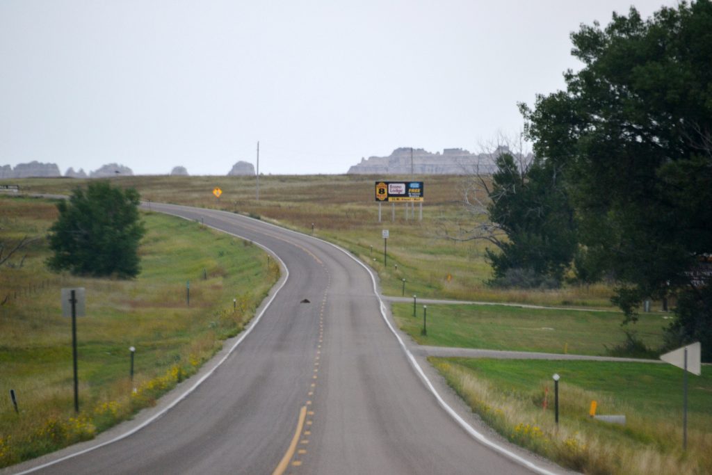
Approaching the Badlands on Interstate 90, I began to notice the fascinating geological formations that makes up this unique region of the United States. I realized soon that I would be reaching the highway exit to the entrance of Badlands National Park, one of the several national parks I would be visiting on my ten-day vacation.
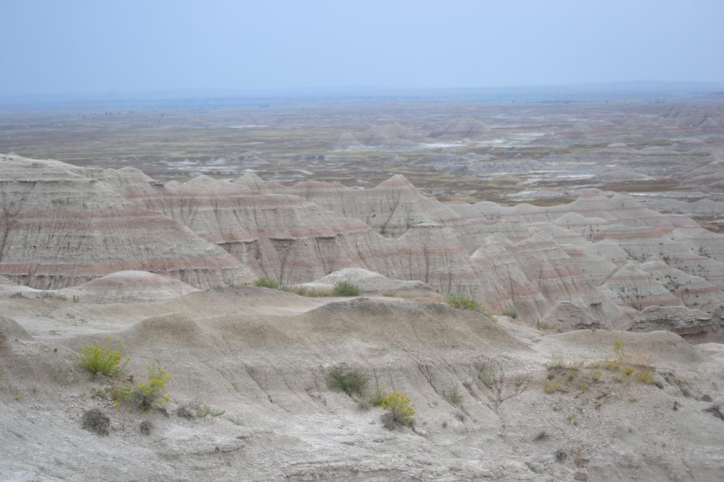
The exit to access the Badlands heading west on I-90 is Exit 131 (Interior) which leads to Badlands Loop Road (Highway 240), one of the country’s most beautiful drives. My plan was to purchase the annual National Park Pass which would allow me entrance to several of the national parks I had scheduled to visit on this trip.
Within minutes upon entering the Badlands National Park, I noticed the scenic trail providing 180 degree views of the Badland’s geology. A fairyland of soaring spires and pinnacles, the landscape is layered in spectacular color as a result of years of water erosion and is best viewed from the White River Valley Overlook. Running more than sixty miles in length, I had come across “The Badlands Wall”. Dividing the upper and lower prairies, the wall is in a state of attrition, washing away into the White River Valley. I followed this wall along The Loop Road making frequent stops along the route and taking in the magical scenery and enjoying its short hikes.
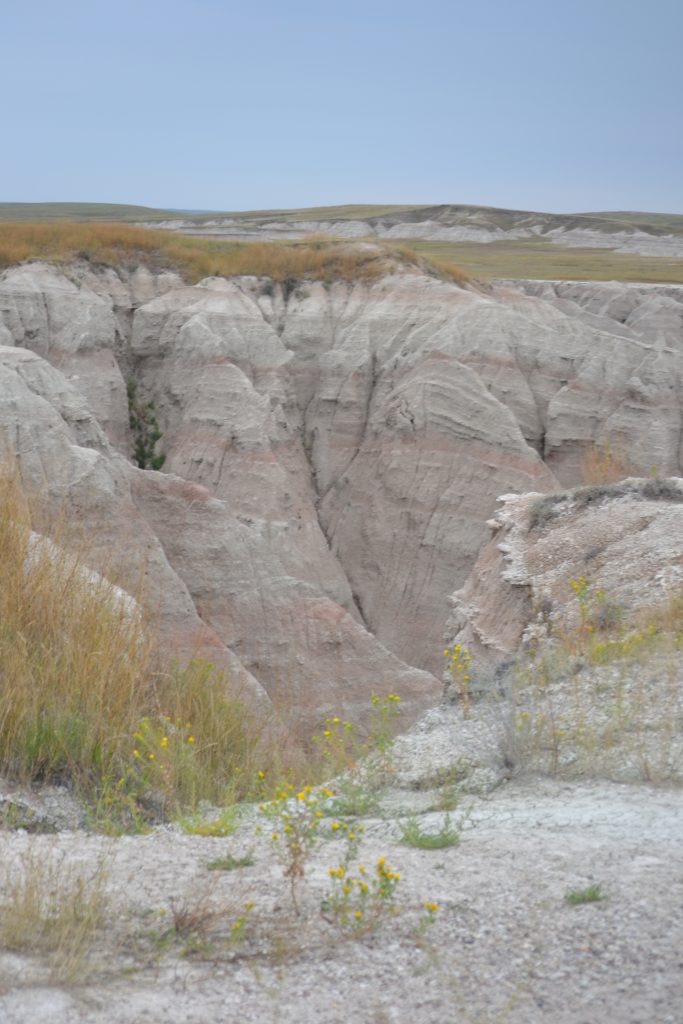
The temperature continued to drop, and with a mist in the air, the park gave off an eerie vibe. The boardwalk to the first overlook had a thin layer of ice and I noticed tourists sliding along the wooden planks careful not to lose their balance. I had expected more visitors at the park by mid-morning, but realized that the weather may have kept them away and although the weather was to reach a high of 70 degrees, there was a threat of thunderstorms ahead. The Badlands are known for its unpredictable hailstorms and sudden rain during the summer.
Taking in the view, I imagined the region during prehistoric times when the area was submerged beneath an ancient sea. Over time, the sea receded and the land would become inhabited by saber-tooth tigers and three-toed horses. Today, its rolling, rounded hills look like the perfect backdrop for a Star Wars movie with its colorful hues and sparse vegetation.
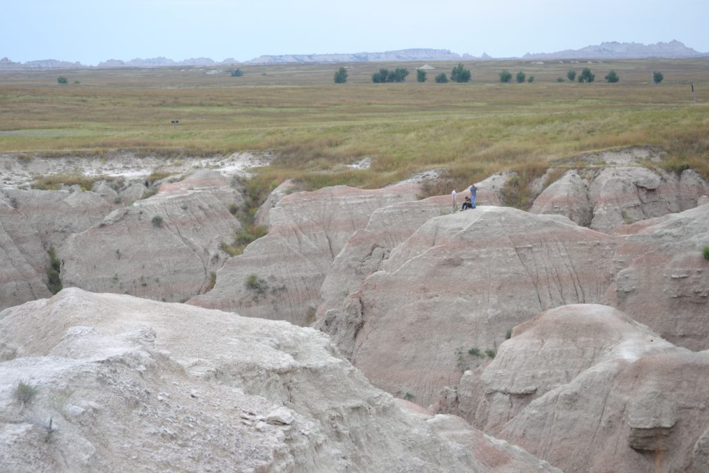
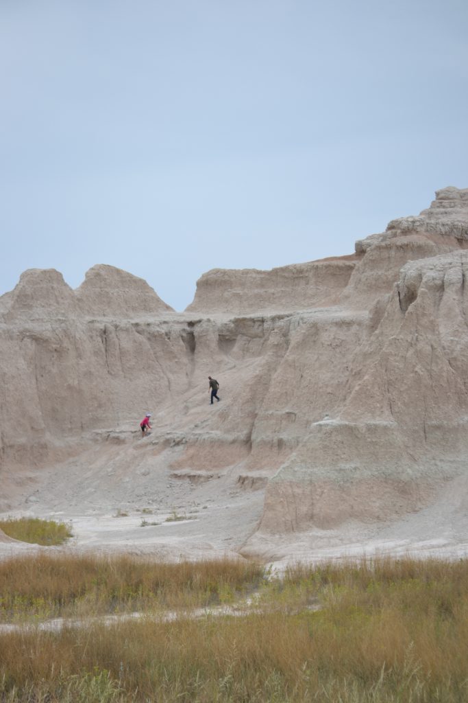
Looking out onto the horizon, I could hardly see the group of hikers relaxing on one of the Badlands’ formations. The contrast between man and rock provided a new perspective of my surroundings where everything looked miniature. This view brought about a realization of just how small I was against this vast, amazing landscape.
I had planned on spending at least three hours touring the park and hiking some of the trails. I estimated that it would take about an hour to drive the loop road while most of the hikes were no longer than a mile, ranging from easy to moderate in level of difficulty.
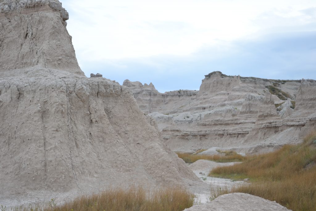
As a result of years of erosion from wind and rain, the Badlands contain a large number of spires, hoodoos, canyons, bluffs and other interesting formations. Once inhabited by the Lakota Indian tribes, it was the French Traders who gave this area its name, “mauvaises terres”, which translates to “Bad Lands”.
Scientists have found fossils of prehistoric mammals throughout the park, many of which were displayed on the Fossil Exhibit Trail. Several other trails lead into the interior for an up close exploration of the Badlands ecology and ecosystems. My favorite trails included the Door Trail, a .75 mile boardwalk path leading to a break in the Badlands Wall and the Window Trail departing from the same trailhead passing a natural window in the Badlands Wall opening up for a view of the canyon.
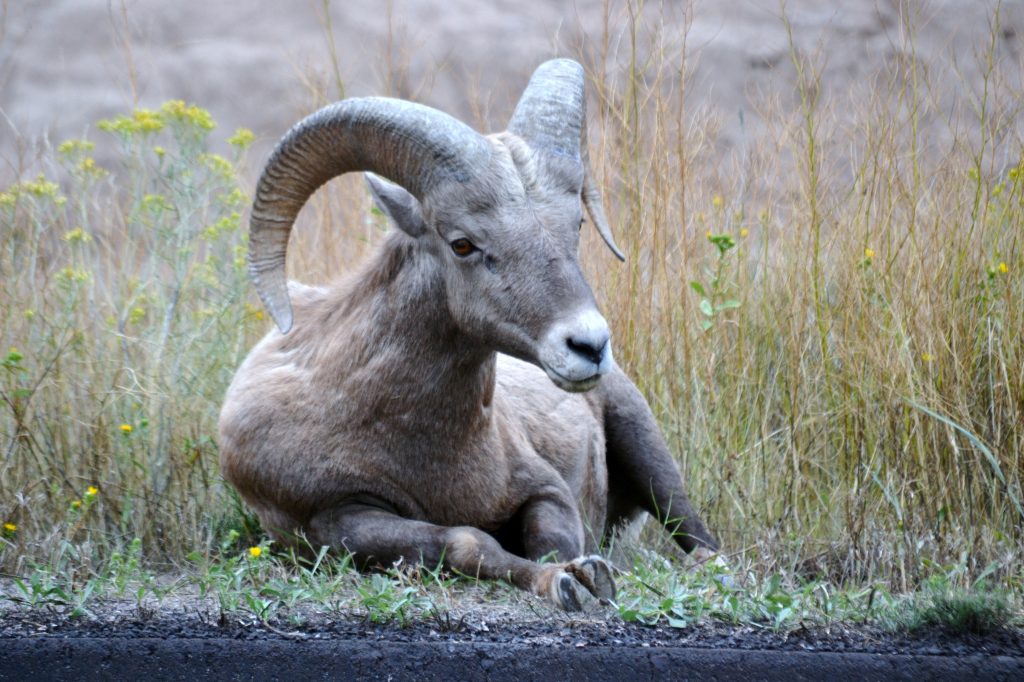
I enjoyed the short jaunts and continued my drive on Dillon Pass where I noticed several cars pulled over to the side of the road. I was so surprised to notice a bighorn sheep resting a short distance from where we had parked and it was one of the most beautiful sights I had ever seen. Seeing wildlife in its natural habitat is exhilarating, but I knew I had to keep my distance.
Bighorn sheep are not the only animals that make the Badlands their home. According to the National Park Service, there are coyotes, porcupine, bobcat, black-tailed prairie dog communities, herds of American bison, pack of red wolves, prairie rattlesnakes, mule deer, black-billed magpies, swift fox and black footed ferrets.
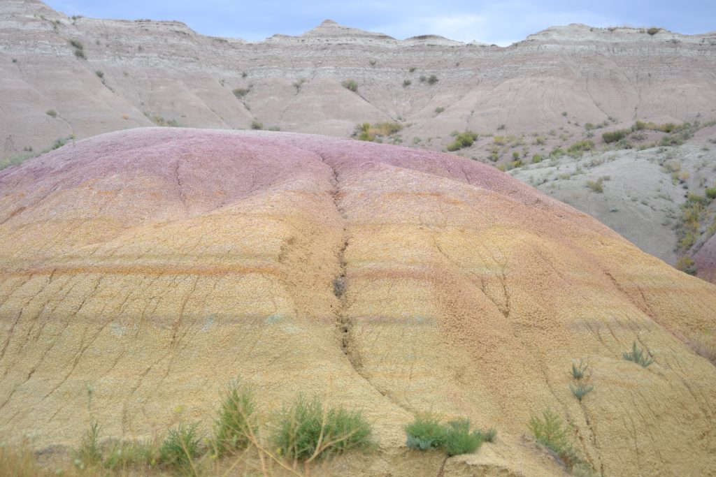
I found it difficult to break away from the bighorn sheep, but the Yellow Mounds Overlook was just around the bend where I would be able to see the spectacular striations of colors on the Badlands formations. From blue coal to red scoria, my favorite colors among the stria were pink and gold.
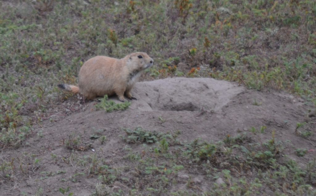
Located off of Sage Creek Rim Road, I looked forward to visiting Roberts Prairie Dog Town. I immediately fell in love with the active prairie dogs and their cute little mannerisms. They were energetic, hopping in and out of their dens, mounds of dirt with entrances on the top. Kicking up dust while digging holes, these little critters would pause only for a moment to let out a little chirp to warn of danger. Posted signs warn humans that these seemingly docile little animals carry disease and touching them is prohibited.
It was an exciting visit to Badlands National Park and I was most excited about seeing all of the wildlife and ecological formations. Geologists predict that, in a half a million years, the Badlands will be gone. I was so glad to have the opportunity to explore this spectacular park and overjoyed with the animal encounters.
For more information about the park, visit the Badlands National Park website and stop by the Ben Reifel Visitor Center to browse the displays.
Have you had the opportunity to visit Badlands National Park? Did you hike or see any of the wildlife that live here? I would love to hear about your adventure if you would kindly leave a message in the comments section below! Many thanks for reading my post about my day at Badlands National Park and wishing you many and Happy Travels!
Badlands National Park is located in the state of South Dakota. Entering the Badlands from the East, I was able to program the following address into my GPS: 21020 SD Highway 240, Interior, South Dakota 57750. For more information about the park, visit the National Park Service website at www.nps.gov and search for the Badlands National Park.
What to See and What to Do:
Badlands National Park
25216 Ben Reifel Road
Interior, SD 57750
Telephone: 605 433 5361
- Admission Fee: All fees are valid for 7 days which includes a $20 fee for private vehicle, $10 for motorcycle, and $10 per person for individuals hiking, biking, etc.
- Hours: Open daily, 24 hours; The Ben Reifel Visitor Center is open from 8AM – 4PM during winter hours; open from 8AM – 5PM April & May; open from 7AM to 7PM during the summer hours and open 8AM – 5PM early September to late October. Closed on Thanksgiving, Christmas Day and New Year’s Day.
- Amenities: visitor center, scenic drive, ranger programs, guided hikes, exhibits, campground, scheduled tours, audio guides are provided in 10 languages, special exhibitions, restaurant, cafes, shops
- Scenic View: The incredible geological formations throughout the park are incredibly scenic along the 38-mile Badlands Loop Road (Hwy 240) as well as the wildlife. For a panoramic view of the White River Valley, hike the mile and a half Notch Trail. Climb the log ladder up a cliff which leads to the top of a butte. A notch in the canyon allows photographers the opportunity to capture the perfect photo. Stick around for sunrise or sunset to photograph the beauty of the Badlands’ strata of color. Other trails include the Fossil Exhibit Trail and the two-day Sage Creek Trail.
- Length of Visit: At least 2 hours but up to 2 days to explore the whole park.
- Tips for Your Visit: The best time to visit the park is during the spring and fall months when the number of visitors is much lower than summer. The South Unit’s White River Visitor Center is only open during the summer months, so check its hours of operation at the Ben Reifel Visitor’s Center. Wear comfortable shoes for hiking and be on the lookout for rattlesnakes. The restrooms are scattered, so use them when you can. Stay on the trails and be careful when walking out into the formations. Trails can be slippery after rain or snow, so proceed with caution along some of the park’s sheer cliffs.
Where to Stay:
Days Inn, Sioux Falls Airport
5001 North Cliff Avenue & 1-90, Exit 399
Sioux Falls, SD 57104
Phone: 605 331 5959
Rate: 66.56 (AAA rate) + tax = 76.88 (includes $2 lodging tax)
Hotel Rating:
The hotel is acceptable for a short stay. Although the rooms are very dated and the furniture is stained, the rooms are clean. Smelled like cigarette smoke, but the air conditioning worked great. It is close to Falls Park and various fast food and dining in restaurants. Did not stay late enough for breakfast.
Badlands Inn, located at the park near the Ben Reifel Visitor’s Center, is the perfect front row seat for Badlands sunrises and sunsets.
Where to Eat:
Red Rock
506 Glenn Street
Wall, SD 57790
Telephone: 605 279 2388
A steakhouse with specialties such as Buffalo Steak, Prime Rib and Walleye Dinner. A little on the pricey side, but there are several options.
Badlands Saloon & Grille
509 Main Street
Wall, SD 57790
Telephone: 605 279 2210
I hear the steak with whiskey glaze is worth a try and the Angus burgers come highly recommended.
What to Eat:
- Buffalo: A meat substitute for beef which is much healthier to eat.
- Chokecherries are a Native American cherry that is made into jam, preserves, butter, wine, jelly and sauce. Wojapi is a chokecherry sauce.
- Dakota Martini is made of three-fourths beer and one-fourth tomato juice
- Fleisch Kuchele is a meat pie originating from Germans who lived in Russia. The dough is filled with meat and onions, then deep fried until the pastry is hot and flaky.
- Hot Beef Commercial, also known as hot beef sandwich, beef combination, hot beef combo and hot beef combination. This is a sandwich made of real mashed potatoes and chunks of seasoned roast beef sandwiched between two pieces of white bread and smothered with homemade gravy until it floods the plate.
- Indian Fry Bread is the state bread of South Dakota, a recipe of the local Indians.
- Indian Tacos are made with a specially spiced beef and beans, cheese, lettuce, sour cream, tomatoes, onion, black olives and house made picante sauce on the top.
- Kolache is an amazing Czech dessert made from pastry and filled with fruit filling such as apple, cherry, lemon, apricot, prune and strawberry.
- Kuchen is German for cake and in South Dakota, visitors can enjoy this pastry filled with custard and fruit.
- Lefse is a flat potato bread coming from Norwegian-American origin and served with butter
- Mocha Cakes, also known as Blarney stones, are square or rectangular blocks of light and airy white cake. Frosted on all sides with vanilla buttercream, they are rolled in lightly salted crushed peanuts for ideal flavor and texture.
- Pasties are savory hand pies.
- Tiger Meat is South Dakota’s answer to steak tartare.
- Wasna is a buffalo and berry dish passed down by the Lakota Indians.
- Zebra Donuts are marbled chocolate and vanilla donuts that is fried, dunked in sweet glaze and hand-dipped in homemade chocolate frosting which feeds 15.
What to Read:
- Death Where the Bad Rocks Live, by C.M. Wendelboe
- Badlands, by C.J. Box
Photo Guide for the Badlands:
- Photograph the sunrise at Badlands Overlook
- Hike the short trails for beautiful views
- Badlands Wall on the Door Trail
- Notch Trail: climb the ladder for outstanding views
- Natural window on the Window Trail
- White River Valley Overlook
- Panorama Point for the sunrise
- Yellow Mounds Overlook for phenomenal colors
Stay tuned as I explore Mount Rushmore, Custer’s Wildlife Loop Road and the Peter Norbeck Scenic Highway!
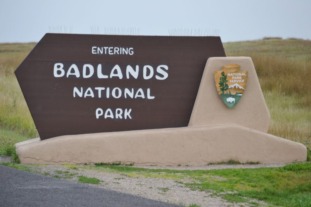
Entering Badlands National Park
Mount Rushmore, An Artistic and Architectural Phenomenon
For reasons I can’t explain, I’ve had a crazy fascination for Mount Rushmore National Memorial. I suppose it started in the eighth grade in Mr. Harness’ American history class, and from that point forward I had hoped to visit there someday. Growing up in the Midwest, over 25 hours away from the national memorial, I came to realize that if I was going to have a chance to see Mount Rushmore, I would need to plan a Western US vacation and add the monument to my itinerary. This year was the year to make that voyage.
With two weeks of vacation, I finally booked the trip not only to visit patriotic Mount Rushmore but to also include several national parks and interesting sites along the way. My dream was finally coming true.
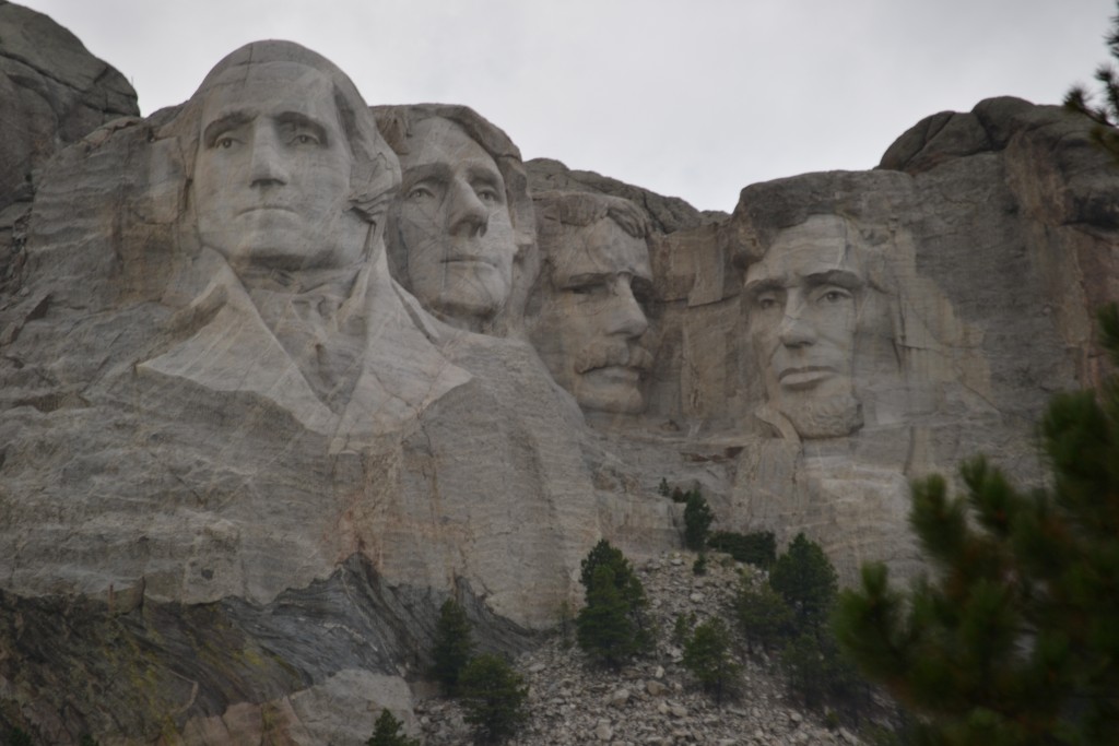
Mount Rushmore is an American icon…a symbol of our country’s progress and freedom. It is a perfect representation of the most influential presidents of the United States….four Presidents who have made enormous contributions to the land of the free.
First, there is George Washington, the first President, who is credited for the founding of the United States. Thomas Jefferson, a principal author of the Declaration of Independence, was President from 1801 to 1809. Serving as the 26th President of the United States was Theodore Roosevelt who was instrumental in establishing the National Park System and preserving the nation’s natural resources. Finally, Abraham Lincoln, who abolishing slavery, signed the Emancipation Proclamation in 1863.
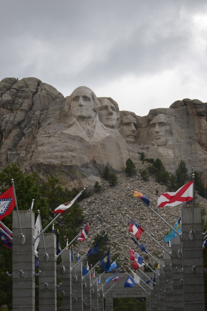
Passing through the visitor’s center, the pavilion is flanked by flags from each of the states, so I began my search looking for California, Florida, North Carolina and Ohio, the states where I have lived for some time in my life. From here, I can see the faces of Washington, Jefferson, Roosevelt and Lincoln.
When Gutzon Borglum was asked to design a monument to draw tourists to the state of South Dakota, Borglum decided on creating the likeness of each Presidential Great. While Lewis and Clark and Buffalo Bill Cody were other options, Borglum insisted that the monument should represent the nation as a whole. It was from this decision, the idea of Mount Rushmore was born.
With years of substantial commitment and determination, Mount Rushmore was finally completed after fourteen long years and unveiled to the public in 1941. The work of Gutzon Borglum, continues to amaze as one of the most fascinating engineering marvels of all time, viewed by millions of visitors each year.
The sight of Mount Rushmore, towering over the Black Hills, left me in awe and inspired to continue our pursuit of equality and help protect our national parks. I finally managed to explore the one monument that had fascinated me all of these years.
Have you had the opportunity to visit Mount Rushmore? Did you too feel a sense of patriotism and were you inspired by the monument? I would love to hear about your experience if you would kindly leave a message in the comments section below. Many thanks for taking a step back in time with me at Mount Rushmore and wishing you many Happy Travels!
What to See and What to Do:
Mount Rushmore National Memorial
13000 SD-244
Keystone, SD 57751
Telephone: 605 574 2523
- Admission Fee: There is no entrance fee for Mount Rushmore National Monument, but parking fees are required: cars, motorcycles and RVs: $10 per vehicle, $5 for Seniors (62 and older) and Free for Active Duty Military;
- Hours: Open daily from 5AM to 11:30PM
- Amenities: Hiking trail, ranger programs, audio tour and Evening Light Ceremony.
- Scenic View: The platform provides a beautiful view of Mount Rushmore.
- Length of Visit: 1 – 2 hours
- Tips for Your Visit: There are several things to do at the park to learn more about Mount Rushmore. You won’t want to miss the Evening Light Ceremony which takes place at sunset to 9:00 PM. You can attend a ranger talk or opt to take the audio tour at your own leisure. A visit to the Lincoln Borglum Visitor Center will provide you with a film and exhibits. The Presidential Trail is just over a half a mile long and allows you a closer view of this amazing sculpture.
Where to Stay:
Country Inn & Suites
2321 N. Lacrosse Street
Rapid City, SD 57701
Telephone: 866 522 8891
Where to Eat:
Carver’s Cafe
Mount Rushmore National Memorial
13000 South Dakota 244
Keystone, SD 57751
Telephone: 605 574 2515
What to Eat:
- Buffalo: A meat substitute for beef which is much healthier to eat.
- Chokecherries are a Native American cherry that is made into jam, preserves, butter, wine, jelly and sauce. Wojapi is a chokecherry sauce.
- Dakota Martini is made of three-fourths beer and one-fourth tomato juice
- Fleisch Kuchele is a meat pie originating from Germans who lived in Russia. The dough is filled with meat and onions, then deep fried until the pastry is hot and flaky.
- Hot Beef Commercial, also known as hot beef sandwich, beef combination, hot beef combo and hot beef combination. This is a sandwich made of real mashed potatoes and chunks of seasoned roast beef sandwiched between two pieces of white bread and smothered with homemade gravy until it floods the plate.
- Indian Fry Bread is the state bread of South Dakota, a recipe of the local Indians.
- Indian Tacos are made with a specially spiced beef and beans, cheese, lettuce, sour cream, tomatoes, onion, black olives and house made picante sauce on the top.
- Kolache is an amazing Czech dessert made from pastry and filled with fruit filling such as apple, cherry, lemon, apricot, prune and strawberry.
- Kuchen is German for cake and in South Dakota, visitors can enjoy this pastry filled with custard and fruit.
- Lefse is a flat potato bread coming from Norwegian-American origin and served with butter
- Mocha Cakes, also known as Blarney stones, are square or rectangular blocks of light and airy white cake. Frosted on all sides with vanilla buttercream, they are rolled in lightly salted crushed peanuts for ideal flavor and texture.
- Pasties are savory hand pies.
- Tiger Meat is South Dakota’s answer to steak tartare.
- Wasna is a buffalo and berry dish passed down by the Lakota Indians.
- Zebra Donuts are marbled chocolate and vanilla donuts that is fried, dunked in sweet glaze and hand-dipped in homemade chocolate frosting which feeds 15.
What to Read:
- The Mystery at Mount Rushmore, by Carole Marsh
- The Carving of Mount Rushmore, by Rex Smith
- Great White Fathers, by John Taliaferro
- Face to Face with Mount Rushmore, Jean L.S. Patrick
- Mount Rushmore: The History and Legacy of America’s Most Unique Monument, by Charles River Editors
Photo Guide for Mount Rushmore, South Dakota:
- Use a telephoto lens.
- Include impersonators with your photos
- Hike the path around the monument
- Take your photo during the golden hour
- Photograph Mount Rushmore on the Iron Mountain Trail through the cave entrance which frames the monument.
- Photograph George Washington’s profile just past the entrance of the national monument.
- Photograph Mount Rushmore from Mountain View Cemetery.
- Book a helicopter tour for an aerial shot of Mount Rushmore.
Disclosure: Please refer to our blog disclaimer tab for more information.
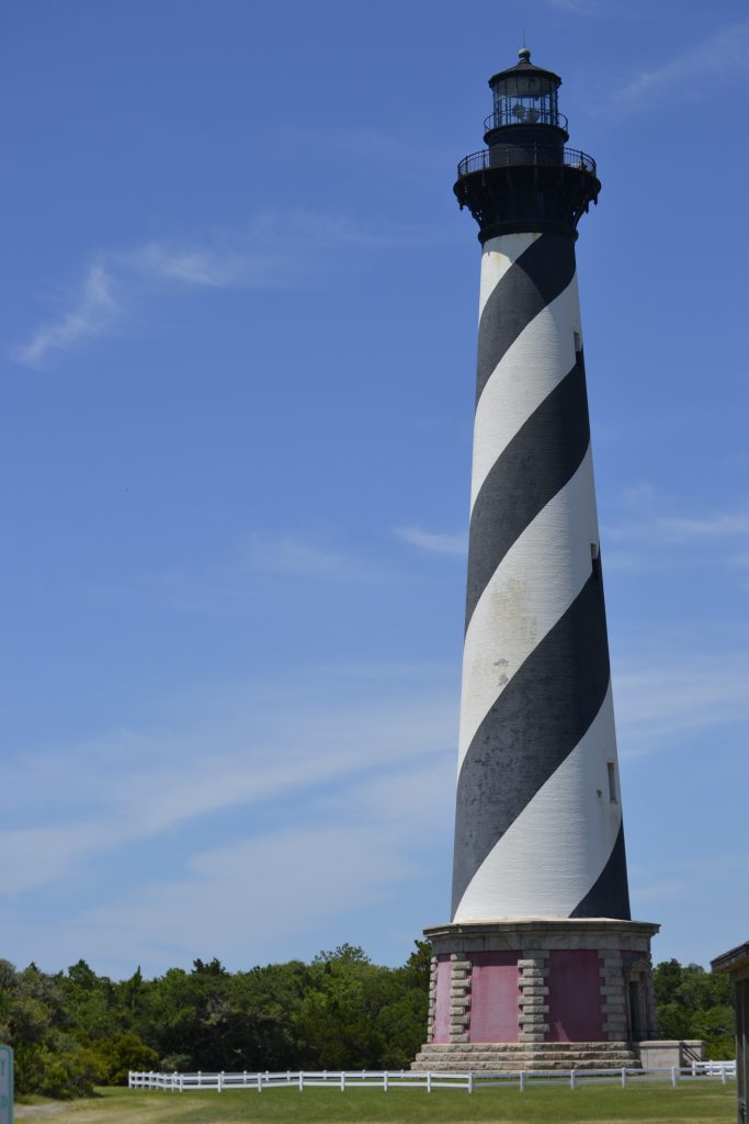
Cape Hatteras Lighthouse, Outer Banks, North Carolina
Protecting the treacherous coastline of the Diamond Shoals, the Cape Hatteras Light Station is the most famous of the lighthouses along the Outer Banks. With an impressive height of 208 feet tall, it is the tallest brick beacon of light in the US offering spectacular coast views that extend from Avon to Hatteras Village. It was at the insistence of Alexander Hamilton, who grew up on this dangerous coast that insisted on the building of Cape Hatteras lighthouse.
I remember when I was young our family would visit the Outer Banks over the summer. I enjoyed the moments we spent at the beach, but a visit to the Cape Hatteras was a vacation pilgrimage. During each visit, we would climb the 257 steps to the top and look out into the ocean and the sound. We considered it one of the highlights of our Cape Hatteras trip.
Our family experienced a once in a lifetime event at Cape Hatteras in 1999. Watching the historical move of the lighthouse, inching its way across the sand, was a week we would never forget. My grandfather even bought the t-shirt to prove he was there.
Due to storms and hurricanes, the beach was gradually eroding, threatening the stabilization of the structure. It was feared that the lighthouse would eventually collapse into the Atlantic Ocean, so it was decided that it should be transported about 2,900 feet inland.
The Cape Hatteras Light Station is open seven days a week from Easter to Thanksgiving. National Park rangers provide guided tours to the top for a small fee. Over 175,000 visitors drop in on the famous lighthouse with its familiar black and white barber pole stripes. Operated by the National Park Service is the Hatteras Island Visitor Center and Museum of the Sea in close proximity to the lighthouse. There are several exhibits, the visitor center, ranger programs and a bookstore as well as a .75 mile nature trail to Cape Point and a shaded picnic area nearby. For many visitors to the Outer Banks, spending time at Cape Hatteras is a family tradition with fond memories of their visit to this fabulous coastal destination.
Have you visited the Cape Hatteras Light Station? What were some of the highlights of your trip to the Outer Banks! I would love to hear from you if you would kindly leave a message in the comments section below. Many thanks for reading about my time spent at the Cape Hatteras Lighthouse and wishing you many Happy Travels!
What to See and What to Do:
Cape Hatteras Lighthouse
46368 Lighthouse Road
Buxton, NC 27920
Telephone: 252 473 2111
Where to Stay:
Hatteras Island Inn
46745 NC-12
Buxton, NC 27920
Telephone: 252 995 6100
Where to Eat:
The Captain’s Table
47048 NC-12
Buxton, NC 27920
Telephone: 252 995 3117
We had already eaten lunch up in Corolla, so we thought we would enjoy a small meal to tie us over for dinner. I was excited to try the fried oysters, taking advantage of the local seafood.
What to Eat:
- Crab Benedict at Sam and Ornies on Nag’s Head
- Frogmore Stew Steamer Bucket from Armstrong’s Seafood in Nag’s Head
- Donuts at Duck Donuts
- Carolina Barbecue at Pigman’s BBQ on Nag’s Head
What to Read:
- Hatteras Blue, by David Poyer
- Early from the Dance, by David Payne
- Surf Men by C.T. Marshall
- Murder at Hatteras by Joe C. Ellis
- Return to the Outer Banks by Diann Ducharme
Photo Guide for the Outer Banks
- Pea Island Wildlife Refuge for capturing local birds
- Jennette’s Pier to photograph local fishermen and beautiful sunrises
- Ocracoke Horses
- Triangle Shipwreck at Kill Devils Hill
- Shipwreck artifacts at Seagreen Gallery
- The Cape Hatteras lighthouse at Cape Hatteras
- Elizabethan Gardens in Manteo
Exploring Central Costa Rica
We spent a couple of days hanging out on the beach, cooking fresh seafood and making daily trips to the grocery store. It was time for us to travel inland towards the Arenal Volcano, La Fortuna Waterfall and spend a night at Tabacon Hot Springs. Our route took us northwest up the coast where we would make a quick stop in Jaco before making the trek towards our first stop at the waterfall. We crossed the bridge saying goodbye to the alligators before stopping at the market for some road snacks then hopped on route 34 passing quaint little coastal towns along the way.
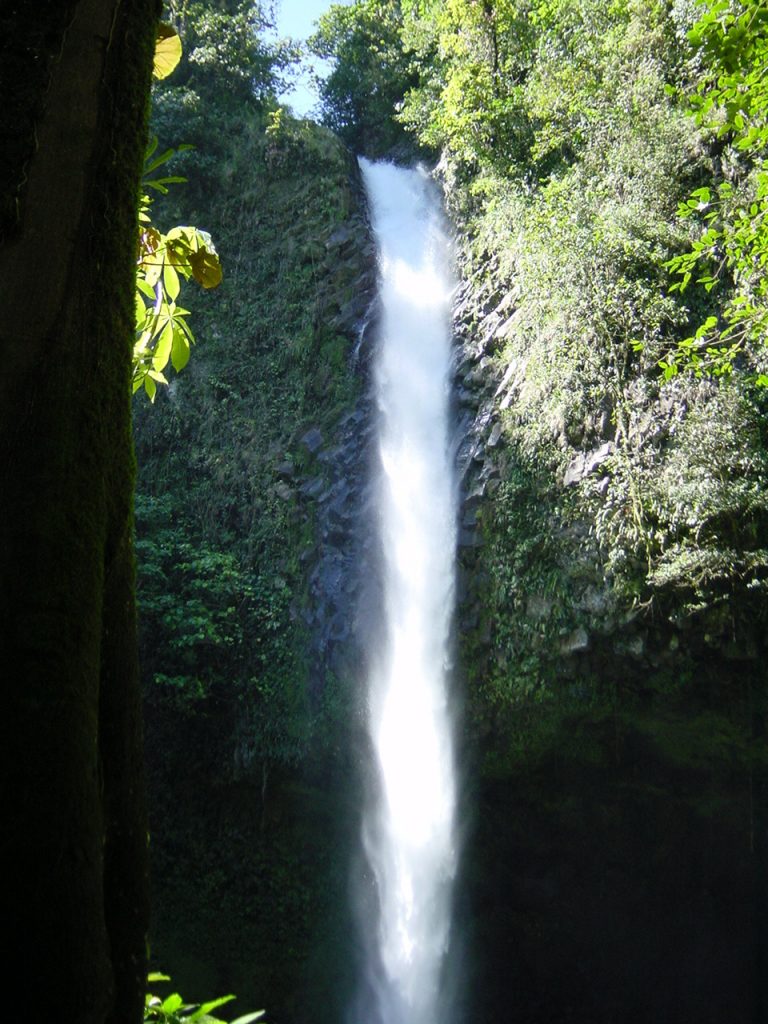
La Fortuna was an impressive 200 feet tall and we couldn’t wait to see one of Costa Rica’s most beautiful waterfalls. The roar of the falls could be heard before we reached this magnificent cascade. This spectacular force of nature is one of the most popular sites in Central America. It didn’t take us long to descend the steps to the rocky base but took note that somehow we would have to make our way back the way we came down.
We had packed a picnic, so we found a space to admire the waterfall and the incredible mist that called us to take a swim. I couldn’t help but test out the water, but even in the tropics, I was surprised the water was so cold and decided against jumping in.
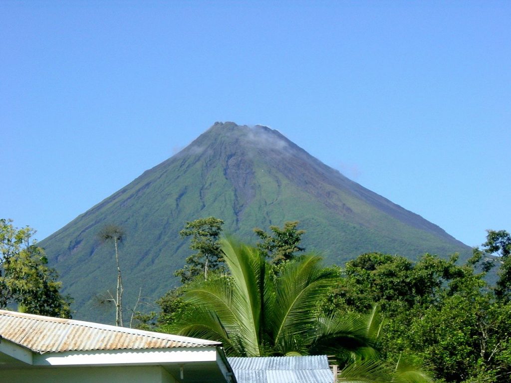
It was difficult to break away from this magical spot, but we wanted to hike up to the Arenal Volcano where we would find several viewpoints and scenic lookouts. The national park is the second most visited in the country and for so many reasons. This was once the most active volcano in Costa Rica, but it has remained dormant since 2010. The last time Arenal exploded was 1968 which destroyed the towns of Tabacon and Pueblo Nuevo. At the time of my visit in 2006, there were rumors that the top could blow off at any moment, but we decided not to let that stop us.
I was pleasantly surprised that there were only two trails and that they were so short with the maximum length measuring 2.1 miles. Hikers can pass through lava beds from blasts from the volcano’s past and capture scenic views of Lake Arenal.
While the hike in the park has a beautiful scenic area we decided to visit the Arenal Observatory for views of the volcano and lake. Both were stunning, impressive and worth the detour.
Lake Arenal is Costa Rica’s largest lake measuring 33 square miles. There are a wide range of activities that revolve around this large, man-made body of water such as boating, windsurfing, hiking, biking and of course spectacular fishing. Arenal is known for its guapote, a local fish with sharp teeth and aggressive attitude. I was surprised to learn that the ancient villages of Tronadora and Arenal are actually below the current lake, while newly built hotels around the volcano offer spectacular views and luxury accommodations.
It was getting late and we stopped at the Tabacon Hot Springs before checking into the Thermal Resort & Spa for the night. Sitting under the grandeur of Arenal Volcano, this gorgeous hideaway is the perfect location for exploring and experiencing the natural pools of Costa Rica. Visitors are not required to stay at the resort to enjoy a day of pampering and can book a day pass. While the Resort and Spa are family friendly, the Shangri-La Gardens is more private and accommodating for an adults-only experience.
The thermal spa was perfect for soothing our muscles after a long ride in the car and the luxurious bed was the perfect spot for an amazing night’s sleep, and what a restful night it was.
Have you visited Costa Rica? What was your favorite place and do you have any recommendations for where to spend my next stay in this beautiful country? I would love to hear from you if you would leave a message in the comments section below. Many thanks for reading about my journey through central Costa Rica and wishing you many Happy Travels!
What to See and What to Do:
La Fortuna Waterfall
Alajuela Province
La Fortuna, Costa Rica
Telephone: 506 2479 9515
- Admission Fee: 18 US dollars to enter
- Hours: All year around from 7AM to 5PM
- Amenities: third party tours provide more details; check Viator for more information
- Length of Visit: 1 – 2 hours
- Tips for Your Visit: Wear comfortable shoes for walking. The busiest time is midday and early afternoon, so it is suggested to arrive in the morning.
Arenal Volcano
Alajuela Province, Costa Rica
Lake Arenal
Arajuela Province, Costa Rica
Tabacon Thermal Resort & Spa
Noreste de Centro de la Fortuna de San Carlos 13 Km
Provincia de Alajuela, Nuevo Arenal, Costa Rica
Telephone: 877 277 8291
- Admission Fee: No charge to visit the hot springs at the resort.
- Hours: Check with the resort for hours of operation
- Length of Visit: 1 – 2 hours
- Tips for Your Visit: Wear comfortable shoes for walking and bathing suit for enjoying the hot springs.
Where to Stay:
Tabacon Thermal Resort & Spa
Noreste de Centro de la Fortuna de San Carlos 13 Km
Provincia de Alajuela, Nuevo Arenal, Costa Rica
Telephone: 877 277 8291
Where to Eat:
Jaco:
Los Mahi Tacos de Cholo
Centro Commercial Urena, Local 3
Avenida Pastor Diaz Diagonal a Calle El Bohio
Jaco Central, Jaco, Garabito Municipality
61101 Costa Rica
Telephone: 506 8741 0562
La Fortuna:
Spectacolar Cantina
Meters west from La Fortuna Church 125
Arenal Volcano National Park
La Fortuna de San Carlos 21007 Costa Rica
Telephone: 506 8569 7676
What to Eat:
- Arroz con Leche is translated to rice with milk and is a popular dessert in Costa Rica. Additional ingredients include milk, cinnamon, salt and lemon zest, making this a delicious end to your meal.
- Casado, which means marriage which is an interesting combination of meat such as beef, pork, chicken and fish as well as rice, beans, tortillas, fried platano maduro and salad. In addition, the dish also includes a fruit juice.
- Gallo Pinto is a mixture of rice and beans with red bell peppers, onions, cilantro and other spices. The secret ingredient is the Salsa Lizano. It is a popular breakfast dish.
- Sopra Negra is translated to black soup, which is the base of this delicious soup. Included with the black beans, there are onions, peppers, tomatoes, soft boiled eggs and spicy spices.
- Tamales are similar to their Mexican cousin, but there are some differences, one of which is the wrapping. In Costa Rica, tamales are wrapped in banana leaves rather than corn husks.
What to Read:
- It’s Every Monkey for Themselves: A True Story of Sex, Love and Lies in the Jungle by Vanessa Woods
- Oro by Cizia Zyke
- Green Phoenix: Restoring the Tropical Forests of Guanacaste, by William Allen
- Monkeys are Made of Chocolate: Exotic and Unseen Costa Rica, by Jack Ewing
- Costa Rica: A Traveler’s Literary Companion by Barbara Ras, Oscar Arias
- The Year of Fog, by Michelle Richmond
Photo Guide for Costa Rica:
- Manuel Antonio National Park for wild animals such as sloths and monkeys
- Tortuguero National Park for amazing loggerheads and hawksbill
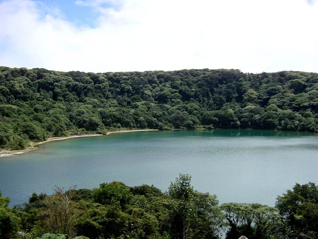
- Poas Volcano National Park for its impressive view of the interior of the volcano